Country:
 City:
City:


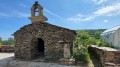

To start this stage, depending on where you are staying or camping, head to the Church of Santa María in the village of O’Cebreiro.
(S) With your back to the church, head west along the street opposite. Pass several hostels before walking alongside the O Cebreiro Municipal Hostel to reach a concrete path, marked by a post engraved with a shell.
(1) Continue along this path, which turns into a stony uphill track leading you into a pine forest and continuing to the junction with a small tarmac road, overlooked by a high-voltage power line.
(2) Turn right and continue, enjoying the beautiful panoramic view before you. Follow the tarmac road and carry on to the public wash house at the entrance to the village of Liñares.
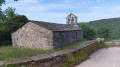
(3) Head towards the stone building: refreshments available at Casa Jaime. Stay on the path that runs between two small sheds and past the Romanesque church of Santo Estevo de Liñares before reaching the junction with the LU-633.
(4) Turn left and follow this road to the junction at the Liñares exit sign. Cross the LU-633 with care and continue along a small tarmac road, slightly downhill, to the first stony path, marked by a boundary stone.
(5) Head left along this steeply ascending path. Cross a wood before continuing along the path running parallel to the LU-633. After a series of steep ascents and descents, you will reach the San Roque Pass, where there is a statue of a pilgrim looking out over the valley. At the foot of the statue, take in the magnificent panorama, which is a real feast for the eyes.
(6) Continue along the path, which climbs away from the road before eventually rejoining it at a boundary stone and a signpost.
(7) Follow the path running parallel to the road north-westwards to reach the entrance to a village.
(8) Turn right, following the signs for Hospital. Enter and cross the village. At a small garage, turn right onto a small, remarkably well-paved path and continue until you reach the LU-633.
(9) Turn right and continue along the narrow track that runs alongside the LU-633. Continue down a gentle slope until you reach a bend with a panoramic view of the valley to your right.
(10) Turn right, following the signs for Sabugos. Continue to the stone hut.
(11) After the hut, turn left onto the path marked by a boundary stone. After crossing meadows and woods, you will arrive between the Church of San Xoán and a wash house, at the entrance to the small village of Padornelo.
(12) Continue north-west and, at the fork, take the stone path which leads, up a steep slope, to the Col d’O Poio, the highest point on the French Way. You will also have reached the LU-633 opposite the Hotel Santa Maria do Poio.
(13) Turn right and head towards Triacastela on the signposted path, running parallel to the LU-633. Continue to the marker near a high-voltage power line.
(14) Stay on the path running alongside the road until you reach the marker at a crossroads.
(15) Continue along the path running parallel to the road, heading north-west towards the village of Fonfría.
(16) Walk through the village, passing the O Galego cheese shop: you might want to stop here – the cheese is delicious. Continue on your way, passing to the right of San Juan de Fonfría Church and carrying on to the fork at the edge of Fonfría.
(17) Continue along the middle stony path. Walk alongside a high-voltage power line before returning to the LU-633.
(18) Turn right to follow this road, then take the small path marked by a boundary stone. Carefully cross the road and continue straight ahead on the gently ascending path that passes under the high-voltage power line. Continue until you reach the road at the entrance to the village of O Biduedo.
(19) Stay on the left-hand road and follow the signs for Biduedo Casa Xato. Cross the village, making a 90° turn towards the south-west to continue along a pretty path that winds through lush, green countryside and is well signposted. Continue until you reach the high-voltage power lines.
(20) Continue south-west then west until you reach a crossroads.
(21) Turn north-west and continue until you reach a farm.
(22) Turn right (north) and continue to the village of Fillobal until you reach the Albergue Fillobal.
(23) Turn left at a hairpin bend to find yourself a few metres further on, on the LU-634A. Walk a few metres along this road to reach a path branching off to the right.
(24) Take this stony, descending, shaded path which runs parallel to the LU-633 and eventually joins this road at a rest area.
(25) Cross the LU-633 with care, then head right and take a path leading down to the left. You will arrive in the small village of Pasantes.
(26) Walk through the village, past the Chapel of As Pasantes, and continue to the edge of the village.
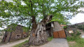
(27) Continue south-west along a tree-lined path. Walk on to the village of Ramil, where you’ll find an impressive tree estimated to be around 800 years old.
(28) Walk through this village along a pretty path paved with flat stones to reach the Garcia guesthouse.
(29) Continue straight on (westwards), keeping the stone retaining wall on your right. Follow this narrow street for a few hundred metres until you reach the village of Triacastela. Stay on this narrow street until you reach the Parrillada Xacobeo restaurant: a statue of a pilgrim stands guard at the entrance.
(29) Continue straight on along Avenida Camilo José Cela. After a 90° left-hand bend, you will arrive at Plaza da Deputación, where there is a stone stele bearing a large red cross (E). Take the small path heading south to find a quiet, secluded spot for the night.
 Visorando Member