


 Country:
 City:
City:



(S) Depending on where you’ve camped, resume your route and head north-west to move away from the village of Peruscallo along the narrow country lane. Soon, at a left-hand bend, head south. Cross a woodland before reaching the village of Cortiñas.
(1) Pass through this village, then through the woods, and continue on to the village of Lavandeira.
(2) Pass through this village and continue westwards. You’ll soon pass the small village of O Casal and, after crossing some farmland, arrive at the village of A Brea, near a farm.
(3) Walk through this village between the dry stone walls. At the Fork in the road, turn left. Walk past a bar before leaving the village and continuing along a small, leafy road through meadows and woods. Walk past Casa Morgade before arriving at the small Chapel of Santa Mariña.
(4) Continue northwards; then, after a left-hand bend, head across the fields towards the south-west and carry on until you reach a pretty property at the entrance to the village of Ferreiros.
(5) First turn right then left and continue along the small tarmac road to the Albergue-Restaurante Casa Cruceiro de Ferreiros: provisions available here.
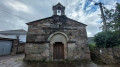
(6) First turn right then left, following the signs for the Romanesque Church of Ferreiros. Carry on to the village of Mirallos and the Church of Santa María de Ferreiros.
(7) Continue north-west until you reach the Fork in the road, then turn left onto the small road leading downhill to reach the village of A Pena, where you’ll see a sign indicating that you have 100 km left to Santiago.
(8) Carry on and then turn left at the junction. Walk past a bar and leave the village via a stony path to reach a small wood at the junction with a tarmac road.
(9) Turn left just before the small hamlet of O Couto, before reaching the village of As Rozas. Walk through this small village and continue for a few hundred metres until you come to a marker post indicating the start of a path.
(10) Leave the tarmac road and follow a stony path to the right. Continue to the viewpoint, marked by a boundary stone.
(11) Continue your walk, heading slightly downhill, until you reach the junction with the LU-P-4203 in the hamlet of Moimentos.
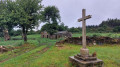
(12) Head straight on along the path paved with flat stones, cross the hamlet and then continue along the tarmac road until you reach the cross.
(13) Turn left onto the stony path. Pass through the hamlet of O Cotarelo, and carry on to reach the hamlets of Marcadoiro and Montras, opposite a Tienda Peter Pank shop. Refreshments available here.
(14) Carry on past this hamlet, then turn left onto the tarmac road. Continue to the pine forest and carry on to the junction.
(15) Head slightly to the left, then, at the cross, turn right to reach the hamlet of A Parrocha.
(16) After this hamlet, carry on to the fir forest until you reach a small tarmac road heading west. As you leave the fir forest, turn right onto the dirt track crossing the meadows to reach the village of Vilacha, near a craft shop.
(17) Walk through the village and follow the signposts to a right-hand bend leading to a crossroads. Carry on straight ahead towards the north-east until you reach a fork in the road.
(18) Head slightly to the left and walk through farmland and wooded areas until you reach the LU-613 at a sharp bend.
(19) Turn left and carry on to the Stop sign by the bridge over the River Miño
(20) Turn right and cross the bridge, following the signs for the Camino de Santiago, until you reach a roundabout. Climb the steps in the centre of the roundabout: Neves Chapel, the old steps of the medieval bridge. Leave the chapel and continue along the narrow cobbled lane until you reach Avenida de Sarria in the town of Portomarin.
(21) Cross at the pedestrian crossing and carry on straight ahead. Pass to the left of the fountain to continue along the gently sloping street, then turn right into Rúa de Compostela. Continue along this street with its beautiful arcades until you reach Plaza Conde Fenosa, opposite the Church of San Xoán de Portomarín.
(22) After walking round the square, retrace your steps and head back down Rúa de Compostela. At the bottom of the street, carry on straight ahead along Avenue Chantada. Walk along the chequered pavement on the right towards Ventas de Naron. At the junction, cross at the pedestrian crossing and continue along the chequered pavement on the left until you reach the next junction.
(23) At a hairpin bend, turn left onto the LU-633, then turn right towards Pombal, crossing the bridge. After the bridge, turn right onto the San Antonio uphill road, which takes you through woods and farmland to the LU-633 at a disused industrial building.
(24) After crossing carefully, follow this road north-westwards. Staying on the path that runs alongside the road, continue to the Camagan Factory, recognisable by its numerous silos.
(25) Cross the road carefully and continue along the LU-633 on your right. Keep going in this direction until you reach the junction with the LU-P-4909.
(26) Continue westwards, passing to the left of the house. Stay on the path until you reach the junction.
(27) First turn right then left to follow the LU-633 on your right-hand side once more. Pass a picnic area sheltered from the sun by huge weeping willows ( Please note: at this point, the route does not correspond to the IGN map). Carry on straight ahead to reach the village of Gonzar, in front of a hotel.
(28) Heading north-west, pass through this village to reach a boundary marker.
(29) Turn slightly left onto the stony track and carry on to the village of Castromajor, arriving in front of the Church of Santa María de Castromaior.
(30) Walk through the village along the main street, exiting via a bar. At the fork in the road, turn left and carry on to the former O Castro Der Castromaior museum: a building by the side of the path with information panels that describe the castro very well, but rather than being called a museum, the place ought to be called an ‘abandoned house’ given its very dilapidated state.
(31) Continue south-west, passing to the right of the Castro de Castromaior: Celtic ruins perched on the hill; a sign indicates that the detour is only a few hundred metres. At the sign, carry on to the right until you reach the next junction, at a bus stop on the LU-633.
(32) Cross the road carefully and head left to follow this road. Carry on until you reach the road crossing sign.
(33) Cross carefully and head right. As you move away from the LU-633, you’ll reach the village of Hospital da Cruz.
(34) Walk through the village. At the Fork in the road, in front of the farm, keep right to reach a path running parallel to the N-640.
(35) Head right, then, at a bar/restaurant, cross the N-640 carefully to pass to the left of the roundabout. Cross the bridge over the N-540 and turn left towards Chantada. Continue to the first junction.
(36) Cross carefully and head right towards Ventas. Pass the marker indicating you are 78.1 km from Santiago, and continue along a small tarmac road through woods and meadows until you reach the entrance to the village of Ventas de Narón, next to an electricity pole.
(37) Turn left to pass between the pole and a low wall, walk past a hostel and then the Magdalena Chapel. Carry on to the cross (E) where you’ll find a rest area on the outskirts of the village, ideal for camping.
 Visorando Member

 Association / Club / Walk leader
 Moderate
