Walk from San Guixeria to Sant Elm in Mallorca

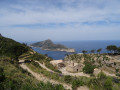
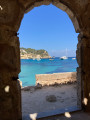
It’s a lovely walk along the coast with superb views. The path is quiet and there are no difficult sections. You may spot birds of prey and come across wild goats. The route is easy and requires no special equipment – just avoid flip-flops. Make sure you bring water, as there is little shade along the route.

Details

1689071
Creation:
Last update:
Last review:
  • Walking
    Activity: Walking
  • ↔
    Distance: 6.68 mi
  • ◔
    Average duration: 3h 40 
  • ▲
    Difficulty: Easy

  • ⚐
    Back to start: No
  • ↗
    Ascent: + 702 ft
  • ↘
    Descent: - 1,785 ft

  • ▲
    Highest point: 1,529 ft
  • ▼
    Lowest point: 43 ft
  • ⚐ Country: Spain
  • ⚐ City: Andratx 
  • ⚑
    Start: N 39.604733° / E 2.40848°
  • ⚑
    End: N 39.585099° / E 2.346896°
  • Hour-by-hour weather

Photos

Description of the walk

Head for the hamlet of San Guixeria just before the K.106 kilometre marker on the MA-10 road. This point is located after Andratx, heading towards Estellens

(S) Turn left onto the wide track called Cami de Ses Basses, which is also theGR® 221. Follow it to the junction with a new path.

(1) Leave theGR® on your left and continue to the right along the Cami de ses Basses. Pass the houses at Caseta de ses Basses. You will reach the Mirador d’en Josep Sastre viewpoint.

(2) Turn left and continue on level ground to reach Cova des Puig, the end of the Cami.

(3) Head down the path opposite to reach the junction with the road coming from Sant Elm.

(4) Follow the road to the left to reach Collet de la Trappa. Begin the descent, staying on this road. A series of tight hairpin bends will take you further on to the houses at Can Sen Biel Seguina.
Note: there is the optionhere to take a detour down to the right towards the ruins of the Trappa monastery; some of the buildings are currently being restored. Then return to the crossroads.

(5) Keep left on the road to reach Sant Elm (E).

Waypoints

  1. S : mi 0 - alt. 1,152 ft - Car park with trail information boards
  2. 1 : mi 1.93 - alt. 1,093 ft - At the junction, leave the GR 221, which heads to the left
  3. 2 : mi 2.82 - alt. 1,483 ft - View of Dragonera Island
  4. 3 : mi 3.13 - alt. 1,512 ft - Cova Puig, the end point of the Cam
  5. 4 : mi 3.86 - alt. 1,132 ft - Small pass and monastery
  6. 5 : mi 5.73 - alt. 207 ft - Can Sen Biel Seguina
  7. E : mi 6.68 - alt. 85 ft - The village of Sant Elm

Notes

This is not a circular walk, so arrange for a driver to take you back to your car.
There are no water points along the route.
In Sant Elm, there is a mini-market, a bakery and numerous restaurants, particularly from April to October.
A bus service runs back to Saracco and Andratx.

Worth a visit

A visit to the ruins of the Trappa Monastery is recommended.

Always be cautious and plan ahead when you're outdoors. Visorando and the author of this route cannot be held responsible for any accidents occurring on this route.

The GR® and PR® markings are the intellectual property of the Fédération Française de Randonnée Pédestre.

Reviews and comments

4 / 5
Based on 3 reviews

Reliability of the description
4 / 5
Ease of following the route
3.7 / 5
Route interest
4.3 / 5
User 6901892

Overall rating : 3.7 / 5

Date of your route : Jun 02, 2025
Reliability of the description : ★★★☆☆ Average
Ease of following the route : ★★★☆☆ Average
Route interest : ★★★★★ Very good
Very busy route : No

My main reservation concerns the route’s ‘Easy’ classification: there is, after all, a ‘technical’ section on the descent towards Sant Elm, where you’ll need to use chains anchored into the rock face. Furthermore, after the Mirador Josep Sastre, the signposting is rather vague. Despite these points, the route is well worth taking for the final panoramic view of Dragonera Island. In May, when temperatures exceed 30°, do not neglect to take sufficient water with you when setting off on the walk.

Machine-translated

User 23282522

Overall rating : 3.7 / 5

Date of your route : May 20, 2025
Reliability of the description : ★★★★☆ Good
Ease of following the route : ★★★★☆ Good
Route interest : ★★★☆☆ Average
Very busy route : No

A lovely walk, with the added bonus of wild goats – some big, some small. Absolutely lovely!

Machine-translated

CocoduPic
CocoduPic

Overall rating : 4.7 / 5

Date of your route : Apr 21, 2025
Reliability of the description : ★★★★★ Very good
Ease of following the route : ★★★★☆ Good
Route interest : ★★★★★ Very good
Very busy route : No

We went on this walk; the scenery is absolutely stunning – the sea, the vegetation and the blue sky – the perfect combination for a really enjoyable walk.

Machine-translated

For more walks, use our search engine .

The GPS track and description are the property of this route's author. Please do not copy them without permission.