Crossing the Comté Forest

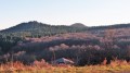
From the stadium in Saint-Babel to the stadium in Vic-le-Comte, this walk takes you through the forest along age-old paths amongst the dormant volcanoes of the County of Auvergne.

One-way walk: arrange for a car to be waiting for you at the end of the route in Vic-le-Comte.

Details

n°415619
Creation:
Last update:
Last review:
  • Walking
    Activity: Walking
  • ↔
    Distance: 5.39 mi
  • ◔
    Average duration: 3h 10 
  • ▲
    Difficulty: Moderate

  • ⚐
    Back to start: No
  • ↗
    Ascent: + 774 ft
  • ↘
    Descent: - 1,086 ft

  • ▲
    Highest point: 2,431 ft
  • ▼
    Lowest point: 1,621 ft

Photos

Description of the walk

Park on the D14 after the hamlet of Le Théron when coming from Saint-Babel, in the stadium car park

GRP® red and yellow markings

(S) Turn left onto theGRP® Tour du Pays de la Reine Margot. Follow it north then west.

(1) Leave theGRP®, turn left and climb up and round the Grand Raymond (orientation table). Retrace your steps.

(1), head left (west).

Signposted “Fayet” – green on a white background

(2) At the next crossroads, turn right and leave theGRP®. Then take the first path on the right. You’ll reach a place called Le Gros Fayard (a remarkable beech tree marking the end of the track). Head left, take a logging track following the “Fayet” markings and reach the edge of the woodland.

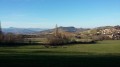
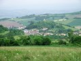
(3) Go through a gate to enter the pasture (private property for 200m), follow the low fence and the “Fayet” signposting. Pass close to the Fayet farm, a former priory in the Middle Ages, on your left. Enjoy the beautiful views over the Livradois-Forez.

(4) Turn left. From this point, follow the “Langlade” signposts (green on a white background). Follow the path lined with hedges and then along the edge of the woodland

(5) Continue along the path, ignoring any paths branching off to the right or left. Follow the straight, clay path at the foot of the Puy des Gardelles.

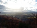
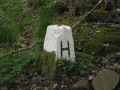
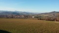
(6) Turn onto the stony path that descends to the left between two old boundary stones. Follow it to the stream, where it becomes a good path through the meadows. Admire the beautiful panoramic views of Pignols and the Puys mountain range. Continue to follow the “Langlade” signposts.

(7) Turn left onto the wide path leading to Langlade. Walk through the village via the Place de la Prada.

Yellow signposts

(8) Turn slightly left, then take Rue du Chevalier, passing the mobile phone mast and continuing to the end of the street.

(9) Take the wide path on the right which leads directly to the D225, whilst admiring the extraordinary panoramic view before you. Ignore all the farm tracks to the right and left. When you reach the D225, follow it to the left and head for the A. Boste stadium (E).

Waypoints

  1. S : mi 0 - alt. 1,939 ft - Stade des Moulins
  2. 1 : mi 0.75 - alt. 2,277 ft - At the foot of the Grand Raymond
  3. 2 : mi 1.3 - alt. 2,264 ft - End of the red and yellow markings
  4. 3 : mi 2.38 - alt. 2,287 ft - Step ladder to climb
  5. 4 : mi 2.7 - alt. 2,192 ft - Langlade signpost junction
  6. 5 : mi 3.09 - alt. 2,365 ft - Crossroads
  7. 6 : mi 3.4 - alt. 2,283 ft - Start of a stony path
  8. 7 : mi 3.96 - alt. 2,044 ft - Crossroads of tracks suitable for vehicles
  9. 8 : mi 4.35 - alt. 2,001 ft - Langlade car park
  10. 9 : mi 4.67 - alt. 1,952 ft - Crossroads
  11. E : mi 5.39 - alt. 1,621 ft - A. Boste Stadium

Notes

This walk takes you through woodland, so be aware of the small creatures that live there: mosquitoes, ticks, etc.; depending on the season, cover your arms and legs.

Worth a visit

A walk through the Comté Forest, one of the region’s most beautiful forests of oak, beech and hornbeam.
Formerly part of the royal estate and later owned by the Counts of Auvergne (with numerous notable boundary markers), it is now owned by the municipality of Saint-Babel and the Departmental Council.

Near the (4) and (5), the centre for sensitive natural areas and nature trails

Reviews and comments

4.7 / 5
Based on 1 review

Reliability of the description
5 / 5
Ease of following the route
5 / 5
Route interest
4 / 5
Arverne63
Arverne63

Overall rating : 4.7 / 5

Date of your route : Mar 11, 2017
Reliability of the description : ★★★★★ Very good
Ease of following the route : ★★★★★ Very good
Route interest : ★★★★☆ Good

Downside: You must leave your vehicle at Vic Le Comte on arrival.

Machine-translated

Other walks in the area

For more walks, use our search engine .

The GPS track and description are the property of this route's author. Please do not copy them without permission.