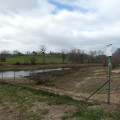
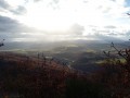
A circular loop around the village of Manglieu

Manglieu (Magnus locus) was the site of an abbey founded in the 7th century, of which the Abbey Church of Saint Sébastien remains. This short walk will allow you to explore this picturesque village, its abbey church and its “Roman” bridge.

Details

n°37805277
Creation:
Last update:
Last review:
  • Walking
    Activity: Walking
  • ↔
    Distance: 2.20 mi
  • ◔
    Average duration: 1h 20 
  • ▲
    Difficulty: Easy

  • ⚐
    Back to start: Yes
  • ↗
    Ascent: + 328 ft
  • ↘
    Descent: - 328 ft

  • ▲
    Highest point: 1,732 ft
  • ▼
    Lowest point: 1,391 ft

Photos

Description of the walk

Park in Place de l’Église.

(S/E) Set off from this square and head south-east along the street that runs through the village.

(1) Immediately after the last house, turn left onto the small road that climbs towards Château Auger.

(2) When the small road bends to the right, take the wide path that climbs straight ahead and reach the top of the hill.

(3) After passing a meadow on your right, turn left onto a small, well-marked path that leads back down through the forest. This path gradually widens into a track. At the bottom of the descent, ignore a track on your right and turn left towards the village.

(4) At the fire station, turn right to join the road leading out of the village, follow it to the right and cross the ‘new’ bridge.
At the crossroads, turn left towards Vic-le-Comte, then, after 60 metres, turn left towards the cemetery. Walk alongside it.

(5) Cross the “Roman” bridge, turn right at the end of it and, after 30 metres, turn left into the alleyway that leads back to the church square (S/E).

Waypoints

  1. S/E : mi 0 - alt. 1,404 ft - Abbey Church Square
  2. 1 : mi 0.16 - alt. 1,391 ft - Crossroads leading towards Auger Castle
  3. 2 : mi 0.66 - alt. 1,657 ft - Uphill path
  4. 3 : mi 1 - alt. 1,726 ft - A path leading downhill through the forest
  5. 4 : mi 1.75 - alt. 1,430 ft - Fire station
  6. 5 : mi 2.11 - alt. 1,398 ft - ‘Roman’ bridge
  7. S/E : mi 2.2 - alt. 1,404 ft - Abbey Church Square

Notes

On the square next to the church is the Auberge de l’Ailloux, a café and restaurant.

Worth a visit

Don’t miss a visit tothe Abbey Church of Saint Sébastien.
Incidentally, it was used as a filming location for the film “Les Choristes”.

On the way back, the “Roman” bridge, which is probably only of medieval construction.

Reviews and comments

5 / 5
Based on 1 review

Reliability of the description
5 / 5
Ease of following the route
5 / 5
Route interest
5 / 5
Stely
Stely

Overall rating : 5 / 5

Date of your route : Oct 09, 2023
Reliability of the description : ★★★★★ Very good
Ease of following the route : ★★★★★ Very good
Route interest : ★★★★★ Very good
Very busy route : No

A very easy, shaded route with little elevation gain and

Machine-translated

Other walks in the area

For more walks, use our search engine .

The GPS track and description are the property of this route's author. Please do not copy them without permission.