Country:

 City:


Park in the car park at Planfoy Church.
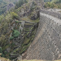
(S/E) Head due east along the Route du Barrage. You’ll reach a car park. Go past the barrier and continue along the track to reach the Pas de Riot dam
(1) Turn left and walk across the dam. Once on the other side, turn right for about twenty metres, then take the path leading uphill to the left – please note: this is a steep climb. When you reach a house, take the path to the right, then left, until you reach a junction. Continue for a few metres until you reach the junction with a second path
(2) Turn right here, then follow this path up to the ridge until you reach the junction with the D8. Turn right and walk along the roadside for about 100 metres on the verge, then cross the road to the left.
(3) Take the path opposite, continue uphill and turn right onto the first path until you reach the junction with the Chemin de la Violette.
(4) Cross it and turn immediately right onto theGR® 42 to head into the woods and reach another crossroads at the edge of a clearing.
(5) Leave theGR® here and turn left towards the Bois du Sapey, following this path. When you reach a Fork in the road, take the right-hand branch; a few metres further on, you’ll come to another path junction.
(6) Turn right onto this path and head downhill; at the lowest point, by a small stream, veer left and head back uphill to reach the clearing in the hamlet of La Loge.
(7) Leave this hamlet on your left and continue uphill to reach the junction with the road to the hamlet of Le Plateau; please note that the climb is steep.
(8) Turn right until the next junction and turn right again onto theGR® 42 to reach the crossroads by the clearing and the woodland you passed earlier.
(5) Turn left and head for the junction with the Chemin de la Violette, which you also passed on the way out.
(4) Here you have two options:
- continue straight ahead on theGR®42to reach theGR® junction
or
- turn left and head downhill along the same route as on the way out to return to the junction by the dam (as shown on the map).
(1) Turn slightly to the right and begin a new climb to reach the aqueduct spanning the Furan stream.
(9) Cross the aqueduct, turn left and follow the aqueduct path. Further on, you’ll come to a Y-junction.
(10) Stay on the right-hand branch and continue up a steep climb, first through the woods and then into a clearing. You’ll reach the hamlet of Les Essertines.
(11) Cross the road, first turning right then left. Go between the houses, turn left and follow the path along the edge of the woodland, then into the woodland itself; you’ll emerge at the junction withthe GR®42, which connects with the alternative route mentioned above.
(12) Turn left onto it and follow it down to the hamlet of Charteloup.
(13) Stay on theGR® until you reach the crossroads at the edge of the woodland, in a left-hand bend.
(14) Follow the single track opposite, which is quite technical in places. At the end of the single track, turn right at thefirst house to reach the village of Rochetaillée via Chemin Victor Jourjon. You’ll come to Route des Echeneaux; follow it to the left towards Rue du Parc. Cross the road and go down the steps to reach Rue de la Roche Corbière. Turn left and head downhill until you reach a Y-junction.
(15) Turn left onto the path running parallel to the road and follow it to reach the Roche Corbière climbing site. Go past the rock and head up the fairly stony path. A few metres further on, turn right. Caution: difficult and technical section over loose stones. Follow the single track until you reach a small concrete road. Cross it and turn left onto the narrow path leading to the Gouffre d’Enfer car park.
(16) Here too, you have two options:
- turn left to admire the waterfall on your left and, about a hundred metres further on, a section of the Planfoy Rochetaillée via ferrata; then continue along the path to reach the Croix du Soldat crossroads (see details in the Practical Information section).
or
- keep to the right (as shown on the map) along a very technical section with some extremely difficult passages; not recommended for inexperienced walkers. Furthermore, on this route it is advisable to have a GPS or this track to follow the route.
(17) Opposite, take the Chemin de Corrières, then Rue Georges Clémenceau; turn left off this street to return to the car park at Planfoy church (S/E).

 Visorando Member

 Moderate

 Easy