Tours de Montmayeur from Villaroux

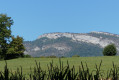
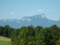
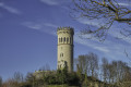
This walk leads to the medieval site of the Montmayeur Towers, between which a village was once built, of which only ruins remain. The Crête du Mont Raillant was also a Resistance stronghold during the Second World War, and the Maison des Résistants serves as a historical memorial to this. Enjoy a360° panoramic view of Les Bauges, the Belledonne massif and the Chartreuse.

Details

n°111947984
Creation:
Last update:
Last review:
–
  • Walking
    Activity: Walking
  • ↔
    Distance: 9.28 mi
  • ◔
    Average duration: 5h 50 
  • ▲
    Difficulty: Moderate

  • ⚐
    Back to start: Yes
  • ↗
    Ascent: + 1,781 ft
  • ↘
    Descent: - 1,772 ft

  • ▲
    Highest point: 2,657 ft
  • ▼
    Lowest point: 1,486 ft

Description of the walk

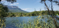
Park at an angle in the car park to the left of the pond on the D29.

(S/E) Walk past the fountain on your left and head up towards Combe Chabert via the Chemin du Fou.

(1) Continue left onto the Chemin de la Générale and reach the top of the hamlet of Soucy (fountains).

(2) Carry on straight ahead, taking the Chemin de Bardet, which leads to the “Sous les Tours” junction (elevation 465)

(3) Head up to the right to reach the Bois Roland crossroads.

(4) Head right-hand way up, towards the south-east, passing to the left of the Rozaz cross, and reach the Fontaine à Petant crossroads.

(5) Turn left and, a little further on, you’ll come out onto a forest track at Les Combettes.

(6) At Les Combettes, head right-hand side along the narrow, fairly steep path to reach the Plateau des Tours.

(7) Take a round trip to the West Tower and head towards the archaeological site.

(8) Walk past the site, with the East Tower directly opposite.

(9) Continue along the path which descends to the right of this tower and, at a sharp bend to the right, join the Chemin des Combettes forest track.

(10) Follow this track to the right for 300 m and, at the start of the bend, head south.

(11) Follow the signposts to the Maison des Résistants on the right. First turn right then left after the house and join a path running perpendicular to the 790-metre contour line.

(13) Turn left, heading south-west along the flat path, and after just under a kilometre you’ll reach the houses at “La Générale”.

(14) Head along the path directly in front of you.

(15) Pass the Montraillant junction, reach “Plan Perrier” via the path opposite, then turn left twice.

(15) At Plan Perrier, follow the signs for Villaroux and head for the car park (S/E).

Waypoints

  1. S/E : mi 0 - alt. 1,867 ft - Angled parking on the D29
  2. 1 : mi 1.04 - alt. 2,060 ft - Combe Chabert
  3. 2 : mi 1.96 - alt. 1,490 ft - Soucy
  4. 3 : mi 2.6 - alt. 1,532 ft - Below Les Tours
  5. 4 : mi 3.57 - alt. 2,119 ft - Bois Roland/Croix des Rozaz
  6. 5 : mi 4.06 - alt. 2,454 ft - Fountain at Petant
  7. 6 : mi 4.18 - alt. 2,500 ft - Les Combettes
  8. 7 : mi 4.32 - alt. 2,595 ft - Junction towards the West Tower
  9. 8 : mi 4.42 - alt. 2,589 ft - Archaeological site
  10. 9 : mi 4.45 - alt. 2,585 ft - Montmayeur East Tower
  11. 10 : mi 4.8 - alt. 2,464 ft - Chemin des Combettes
  12. 11 : mi 5.01 - alt. 2,287 ft - Towards the Maison des Résistants
  13. 12 : mi 5.58 - alt. 2,621 ft - Elevation 790
  14. 13 : mi 6.26 - alt. 2,493 ft - La Générale
  15. 14 : mi 6.96 - alt. 2,530 ft - Le Montraillant
  16. 15 : mi 7.81 - alt. 2,428 ft - Map: From Perrier to Villaroux
  17. S/E : mi 9.28 - alt. 1,867 ft

Notes

Between (3) and (6), the paths are particularly muddy. Between (6) and the Plateau des Tours, there is a slope to the left – take care.

At point (14), I came across a particularly aggressive dog – please take care.

Worth a visit

The ‘Tours’ site and the interactive trail through the excavations of the old village. The ‘Maison des Résistants’ site and, of course, the panoramic views on both the outward and return journeys.

Other walks in the area

For more walks, use our search engine .

The GPS track and description are the property of this route's author. Please do not copy them without permission.