


 Country:

 City:
City:


No description
Tour Lac Annecy jour 1 - L'Empreinte Baroudeuse
Details
Creation:
Last update:
-
 Activity: Walking
 -
 Distance: 11.05 mi
 -
 Average duration: 8h 55
 -
 Difficulty: Moderate
 -
-
 Back to start: No
 -
 Ascent: + 4,393 ft
 -
 Descent: - 420 ft
 -
-
 Highest point: 5,545 ft
 -
 Lowest point: 1,463 ft
Description of the walk
Waypoints
- S : mi 0 - alt. 1,473 ft
- E : mi 11.05 - alt. 5,446 ft
This route passes through multiple protected areas, which may be subject to special regulations:
Other walks in the area
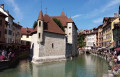
Strolling through the old town of Annecy
 Visorando Member
 3.11 mi
+92 ft
-92 ft
1h 30
3.11 mi
+92 ft
-92 ft
1h 30
 Easy
Easy
 Departure from Annecy (Haute-Savoie)
An urban circuit dedicated to water, exploring the narrow streets and passageways of the "Venice of the Alps". A rich heritage and beautiful views of the lake and surrounding peaks await you.
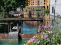
Thiou Walk
 4.37 mi
+187 ft
-180 ft
2h 10
Easy
Departure from Annecy (Haute-Savoie)
4.37 mi
+187 ft
-180 ft
2h 10
Easy
Departure from Annecy (Haute-Savoie)
An extremely easy walk in the heart of Annecy (because even city dwellers are allowed to take a stroll), along the famous lake spillway: the Thiou. A flat walk through the trees, dotted with numerous wash houses, mills and ducks... Ideal for a short stroll after lunch or a family outing.
Annecy from the Grande Jeanne
6.55 mi
+922 ft
-932 ft
3h 50
Moderate
Departure from Annecy (Haute-Savoie)
Discover the old town of Annecy from one of the car parks in the Semnoz Massif after walking along the lake shore. This first part of the hike is not very relaxing but allows you to observe the birds, which are not very shy, and enjoy beautiful views of the surrounding mountains. After a walk along the city's canals, return through the quieter forest on the ridge, passing by two viewpoints that unfortunately face west.
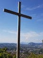
The Cross of Sainte-Catherine via the ruins of the convent and the valley
 3.11 mi
+889 ft
-889 ft
2h 10
Easy
Departure from Annecy (Haute-Savoie)
3.11 mi
+889 ft
-889 ft
2h 10
Easy
Departure from Annecy (Haute-Savoie)
Starting from the hamlet of Vovray, this is an easy walk, mostly shaded, with superb views of the town of Seynod and the Annecy basin.
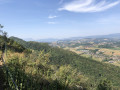
The Semnoz Viewpoints via the Vovray car park
 4.64 mi
+1,460 ft
-1,447 ft
3h 25
Moderate
Departure from Annecy (Haute-Savoie)
4.64 mi
+1,460 ft
-1,447 ft
3h 25
Moderate
Departure from Annecy (Haute-Savoie)
A walk through the Semnoz Forest takes you to the ‘Grande Jeanne’, ‘Gélinottes’ and ‘Rochers des Becs’ viewpoints. These viewpoints offer views over the Sacconges plain and the Albanais region. It’s a very enjoyable outing in summer as the route is almost entirely through the forest.
Mont Veyrier
 6.57 mi
+2,795 ft
-2,795 ft
5h 25
6.57 mi
+2,795 ft
-2,795 ft
5h 25
 Difficult
Departure from Annecy-le-Vieux (Haute-Savoie)
Difficult
Departure from Annecy-le-Vieux (Haute-Savoie)
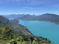
The ridge trail from Mont Veyrier to Mont Baron overlooks Lake Annecy from a height of over 800 metres and offers panoramic views of the Bauges peaks.
⚠️ A decree issued by the municipalities of Annecy and Veyrier-du-Lac prohibits motorised vehicles from accessing the Col des Contrebandiers and Pré Vernet.
Le Semnoz from Les Puisots
 5.56 mi
+1,007 ft
-1,001 ft
3h 25
Moderate
Departure from Annecy (Haute-Savoie)
5.56 mi
+1,007 ft
-1,001 ft
3h 25
Moderate
Departure from Annecy (Haute-Savoie)
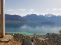
A pleasant hike through the forest covering the slopes of Semnoz, a mountain overlooking Lake Annecy on its western shore. Superb views of the lake and its surroundings are on the menu.
Le Veyrier
5.94 mi
+2,677 ft
-2,654 ft
5h 05
Moderate
Departure from Annecy-le-Vieux (Haute-Savoie)
This is a route on one of the most accessible 'mountains' around Lake Annecy.
⚠️ A decree issued by the municipalities of Annecy and Veyrier-du-Lac prohibits motor vehicles from accessing the Col des Contrebandiers and Pré Vernet.
For more walks, use our search engine .
The GPS track and description are the property of this route's author. Please do not copy them without permission.

