Country:

 City:
City:


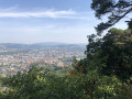
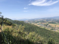
Parking is available at the Vovray car park, situated not far from the industrial estate and accessible from the Route de Vovray via the Chemin de Sainte-Catherine. At the far end of the car park, a sign indicates the various footpaths.
(S/E) From the sign, start the climb which leads, after a few dozen metres, to the Ruisseau de Sainte-Catherine at a left-hand bend. Continue to the start of a path on the left at a bend in the track.
(1) Leave the tarmac road on your right – this is the route back – and turn left onto the Georges Grandchamp path towards the Crêt du Maure (signposted 0h25). Continue through the forest along a path also used by trail runners, until you reach a junction marked by the ‘Crêt du Maure’ sign.
(2) Carry on to your left and, some 200 metres further on, you’ll arrive above the Basilica of the Visitation. A signpost, as at the Vovray car park, lists the various trails.
(3) Follow the path southwards towards Les Puisots. After a few dozen metres, you’ll come to a junction.
(4) Leave the path on your right leading to the climbing rocks below the viewpoints and turn left towards Les Puisots on the Sentier de la Crête. It runs eastwards for about 150 m, then turns south-south-east and approaches the Route de Semnoz.
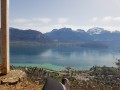
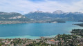
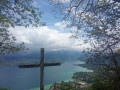
(5) Keep to the right to stay on the path. Continue in this direction to reach the Grande Jeanne viewpoint, then the Gélinottes viewpoint.
(6) Pass the Chemin de Gélinotte on your left and carry on along the Sentier de la Crête. Ignore the paths branching off to the left or right and you’ll reach the junction with the Sentier sous la Roche (IGN elevation 871)
(7) Do not take the path on the right leading from the climbing sites; instead, continue left along a track suitable for vehicles, which is also used for timber hauling, heading south all the way to the Pas de l’Âne (IGN elevation 871).
(8) Leave the route towards Les Puisots and head down towards the Sainte-Catherine valley. Walk westwards for about 200 m and turn 90° to the right. Shortly afterwards, you’ll join the Chemin de Sainte-Catherine at the climbing site known as ‘des Voleurs’.
(9) Turn right onto the track, which is suitable for vehicles; it heads due north at first, then turns left before reaching a junction.
(10) Leave the Chemin du Couvent de Sainte-Catherine on your left, turn right and head roughly north, which will take you back to the crossroads you passed on the way out.
(1) Turn left and follow the outward route in the opposite direction to return to the car park where you started (S/E).

 Visorando Member
 Easy
Easy