Tour and ascent of Mont Garde

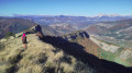
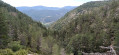
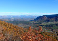
A climb through the shade of the woods to a lovely viewpoint, followed by a descent down the other side. You can extend the route by first climbing up to Rocher Pointu, Clos Besson and Costa Rascle, before descending back to the Col de Garde.

Details

n°110274704
Creation:
Last update:
Last review:
–
  • Walking
    Activity: Walking
  • ↔
    Distance: 5.29 mi
  • ◔
    Average duration: 3h 40 
  • ▲
    Difficulty: Moderate

  • ⚐
    Back to start: Yes
  • ↗
    Ascent: + 1,467 ft
  • ↘
    Descent: - 1,490 ft

  • ▲
    Highest point: 3,527 ft
  • ▼
    Lowest point: 2,080 ft

Description of the walk

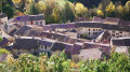
From Sisteron or Serres, head to the village of Trescléoux and park at the village entrance.

(S/E) Go down the steps, then follow the Chemin des Gravettes to the bridge over the Blaisance.

(1) Do not cross it, but follow the Blaisance river to the stone bridge.

(2) Cross the bridge and head up above the Blaisance until you reach a crossroads of footpaths.

(3) Turn left towards Rocher Pointu, then follow the left bank of the Torrent d’Auriac at a distance. You’ll reach a T-junction.

(4) Continue straight ahead and, via a steeper climb, reach the Col de Garde.

(5) Turn left and follow an easy climb up to Mont Garde.

(6) Return via the same path to the Col de Garde

(5) Descend to the left along the GRP® marked in yellow and red; take care as this section is steep and stony. You will then come to another junction.

(7) Turn left, staying on the GRP®, and arrive at the Mont Garde stopover lodge, at a place called Pied de Garde.

(8) Walk now along the banks of the Blaisance and the edge of the woods until you reach the original crossroads.

(1) Head back up to the Tréscléoux car park (S/E) via the same route as on the way there.

Waypoints

  1. S/E : mi 0 - alt. 2,221 ft - Tréscléoux car park
  2. 1 : mi 0.21 - alt. 2,133 ft - Bridge
  3. 2 : mi 0.38 - alt. 2,149 ft - Footbridge
  4. 3 : mi 0.53 - alt. 2,254 ft - Trail junction
  5. 4 : mi 1.08 - alt. 2,808 ft - Junction for alternative route
  6. 5 : mi 1.48 - alt. 3,307 ft - Col de Garde
  7. 6 : mi 1.87 - alt. 3,504 ft - Mont Garde (1080 m)
  8. 7 : mi 3.05 - alt. 2,467 ft - Junction
  9. 8 : mi 4.12 - alt. 2,093 ft - Gîte du Mont Garde
  10. S/E : mi 5.29 - alt. 2,228 ft - Tréscléoux car park

Notes

(4) Here, as mentioned in the introduction, you can turn right to reach the Rocher Pointu, then Clos Besson and Costa Rascle. You will then reach the GRP® Tour du Buëch trail; turn left and you will reach the Col de Garde at (5).
(8) Mont de Garde lodge

Worth a visit

Sisteron and its citadel

Other walks in the area

For more walks, use our search engine .

The GPS track and description are the property of this route's author. Please do not copy them without permission.