Tour du Villard from Lantriac

An easy walk with lovely scenery, along small paths starting from Lantriac. You’ll cross the Gagne twice: the first time via a ford and the second via a bridge.

Details

n°63712398
Creation:
Last update:
Last review:
  • Walking
    Activity: Walking
  • ↔
    Distance: 5.32 mi
  • ◔
    Average duration: 2h 50 
  • ▲
    Difficulty: Easy

  • ⚐
    Back to start: Yes
  • ↗
    Ascent: + 489 ft
  • ↘
    Descent: - 495 ft

  • ▲
    Highest point: 2,608 ft
  • ▼
    Lowest point: 2,306 ft

Photos

Description of the walk

(S/E) From the car park at the Lantriac sports complex, follow the D633 (Rue de la Rampe) to the first major junction.

(1) Turn left onto the D39 (Route de Saint-Front), then turn right onto Rue des Pinédes, running alongside the Terres Blanches, and at the junction, turn left onto Rue de Chaumier until you reach the last houses in the village.

(2) Turn onto the track at the far end on the right and continue until you reach the River Gagne.

(3) Cross the Gué de la Gagne ford (please note that, depending on rainfall in the preceding days, the water may be calf-deep). After crossing, carry on to the hamlet of Le Moulin Neuf.

(4) Cross through the hamlet, continue along the track which goes straight on until you reach Route du Villard, then cross the road and continue along the track.

(5) At the junction with the path to Noustoulet, turn right to carry on and pass the village of Rachassac.

(6) After passing through a short stretch of woodland, turn off onto the path that descends to the right towards the village of Le Villard.

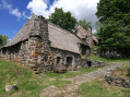
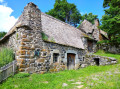
(7) Take the path to Le Villard, cross the village via the road and continue along the road until you reach the magnificent Château du Villard.

(8) Continue on, cross the Gagne again, reach the D39 and follow it to the right for about a hundred metres. Cross carefully to reach the hamlet of La Berthe.

(9) Walk up the path leading to the entrance to the Suc d’Armenaud Forest, turn right at the first junction and do the same at the second to head back down to Bordaigue.

(10) Ignore the departmental road and turn immediately left onto the path leading to the car park of the Lantriac sports complex (S/E).

Waypoints

  1. S/E : mi 0 - alt. 2,352 ft - Sports centre car park
  2. 1 : mi 0.33 - alt. 2,356 ft - Major crossroads
  3. 2 : mi 0.7 - alt. 2,402 ft - Take the path on the right at the end of Les Terres Blanches
  4. 3 : mi 1.19 - alt. 2,306 ft - Ford - Gagne (rivière)
  5. 4 : mi 1.4 - alt. 2,329 ft - The Moulin Neuf
  6. 5 : mi 1.89 - alt. 2,388 ft - Path on the right as you enter Noustoulet
  7. 6 : mi 2.71 - alt. 2,608 ft - Descent to Le Villard
  8. 7 : mi 3.15 - alt. 2,493 ft - Entrance to Le Villard
  9. 8 : mi 3.68 - alt. 2,454 ft - Château du Villard
  10. 9 : mi 3.96 - alt. 2,497 ft - The climb up the Berthe
  11. 10 : mi 4.72 - alt. 2,434 ft - Entrance to Bordaigue
  12. S/E : mi 5.32 - alt. 2,352 ft - Sports centre car park

Notes

Please note that you’ll need sturdy footwear as most of the paths are stony. I’d also advise you to take a bag with a towel, as, depending on the weather (on the day and in the days leading up to it) and the season, you may have to cross the River Gagne (where the water can be as deep as your calves at the crossing point).

Worth a visit

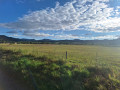
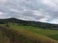
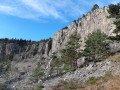
Enjoy the views of the knolls and peaks that line the path, and take a dip in the Gagne to cool off (especially in summer, when the water temperature is pleasant).
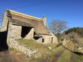
During the walk, you’ll be able to admire the superb Château du Villard.

Reviews and comments

4.3 / 5
Based on 2 reviews

Reliability of the description
5 / 5
Ease of following the route
4 / 5
Route interest
4 / 5
pierreantoine
pierreantoine

Overall rating : 4.3 / 5

Date of your route : Nov 11, 2024
Reliability of the description : ★★★★★ Very good
Ease of following the route : ★★★★☆ Good
Route interest : ★★★★☆ Good
Very busy route : No

A lovely walk taking us through some beautiful villages; the only problem was fording the Gagne at this time of year – luckily we were able to use a farmer’s tractor, otherwise we’d have been back to square one.

Machine-translated

valours
valours

Overall rating : 4 / 5

Date of your route : Nov 09, 2024
Reliability of the description : Not used / Not applicable
Ease of following the route : Not used / Not applicable
Route interest : ★★★★☆ Good
Very busy route : No

A few clarifications regarding this route, even though the description appears to be correct:
- At the start, take Rue de la Chartreuse before Rue de la Rampe
- At point 2), you need to go right to the END to turn right onto the second path
- At point 3), it’s a completely natural ford; there are no facilities. So you have to walk through the water. After two weeks without any rain, the water was about 20 cm deep. Because of this, I didn’t carry on, even though the route looks interesting.

Machine-translated

Other walks in the area

For more walks, use our search engine .

The GPS track and description are the property of this route's author. Please do not copy them without permission.