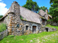
Tour of the Knoll d’Armenaud

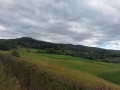
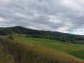
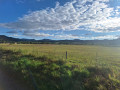
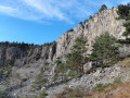
A pleasant little route starting in Lantriac, offering the chance to explore the village of Le Mont whilst passing close to the Knoll of Armenaud, where the view is spectacular for those willing to venture there.

Details

n°62293964
Creation:
Last update:
Last review:
  • Walking
    Activity: Walking
  • ↔
    Distance: 4.61 mi
  • ◔
    Average duration: 2h 50 
  • ▲
    Difficulty: Easy

  • ⚐
    Back to start: Yes
  • ↗
    Ascent: + 804 ft
  • ↘
    Descent: - 817 ft

  • ▲
    Highest point: 3,120 ft
  • ▼
    Lowest point: 2,339 ft

Photos

Description of the walk

Park in the sports centre car park.

(S/E) Walk past the D36 roundabout and follow the small sandy path next to the Lantriac sports complex car park. Turn left at the first Fork in the road and you’ll reach a junction.

(1) Turn onto the small track on the right, which becomes quite narrow a little further on, and joins a road at a place called Les Blaches.

(2) Carry on along the small track to the left, which passes a poultry farm, until you reach a bend.

(3) Ignore the path on the left – you’ll take that on the way back – and carry on, keeping to the right on the path which climbs and is very stony. You’ll reach a fork in the path opposite a stone wall.

(4) Take the path on the left, which is quite narrow in places. Follow it, making a circular turn to the right, towards the small village of Le Mont.

(5) Cross the village via a short stretch of road.

(6) Before the road bends to the left, turn right onto the path that runs to the right of the Knoll d’Armenaud. You’ll come out onto a road at the hamlet of Armenaud and follow it for about fifty metres.

(7) Turn onto the path to the right of the road after passing the two houses on the left. Continue to the fork by the stone wall.

(4) Turn left and follow the route you took on the way there, in the opposite direction, until you reach the next crossroads.

(3) Turn right onto the path leading to the D39 at the entrance to Bordaigue.

(8) Ignore the departmental road and turn immediately left onto the path leading back to the car park at the Lantriac sports complex (S/E).

Waypoints

  1. S/E : mi 0 - alt. 2,352 ft - Sports centre car park
  2. 1 : mi 0.33 - alt. 2,385 ft - Start of the narrow path
  3. 2 : mi 0.65 - alt. 2,552 ft - Les Blaches
  4. 3 : mi 0.97 - alt. 2,602 ft - Crossroads at the end of the circular loop
  5. 4 : mi 1.23 - alt. 2,740 ft - Stone wall
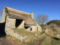
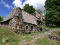
  6. 5 : mi 2.21 - alt. 3,035 ft - The Mont
  7. 6 : mi 2.43 - alt. 3,077 ft - Path on the right
  8. 7 : mi 3.14 - alt. 2,789 ft - Path on the right
  9. 8 : mi 4.02 - alt. 2,434 ft - Entrance to Bordaigue. Near the - Gagne (rivière)
  10. S/E : mi 4.61 - alt. 2,352 ft - Sports centre car park

Notes

Take care on certain sections of the walk, particularly on the descents where there are some very stony patches.

Worth a visit

Make the most of the mulberries in early September, which are plentiful throughout much of the Suc d’Armenaud Forest.

Reviews and comments

4.3 / 5
Based on 2 reviews

Reliability of the description
4 / 5
Ease of following the route
4.5 / 5
Route interest
4.5 / 5
pauline43
pauline43
• Edited:

Overall rating : 4.5 / 5

Date of your route : Aug 04, 2025
Reliability of the description : Not used / Not applicable
Ease of following the route : ★★★★★ Very good
Route interest : ★★★★☆ Good
Very busy route : No

Thanks for the suggestion for a walk. Beautiful views.
I did this walk with my 7-year-old children.

Please note that there is forestry work going on after point 7 (before leaving the forest) for about a hundred metres.

Machine-translated

michem
michem

Overall rating : 4.3 / 5

Date of your route : Sep 15, 2024
Reliability of the description : ★★★★☆ Good
Ease of following the route : ★★★★☆ Good
Route interest : ★★★★★ Very good
Very busy route : No

A really lovely walk with some beautiful views. A few incorrect signposts mean you have to search for the right route!

Machine-translated

Other walks in the area

For more walks, use our search engine .

The GPS track and description are the property of this route's author. Please do not copy them without permission.