Country:

 City:
City:


Parking is available in the car park before the station, on the second street on the right after the bridge over the Rieutord, on Avenue de la Gare.
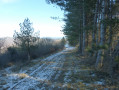
(S/E) Head towards the old station and from there continue due south to join the Voie Verte. Walk along it for just over 400 m.
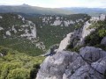
(1) Turn left at a stone parapet onto a small path marked in yellow. Take care: the path is stony and narrow in places. Continue along this path via the Pas du Loup (a rocky overhang with a beautiful view) and the Pas de Madame until you reach a junction with a sign marked ‘Ranc de la Banes, 665 m’.
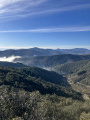
(2) Continue left towards the summit and the viewpoint.
(3) Retrace your steps back to the signpost.
(2) Turn left towards the Col de l’Agas, signposted as 1 km away.
(4) After walking 400 m, you’ll reach another junction; ignore the path on the right which descends steeply towards the caves and turn left to begin the descent towards the pass through a wood and then a sparse area. You’ll reach the Col de l’Agas (signpost).
(5) The descent continues due east to the first three-way junction.
(6) Take the hairpin bend to the left and continue descending due west for 900 m (watch out for a scree slope) until you reach the junction with a wider path.
(7) Carry on to the left. Caution: another steep descent with slippery stones if it’s raining or icy! You’ll come out at a T-junction, facing the stream called the Recodier.
(8) Turn left along the stream, pass under the viaduct and reach Avenue du Pont Neuf. Follow it to the left for about 250 metres, then turn left onto Avenue de la Gare to return to the starting car park (S/E).

 Visorando Member

 Association / Club / Walk leader
 Easy
Easy