Circuit of the Parmelan plateau via the Pertuis Valley

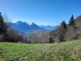
I suggest you take a lovely walk around the Parmelan plateau, situated between the Fier Valley (to the south) and the Fillière Valley (to the north), near Annecy and its lake.
The route, which can be challenging at times, winds through a landscape strongly characterised by limestone and its Urgonian sharp limestone pavement, all set against a backdrop of magnificent scenery.

Details

10514815
Creation:
Last update:
Last review:
  • Walking
    Activity: Walking
  • ↔
    Distance: 11.25 mi
  • ◔
    Average duration: 9h 00 
  • ▲
    Difficulty: Difficult

  • ⚐
    Back to start: Yes
  • ↗
    Ascent: + 4,396 ft
  • ↘
    Descent: - 4,400 ft

  • ▲
    Highest point: 6,066 ft
  • ▼
    Lowest point: 3,816 ft

Photos

Description of the walk

The route starts from the Bois Brulé car park at the end of a forest road. To reach it, first follow the Route du Parmelan on the outskirts of Villaz.

(S/E) Take the wide path uphill.

(1) At a fork, turn left (towards the Refuge du Parmelan via the Chemin des Vaches).

(2) After a short while, you’ll join another path: continue to the left.

(3) A little further up, turn right towards the Grand Montoir: there are some aids (stairs made of logs or carved into the rock, and cables) to help you on your way, but a degree of caution is still required.

(4) Once you reach the Grand Montoir, head right towards the Refuge du Parmelan along a relatively easy route.

(5) Head right (north), passing in front of the refuge, and make your way towards a clearly visible cross ahead.

(6) From the Tête du Parmelan, enjoy a lovely 360° view. Retrace your steps back to the refuge.

(5) Head towards a goods lift to take in another beautiful view. Follow a path towards the Plateau de Parmelan, heading south-east

(7) At a fork, continue almost straight on, heading uphill towards Sur le Pertuis. In a distinctly limestone landscape, the path winds through a series of ascents and descents, passing close to the route’s highest point at an altitude of 1,856 metres. A degree of caution is required on this section.

(8) Suddenly, the path becomes a steep, slippery slope over very stony ground. At times, you’ll need to use your hands to navigate short sections where you have to climb down. On this challenging stretch, you must be extremely vigilant: watch out for falling rocks (for your own safety and that of others) and take your time.

(9) Turn left towards the Cabane des Bûcherons (marked ‘Chasseurs’ on IGN maps), heading north-east: the path continues relatively gently, mostly downhill.

(10) At the Cabane des Bûcherons, carry on straight ahead towards the Fontaine du Geai.

(11) At the fork, take the left-hand path towards the Refuge du Parmelan. The path climbs with some steep sections, then reaches a few tricky passages equipped with cables.

(12) After a short while, you’ll reach a junction: turn left towards the Grotte de l’Enfer. On the way, you’ll pass the Fontaine du Tour

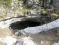
(13) After passing two caves (lovely spots well worth a detour), turn right at the nearby fork towards Bois Brulé.

(14) At the junction, continue to the left, then a little further on, turn right towards Petit Montoir onto a path leading downhill.

(15) The path winds through a lovely spot at the foot of the cliffs: carry on straight ahead at the fork.

(3) At the Grand Montoir junction, you’ll reach a spot you’ve seen before: carry straight on

(2) At Balmont Nord, carry on straight towards the Chalet Chapuis (a different route to the outward leg). After passing through Balmont Sud and winding your way up a few hairpin bends, you’ll reach the chalet: it’s a lovely spot (and you can buy some Tome de Savoie cheese there).

(16) Take the wide path on the right towards the Bois Brulé car park and return to the starting point (S/E)

Waypoints

  1. S/E : mi 0 - alt. 3,819 ft - Bois Brulé car park
  2. 1 : mi 0.15 - alt. 3,983 ft - Bois Brulé
  3. 2 : mi 0.89 - alt. 4,587 ft - Balmont North
  4. 3 : mi 1.33 - alt. 5,026 ft - Grand Montoir junction
  5. 4 : mi 1.66 - alt. 5,666 ft - Le Grand Montoir
  6. 5 : mi 2.02 - alt. 5,988 ft - Refuge du Parmelan
  7. 6 : mi 2.16 - alt. 5,974 ft - Tête du Parmelan
  8. 7 : mi 2.55 - alt. 5,856 ft - Parmelan Plateau
  9. 8 : mi 3.28 - alt. 5,797 ft - On the Pertuis
  10. 9 : mi 3.98 - alt. 5,023 ft - Alpage du Pertuis
  11. 10 : mi 5.3 - alt. 4,508 ft - Cabane des Bûcherons
  12. 11 : mi 5.97 - alt. 4,157 ft - Fontaine de Geai
  13. 12 : mi 7.22 - alt. 5,279 ft - Laud Mountain
  14. 13 : mi 8.07 - alt. 5,545 ft - Grotte de l'Enfer
  15. 14 : mi 8.87 - alt. 5,289 ft - Crêt des Outalays
  16. 15 : mi 9.38 - alt. 5,039 ft - Glacière d'Avernioz
  17. 16 : mi 10.7 - alt. 4,104 ft - Chalet Chapuis
  18. S/E : mi 11.25 - alt. 3,816 ft - Bois Brulé car park

Notes

Good walking boots and walking poles are recommended.
There are virtually no water sources: make sure you bring what you need.
Nature cannot break down your rubbish. Please take it all back with you!
The route is fairly busy up to the Refuge du Parmelan. After that, you should find it much quieter.
On the return journey, the trail gradually becomes busier again after the Grotte de l’Enfer.
The route is generally in fairly good condition:
- signposts are fairly frequent,
- throughout the route, there are markings with yellow arrows which you should follow. There are other (older) markings, which are detailed below.
Here is a description of the difficulties encountered by section (the route is not uniform):
- green: fairly straightforward terrain with no significant elevation changes or difficulties
- blue: steeper slopes and/or more pronounced elevation changes on a well-marked route.
- Orange: a route presenting some technical difficulties and/or poor route conditions (markings or visibility of the path).
- Red: a difficult route due to significant elevation changes that may require some climbing, in an environment presenting certain hazards.
- Black: a route on a fairly difficult trail and/or involving imminent dangers.
- White: routes through very challenging technical terrain requiring specific equipment.
From (S/E) to (3): blue difficulty.
The route follows good paths and tracks.
From (3) to (4): orange difficulty.
The route passes through rugged terrain, featuring numerous aids to make the walk easier (carved-out rock, cables, wooden log steps). Please note that snow may make access difficult
From (4) to (6): blue difficulty
The route is relatively easy, and finding your way should not pose any problems.
From (6) to (8): orange difficulty.
In a landscape with a sharp limestone pavement, the route is rather rugged, with a succession of ascents and descents.
From (8) to (9): red difficulty.
This is a steep, rocky and slippery path. Some sections require you to use your hands. Take care
From (9) to (10): blue difficulty.
In a wooded setting, the route follows a fairly easy path.
From (11) to (12): orange difficulty.
Much of the route follows a steeply sloping path, sometimes requiring you to use your hands. Cables are in place to aid progress.
Old red markings complement the yellow ones (with arrows).
From (12) to (13): blue difficulty.
The path follows a route with no significant elevation gain, marked in places by a few exposed limestone rocks. A few old red markings complement the yellow ones.
Access to the Grotte de l’Enfer is dangerous. Take care.
From (13) to (14) – blue difficulty.
As before, the route follows a fairly straightforward path. A few red markings complement the yellow ones.
From (14) to (3): blue difficulty.
On a few steeper slopes, following the route does not pose any major problems. Please note that snow may make access difficult.
From (3) to (2): blue difficulty.
On a well-marked route, this is a good path to follow
From (2) to (S/E): green difficulty.
The return to the starting point is straightforward.

Worth a visit

Parmelan Refuge: it was established in 1883 in honour of Camille Dunant (founder of the Annecy Alpine Club). To find out more, click here and here

Mount Parmelan: click here

Reviews and comments

5 / 5
Based on 2 reviews

Reliability of the description
5 / 5
Ease of following the route
5 / 5
Route interest
5 / 5
yam100907
yam100907

Overall rating : 5 / 5

Date of your route : Sep 21, 2024
Reliability of the description : ★★★★★ Very good
Ease of following the route : ★★★★★ Very good
Route interest : ★★★★★ Very good
Very busy route : No

A superb route that takes you across all kinds of terrain throughout the walk!!! A breathtaking view from the summit of Parmelan. The first descent is actually quite technical, with steep slopes and very slippery stony ground – ‘slow and steady wins the race’. There were quite a few walkers from the start up to the Grand Montoir, but fewer people before the final descent.
It took me 8 hours to complete the route.
Many thanks for the route description

Machine-translated

Tom Asgar
Tom Asgar

Overall rating : 5 / 5

Date of your route : May 26, 2023
Reliability of the description : ★★★★★ Very good
Ease of following the route : ★★★★★ Very good
Route interest : ★★★★★ Very good
Very busy route : No

A brilliant hike! It’s a comprehensive route that takes you past all the must-see spots on the Parmelan.
We had a quick look inside the first cave: ice stalactites and stalagmites Be careful though – there are holes and ice too.
As for the ‘Grotte de l’Enfer’, we descended about ten metres, but couldn’t go any further without the right kit!
A challenging hike: between 18 and 20 km covered in 7 hours without breaks.
Thanks for the route!

Machine-translated

Other walks in the area

For more walks, use our search engine .

The GPS track and description are the property of this route's author. Please do not copy them without permission.