Walk around Lake Flourens and the surrounding area

A walk starting from Flourens. After the walk round the lake, there’s a short stroll along a well-maintained and popular circular route. You’ll head out onto the surrounding hillsides, with a view of the Pyrenees from the ridge on the way back.

Details

n°16672609
Creation:
Last update:
Last review:
  • Walking
    Activity: Walking
  • ↔
    Distance: 3.31 mi
  • ◔
    Average duration: 1h 45 
  • ▲
    Difficulty: Easy

  • ⚐
    Back to start: Yes
  • ↗
    Ascent: + 217 ft
  • ↘
    Descent: - 203 ft

  • ▲
    Highest point: 709 ft
  • ▼
    Lowest point: 522 ft
  • ⚐ Country: France
  • ⚐ City: Flourens (31130)
  • ⚑
    Start/End: N 43.596422° / E 1.566031°
  • ❏
    IGN map(s): Ref. 2143E
  • Hour-by-hour weather

Photos

Description of the walk

Park in the car park after the Flourens Lake dam.

(S/E) Take the path round the lake heading south-east. Continue to its eastern end.

(1) Keep to the right to complete the loop round the lake and return to the junction at the end of the dam. Turn left just before the car park. At the next junction, turn right onto the Chemin de Lasserre. You’ll soon reach a T-junction at a place called En Poulet.

(2) Turn left towards the north and take a wide track that descends towards the Seillonne. Pass the private track on your right at the farm. You will then reach another T-junction just before the river.

(3) Turn right onto the wide track. Pass under a power line to reach another T-junction.

(4) Turn right again and begin a gentle climb to reach the junction with the D50d at the highest point.

(5) Cross it carefully, then turn right onto Rue du Cluzel. Leave this road a few metres further on to the right to cross the housing estate. Keep to the edge of the stream feeding the lake to return to the junction at the eastern end of the lake, which you passed earlier.

(1) Retrace your steps along the route you took on the way there to return to the car park by the dyke (S/E).

Waypoints

  1. S/E : mi 0 - alt. 604 ft - Car park by the - Lac de Flourens
  2. 1 : mi 0.34 - alt. 604 ft - Eastern end of the lake
  3. 2 : mi 1.17 - alt. 643 ft - A place called En Poulet
  4. 3 : mi 1.49 - alt. 525 ft - Crossroads before the river - Seillonne (rivière) - Affluent de la Sausse
  5. 4 : mi 2.1 - alt. 535 ft - T-junction
  6. 5 : mi 2.58 - alt. 705 ft - D50d junction
  7. S/E : mi 3.31 - alt. 604 ft - Car park by the - Lac de Flourens

Notes

The route is not shaded apart from the walk around the lake.
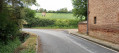
The paths are very easy to walk on, wide and well-maintained.

Worth a visit

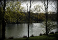
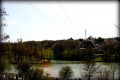
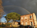
(S/E) A lovely view of the lake and the trees in their autumn colours. The play equipment by the lake can be a great way for children to unwind at the end of the walk. Depending on the day and time, they may be quite busy: the spider’s web, the zip line, etc.

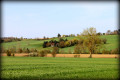
(5) Views of the Pyrenees if the sky is clear.

Reviews and comments

4.2 / 5
Based on 2 reviews

Reliability of the description
4 / 5
Ease of following the route
4 / 5
Route interest
4.5 / 5
Gobscricri
Gobscricri

Overall rating : 3.3 / 5

Date of your route : Sep 17, 2025
Reliability of the description : ★★★☆☆ Average
Ease of following the route : ★★★☆☆ Average
Route interest : ★★★★☆ Good
Very busy route : No

Hello, We had a problem at point 3. The path along the Roussel is not very visible, and the name of the stream is not mentioned. It should be indicated that you have to pass to the right of the stream at the edge of the field on a narrow track suitable for one person. There should be an alternative route between points 3 and 5.
Thank you very much for all your work in surveying the route.
Best regards.

Hike from Lake Flourens to Lake Mons.

Machine-translated

Mymi3189
Mymi3189

Overall rating : 5 / 5

Date of your route : Mar 27, 2022
Reliability of the description : ★★★★★ Very good
Ease of following the route : ★★★★★ Very good
Route interest : ★★★★★ Very good
Very busy route : Yes

A lovely walk around the lake and in the surrounding area, suitable for families and sure to be enjoyed by everyone

Machine-translated

Other walks in the area

For more walks, use our search engine .

The GPS track and description are the property of this route's author. Please do not copy them without permission.