Country:

 City:


Park in the small car park at the entrance to the hamlet of Plampinet (1,480 m).
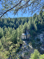
(S/E) Cross the bridge over the Clarée, turn left at the inn, then turn right to pass the other inn and follow the forest track (GR®5 signposted) which climbs in wide hairpin bends before levelling out as it leads towards the valley of the Acles chalets. Pass the Oratoire Saint-Roch and reach a junction.
(1) Leave the forest track and take the path that climbs to the left towards the Col des Acles: the GR®5B path.
(2) Turn left to pass in front of the Acles blockhouse and reach the pass of the same name (2,273 m).
(3) Turn right to follow the wide track which, crossing the French-Italian border, leads north-east to the Col de la Mulattiera (2,412 m).
(4) From the pass, take path 705 opposite, which makes a sharp left-hand bend before reaching a three-way junction. Head right to descend eastwards, following the signs for the Guido Rey Refuge.
(5) Cross the stream (there are springs here where you can fill your water bottles), then follow the descending dirt track. On your right, about a hundred metres further on, you will see the Sanità Chapel, situated about 50 m into the woods (1,920 m).
(6) Leave the dirt track and follow the path on the right, signposted towards the Guido Rey Refuge and the Chapel of San Giusto. You will reach the chapel, at the foot of which there is a substantial spring (1,820 m).
(7) Continue along the single path, which has a few ascents and descents, until you reach the junction with another path on the right.
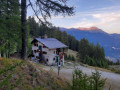
(8) Turn right onto a steep climb through the forest, made easier by a wooden staircase. At the top of the climb, as you emerge from the forest, descend through clearings and pine trees to the Guido Rey Refuge ( 1,761 m).
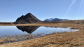
(9) Follow the steep path to the right, which passes close to a small lake: signpost for Rocher de la Garde and the Blanchetti bivouac. Continue through the woodland along the only path, which leads to the altitude of 2228 and known as Rocher de la Garde: the ruins of a small chalet.
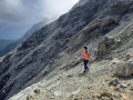
(10) Continue the ascent via several tight hairpin bends until the path veers off to the right, heading towards the Pas de l’Ours and the Blanchetti bivouac. During this traverse, remain vigilant due to a few exposed sections and unstable ground.
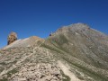
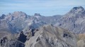
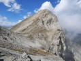
(11) From the pass and the bivouac, you can choose between ascending the Grand’Hoche or descending towards Plampinet. To reach the Grand’Hoche, follow the track (marked with red signs and cairns) which climbs steeply up the broad ridge forming the border between France and Italy. At the summit, there isa magnificent panorama across the entire Alps, from the Écrins to Mont Blanc and Monte Rosa.
(12) Descend via the same route you took up to the bivouac.
(11) From there, descend on the French side (signs for the Chalets des Acles – Plampinet) for a descent of around 200 metres to reach a fork in the path: take the left to either climb up to the Col des Desertes and return to Italy, or descend the valley – clearly visible along its entire length – to the Chalets des Acles and Plampinet.
(13) Choose this route.
(14) Take care when crossing the stream bed (at an altitude of around 2,100 m), where the water often washes away the trail. The crossing is easy, but you must follow the cairns carefully as they mark the way to the opposite bank, where the path becomes clearly visible again through the woodland. This will take you to the Acles chalets: there are numerous chalets, pastures and springs.
(15) Ignore the path that branches off to the left towards the Opon valley and Montgenèvre, and continue down the track suitable for vehicles until you reach the original junction.
(1) Carry on straight ahead, passing the Oratoire Saint-Roch once more, then follow the last few kilometres along the track you took on the way out. Return to the starting point at Plampinet (S/E).
 Visorando Member
 Moderate

 Difficult