Tour de la Barme starting from Montcusel

A walk crossing the Bienne valley to the slopes of the Ain valley.

Details

n°3597533
Creation:
Last update:
Last review:
  • Walking
    Activity: Walking
  • ↔
    Distance: 11.24 mi
  • ◔
    Average duration: 6h 40 
  • ▲
    Difficulty: Moderate

  • ⚐
    Back to start: Yes
  • ↗
    Ascent: + 1,703 ft
  • ↘
    Descent: - 1,703 ft

  • ▲
    Highest point: 2,398 ft
  • ▼
    Lowest point: 1,745 ft

Description of the walk

Park in front of Montcusel Town Hall.

(S/E) Walk down to the centre of the village and turn left onto Rue de Niella until you reach the three-way junction.

(1) Follow the shaded path to the right to reach the hang-gliding launch site.

(2) Continue along the main path heading south. You’ll reach the T-junction at a place called Cezinet.

(3) Keep left on the main path towards Cul de la Pra; there are signposts. Continue along this path, ignoring all turn-offs to the right or left. Climb up to reach the hamlet of Grand Serve.

(4) Turn right onto a road leading to La Queille, which you’ll reach after two hairpin bends.

(5) Head down to the right along the correct path, following the yellow markings, along the hillside overlooking the hamlet of Douvre. Continue to Les Vignes.

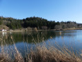
(6) Cross a pasture. Continue to the far end of the field and find a stony path which, after two bends, leads into a meadow with boxwood, juniper, pine and white birch trees. Reach Chanon, cross the hamlet to arrive at the western side of Lac de Chanon.

(7) Turn left towards Martigna and head for the Côte de Venière.

(8) Please note: there is a junction here, situated on a bend; do not under any circumstances continue along the stony white track, as the main path leads towards Lect.
Turn left onto the track crossing the Bois de Cruzille.

(9) At the next junction, turn right onto a dirt track which winds its way through rolling countryside, skirting meadows before passing through woodland to reach the Chemin de Cruzille. You’ll arrive just below the power line.

(10) Pass under the power line, take a dirt track on the left and follow the Molard de la Chouette. It passes through La Meille. You’ll reach the crossroads by the signpost known as Courbet.

(11) Follow this direction, crossing a clearing and then a wood. Continue through the next clearing to reach the hamlet of Nézan.

(12) Carry on to the left at the crossroads marked by the cross, heading towards Montcusel. You’ll reach a hairpin bend in the road.

(13) Stay on the road, turning right at the hairpin bend; you’ll reach another hairpin bend; carry on for a few metres to find the start of a footpath.

(14) Leave the road and take this path on the right; follow it until you reach Rue Niella in Montcusel, then leave it at the junction to turn left onto the street leading to the car park at Montcusel Town Hall (S/E).

Waypoints

  1. S/E : mi 0 - alt. 2,031 ft - Montcusel Town Hall car park
  2. 1 : mi 0.26 - alt. 2,096 ft - Crossroads on Rue de Niella
  3. 2 : mi 1.13 - alt. 2,165 ft - Hang-gliding launch site
  4. 3 : mi 1.61 - alt. 1,969 ft - Cezinet
  5. 4 : mi 3.03 - alt. 2,359 ft - Grand Serve
  6. 5 : mi 3.56 - alt. 2,244 ft - La Queille
  7. 6 : mi 5.03 - alt. 1,834 ft - Les Vignes
  8. 7 : mi 6.21 - alt. 1,965 ft - Lake Chanon
  9. 8 : mi 6.98 - alt. 1,903 ft - Cruzille Path
  10. 9 : mi 7.49 - alt. 2,001 ft - Turn left at the fork
  11. 10 : mi 8.51 - alt. 2,244 ft - Passing under a power line
  12. 11 : mi 8.97 - alt. 2,372 ft - The ‘Courbet’ signpost
  13. 12 : mi 9.65 - alt. 2,093 ft - Crossroads
  14. 13 : mi 9.88 - alt. 2,136 ft - Hairpin bend in the road
  15. 14 : mi 10.34 - alt. 2,385 ft - Trail junction
  16. S/E : mi 11.24 - alt. 2,031 ft - Montcusel Town Hall car park

Notes

Make sure you take plenty of water with you when you set off, as the only place along the route where you can fill your water bottles is the fountain in the village of Nezan. To get there, when you reach the crossroads, turn right to reach the fountain, where the water is safe to drink.

Worth a visit

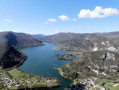
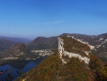
Between (1) and (2) Hang-gliding launch site to enjoy the view:
- the Bienne at its confluence with the Ain,
- the village of Chancia, dominated by the Molard de Netru,
- Lake Coiselet, framed to the south-west by the Pic d’Oliferne,
- and to the west by the Pierre qui Vire above Dortan.
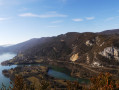
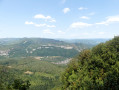
(4) The hamlet of Grand Serve: a viewpoint over the Bienne valley and the mountains around Saint-Claude, such as the Pyramide du Crêt Pourri flanked by the Rocher du Fresnois, and, in the distance, the Haute-chaîne du Jura.
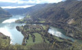
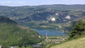
Between (9) and (10) In Nezan: a viewpoint overlooking Lake Coiselet

Reviews and comments

4.7 / 5
Based on 1 review

Reliability of the description
4 / 5
Ease of following the route
5 / 5
Route interest
5 / 5
Nomack
Nomack

Overall rating : 4.7 / 5

Date of your route : Aug 08, 2021
Reliability of the description : ★★★★☆ Good
Ease of following the route : ★★★★★ Very good
Route interest : ★★★★★ Very good
Very busy route : No

All in all, I was really delighted to have been able to explore this walk through meadows and woods. There were very few people on the paths, partly due to the heavy rain over the last few days. Two or three lovely viewpoints, plus the tranquillity of the forest…
However, in these conditions, it’s all the more important to have good-quality high-top shoes (and perhaps a spare pair of socks). At times, it was unavoidable to cross certain sections that were waterlogged.
The final stretch of road to reach this village by car isn’t long but is winding and narrow, so do take care when approaching Montcusel.

Machine-translated

Other walks in the area

For more walks, use our search engine .

The GPS track and description are the property of this route's author. Please do not copy them without permission.