Tête Rouge from La Treille

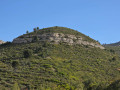
Ascent to the Grande Tête Rouge via the Sources du Laurier and the Sources du Chien.

Details

48635668
Creation:
Last update:
Last review:
  • Walking
    Activity: Walking
  • ↔
    Distance: 3.67 mi
  • ◔
    Average duration: 2h 40 
  • ▲
    Difficulty: Moderate

  • ⚐
    Back to start: Yes
  • ↗
    Ascent: + 1,152 ft
  • ↘
    Descent: - 1,152 ft

  • ▲
    Highest point: 1,703 ft
  • ▼
    Lowest point: 807 ft
  • ⚐ Country: France
  • ⚐ City: Allauch (13190)
  • ⚑
    Start/End: N 43.324775° / E 5.513666°
  • ❏
    IGN map(s): Ref. 3145ET
  • Hour-by-hour weather

Photos

Description of the walk

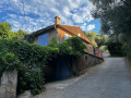
Park in the hamlet of Les Bellons. Please note: there are only two parking spaces available opposite the Bastide Neuve (Pagnol’s house); see ‘Practical Information’ for further details on parking.

(S/E) Take the track, following the yellow markings, which leave the track twice (you can stay on the track) and lead to a Y-junction.

(1) Keep left onto the blue-marked track and you’ll soon come to another junction at the bottom of the valley.

(2) Turn left, cross the valley and follow the loosely marked yellow path. You’ll come to a track; take it to the left until you reach a multi-way junction.

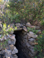
(3) Take the path – for a round trip – which climbs to the right and leads to the Source du Laurier.

(4) Then return to the multi-way junction.

(3) Continue to the right along the track and, at the three-way junction, take the right-hand branch. Walk a few steps until you reach the start of the path leading to Tête Rouge.

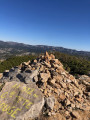
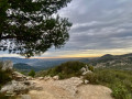
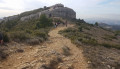
(5) Take this path to the right and begin a steep, sustained climb to reach the summit of Grande Tête Rouge.

(6) Descend via the track on the left, then turn right at the next junction. Reach a multi-way junction and veer right to follow the blue-marked track. You’ll reach the three-way junction at Pas dei Menoun.

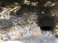
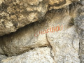
(7) Turn right, pass the Pas de Menoun and keep to the left to reach the decorated rock shelter (no markings, no signposts – take care).

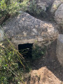
(8) Return to the path and continue to the left. You will reach the Source du Chien.

(9) Turn right onto the blue-marked path, continue down the slope and return to the junction you passed on the way out.

(2) Turn left and follow the route you took on the way there in the opposite direction to return to the Bellons car park (S/E).
Waypoints

  1. S/E : mi 0 - alt. 807 ft - Les Bellons car park
  2. 1 : mi 0.65 - alt. 1,171 ft - Take the track that descends to the left
  3. 2 : mi 0.77 - alt. 1,109 ft - Junction on the circular loop
  4. 3 : mi 1.02 - alt. 1,234 ft - Multi-way junction
  5. 4 : mi 1.06 - alt. 1,266 ft - Source du Laurier
  6. 5 : mi 1.3 - alt. 1,217 ft - Crossroads towards the - Grande Tête Rouge
  7. 6 : mi 1.53 - alt. 1,693 ft - Grande Tête Rouge
  8. 7 : mi 1.94 - alt. 1,526 ft - Leave the signposted path
  9. 8 : mi 2.16 - alt. 1,549 ft - Decorated rock shelter
  10. 9 : mi 2.43 - alt. 1,293 ft - Source du Chien
  11. S/E : mi 3.67 - alt. 807 ft - Les Bellons car park

Notes

(S/E) There are other parking spots further up the road, but please do not obstruct traffic: the road is narrow.

Reviews and comments

4.7 / 5
Based on 2 reviews

Reliability of the description
4.5 / 5
Ease of following the route
4.5 / 5
Route interest
5 / 5
juliemolto
juliemolto

Overall rating : 4.3 / 5

Date of your route : Aug 18, 2025
Reliability of the description : ★★★★☆ Good
Ease of following the route : ★★★★☆ Good
Route interest : ★★★★★ Very good
Very busy route : No

It's always a pleasure to climb up to the Grande Tête Rouge! But the view is well worth the effort, as the climb is tough! I had a great time with my dog after a day at work, enjoying the long summer days

Machine-translated

Mireille7313
Mireille7313

Overall rating : 5 / 5

Date of your route : Jun 22, 2025
Reliability of the description : ★★★★★ Very good
Ease of following the route : ★★★★★ Very good
Route interest : ★★★★★ Very good
Very busy route : No

A very enjoyable walk despite the intense heat. The climb to the summit is tough, but doesn’t last long. There are some lovely views of Marseille once you reach the top. Part of the return route is closed due to rockfalls. But taking a short detour doesn’t spoil the walk in the slightest. A lovely circular walk!

Machine-translated

Other walks in the area

For more walks, use our search engine .

The GPS track and description are the property of this route's author. Please do not copy them without permission.