Heritage sites around Vassieux-en-Vercors

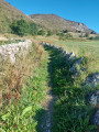
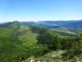
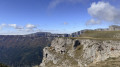
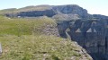
A historic route accessible to all, offering the chance to learn more about the French Resistance, with stunning panoramic views of the Grand Veymont and a rich and fascinating heritage.

Details

29695095
Creation:
Last update:
Last review:
  • Walking
    Activity: Walking
  • ↔
    Distance: 7.20 mi
  • ◔
    Average duration: 4h 35 
  • ▲
    Difficulty: Moderate

  • ⚐
    Back to start: Yes
  • ↗
    Ascent: + 1,457 ft
  • ↘
    Descent: - 1,467 ft

  • ▲
    Highest point: 4,764 ft
  • ▼
    Lowest point: 3,412 ft

Description of the walk

Park at the Place des Martyrs car park in Vassieux-en-Vercors.

(S/E) From the car park, head west along Place de la Fontaine, then turn right onto Avenue Jacques Roux. Continue straight on, heading due north.

(1) Leave the tarmac and take the path branching off to the left towards the Col de la Chau (marked with yellow and green signs).
Head due north towards the pass (there’s a fairly steep climb on this section, with lovely views of the Vercors massif and the Grand Veymont) .
Further on, the path turns into a tarmac slab leading to the Resistance Memorial.

(2) A path with steps and information boards then leads to the Col de la Chau.

(3) Join the D76 on the right and follow it to the right until you reach a junction sign.

(4) Leave the road and take the path that branches off to the left, leading to the Grange de Vauneyre (a former hideout for Resistance fighters).

(5) Continue due north along the path, which turns into a forest track at a place called Petit Pré and leads to a junction of tracks.

(6) Follow the track to the right, which leads to the Col de la Mure.

(7) Turn right onto the descent heading south-east, pass a sign once again indicating the Col de la Mure, and continue the descent south-east. Ignore any side trails on this section and stay firmly on the yellow and green-marked path which leads to the D76 road.
Caution: this is a fairly technical descent (a 200-metre drop over a short distance); please take care.

(8) Take the path (still signposted) which descends to the left and joins the D178 less than 1 km further on.

(9) Cross this road to take the minor road towards La Mure. Pass the hamlet, then the chapel, and continue along this path. Further on, cross a road to stay on the path and reach a junction of paths.

(10) Follow the path branching off to the right towards the National Resistance Necropolis and rejoin the D76.

(11) Take the route towards Vassieux, which is behind the necropolis. Leave the track when a sign indicates a path branching off to the left.

(12) Take this path on the left until you reach the D178 and the entrance to the village.

(13) Follow the road leading into the centre of the village. At the roundabout, turn right to reach the Place des Martyrs (S/E).

Waypoints

  1. S/E : mi 0 - alt. 3,471 ft - Place des Martyrs car park
  2. 1 : mi 0.4 - alt. 3,484 ft - Junction on the path
  3. 2 : mi 1.1 - alt. 4,281 ft - Mémorial de la Résistance (Vassieux-en-Vercors)
  4. 3 : mi 1.28 - alt. 4,380 ft - Col de la Chau (1337m)
  5. 4 : mi 1.46 - alt. 4,324 ft - Withdrawal point: Route D76
  6. 5 : mi 1.88 - alt. 4,636 ft - Vauneyre Barn
  7. 6 : mi 2.56 - alt. 4,698 ft - Forest track junction
  8. 7 : mi 3.35 - alt. 4,682 ft - Col de la Mure (1424m)
  9. 8 : mi 3.93 - alt. 3,930 ft - D76 road
  10. 9 : mi 4.39 - alt. 3,563 ft - D178 road
  11. 10 : mi 5.97 - alt. 3,455 ft - Trail junction
  12. 11 : mi 6.2 - alt. 3,491 ft - Nécropole nationale (Vassieux-en-Vercors)
  13. 12 : mi 6.67 - alt. 3,474 ft - Leaving the trail
  14. 13 : mi 6.97 - alt. 3,422 ft - D76 road
  15. S/E : mi 7.2 - alt. 3,471 ft - Car park at Place des Martyrs

Notes

Don’t forget a hat or cap and sun cream during the summer months.

Walking poles are very useful between (7) and (8).

Worth a visit

Watch a video of this hike.

The Vercors Resistance Museum in the village, near the church.

The Resistance Memorial at the Col de la Chau.

The National Resistance Cemetery.

Font d’Urle ski resort, a few kilometres from Vassieux-en-Vercors

Reviews and comments

3.7 / 5
Based on 5 reviews

Reliability of the description
4 / 5
Ease of following the route
3 / 5
Route interest
4.2 / 5
pierreantoine
pierreantoine

Overall rating : 3.7 / 5

Date of your route : Jul 15, 2025
Reliability of the description : ★★★★☆ Good
Ease of following the route : ★★★☆☆ Average
Route interest : ★★★★☆ Good
Very busy route : No

A lovely hike in the heat, with the icing on the cake being a fawn that came to say hello whilst we were having our lunch break. And, like most hikers, we lost our way on the descent from the Col de la Mure.

Machine-translated

MC5638
MC5638

Overall rating : 3.7 / 5

Date of your route : May 15, 2025
Reliability of the description : ★★★★☆ Good
Ease of following the route : ★★★☆☆ Average
Route interest : ★★★★☆ Good
Very busy route : No

The descent from the Col de la Mure is steep. We’ve lost sight of the signposts. In my opinion, there aren’t enough of them.

Machine-translated

Wingardium
Wingardium
• Edited:

Overall rating : 5 / 5

Date of your route : Nov 08, 2023
Reliability of the description : Not used / Not applicable
Ease of following the route : Not used / Not applicable
Route interest : ★★★★★ Very good
Very busy route : No

A hike we went on on a whim, on the only day of really fine weather in the middle of a rather rainy autumn! The early-morning frost was a nice touch on the route.
A lovely route that’s easily adaptable and presents no difficulties.
Between (5) and (6), you can pass through the Pelouse de Derbounouse.
A few metres past the point (6) (Col de la Mure), don’t hesitate to make a round trip to the Serre Plumé, where the 360° view is well worth the extra effort (watch out for the wind at the summit!). The panorama stretches from the Ardèche mountains to the Grand Veymont.
Between (6) and (7), part of the path must have been washed away by heavy storms as it disappears completely. Fortunately, the Visorando app on your phone helps you find your way to the hairpin bend on the D76 road through the undergrowth.
In the hamlet of La Mure, I took a short round trip to the ruins of two windmills, plus a short circular loop to Le Scialet Couvert.
At the point (9), I carried on straight on to the village as I was already familiar with the Necropolis.

Machine-translated

Guy34
Guy34

Overall rating : 3.7 / 5

Date of your route : Sep 18, 2023
Reliability of the description : ★★★★☆ Good
Ease of following the route : ★★★☆☆ Average
Route interest : ★★★★☆ Good
Very busy route : No

Lost my way between points 6 and 7 on a very steep, unmarked descent

Machine-translated

corbelgilles
corbelgilles

Overall rating : 3.7 / 5

Date of your route : Sep 10, 2023
Reliability of the description : ★★★★☆ Good
Ease of following the route : ★★★☆☆ Average
Route interest : ★★★★☆ Good
Very busy route : No

Section 6-7 seems to be very rarely used, so the descent was very difficult without proper signposting; as a result, we got lost but managed to find our way back with some difficulty thanks to “Iphigénie”. The locals (at the Memorial) had warned us… we didn’t come across a single person on a Sunday when the weather was absolutely glorious!!!

Machine-translated

Other walks in the area

For more walks, use our search engine .

The GPS track and description are the property of this route's author. Please do not copy them without permission.