Country:
 City:
City:


Start: There is a large car park in front of the entrance to Nuremberg’s Tiergarten on Schmausenbuckstraße. This is also the terminus for tram lines 5 and 11 from Nuremberg Central Station.
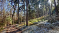
(S/E) From the car park, we head towards the main entrance to the Tiergarten and, just before it, turn left into Schmausenbuck. We follow the road, ignore the first path to the left and, at the next fork, keep left onto the sandy path; after a good 50 metres, we turn right onto the path. After a gentle climb, we come to a junction where we turn left. The forest path curves widely to the right; at the following T-junction, we turn left and soon see the first tall sandstone cliffs.
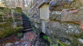
(1) At the fork by the former quarry at Schmausenbuck, we continue to the left. The path takes us through the sandstone cliffs, which are now designated as a geotope. Incidentally, three of these ‘windows into the Earth’s history’ are located within the town limits (in addition to the sandstone cliff at the Kaiserburg and the Felsenkeller).
At the next T-junction, we turn left, then right at the fork. Further remains of the quarry can be seen all around.
(2) On the left-hand side, there is a coat of arms carved into the rock. Here, we turn right and reach the edge of the woodland.
(3) A short detour to the left onto the road takes us, after a few metres, to a pretty old drinking fountain.
After this short detour, we head back and turn left just past the edge of the woods. At the second junction, we turn right and continue through the woods. After a good 100 metres, we turn left, then left again onto the footpath marked ‘Bethang ’ and ‘Anton-Leidinger-Weg’.
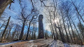
After a short distance, a few steps lead us up the slope and we reach the observation tower, from which you can enjoy a superb view in fine weather.
(4) The Schmausenbuckturm was opened in 1888 to replace a pyramid-shaped wooden structure known as the ‘Himmelsleiter’ (ladder to heaven). The tower was severely damaged during the Second World War but was later rebuilt in its present form, standing at a height of just under 30 metres.
We follow the path over the Schmausenbuck, staying on the main track marked ‘Bethang’, which turns right at a fork after about 300 metres. At the next fork, we turn right, then left, and left again.
About 50 metres further on, we reach a clearing that divides the Lorenzer Reichswald. We cross this and head back into the forest on the other side. At the next junction, we leave the ‘Bethang’ signpost and continue to the left along the ‘Never Walk Alone 1’ trail. We cross the junction straight ahead.
(5) Shortly afterwards, somewhat hidden away on the left-hand side, lies the Buchenklinge, a spring that was turned into a monument over 700 years ago. Whilst today the large folk festival takes place at the Dutzendteich in Nuremberg, from the Middle Ages right up to modern times the Buchenklinge was a meeting place for young and old alike. There used to be an inn here, a band would play, and people would take to the dance floor.
Behind the Buchenklinge, the footpath turns right, then left, and comes to a large crossroads. Here, we turn left onto the sandy path. After a few metres, we keep slightly to the right and continue along the narrow path through the woods, which runs parallel to the sandy path and is situated about 10 to 20 metres to the right.
(6) After about 700 m, behind the clearing, we pass the forest nursery, which is slightly hidden to the left of the sandy path.
(7) A further 700 m on, we walk straight ahead at the junction, beyond which the forest path veers slightly to the right away from the sandy path, before ending on the Schmausenbuck just before the entrance to the Tiergarten.
(S/E) Here we turn right and, in front of the Tiergarten’s entrance gate, turn right again into the car park from which we set off.
 Visorando Member
 Moderate