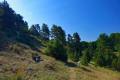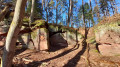
Happurg Reservoir

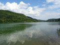
A lovely circular walk from Happurg around the Happurg Reservoir in the Nürnberger Land region.

Details

n°24412242
Creation:
Last update:
Last review:
  • Walking
    Activity: Walking
  • ↔
    Distance: 4.09 mi
  • ◔
    Average duration: 1h 55 
  • ▲
    Difficulty: Easy

  • ⚐
    Back to start: Yes
  • ↗
    Ascent: + 89 ft
  • ↘
    Descent: - 89 ft

  • ▲
    Highest point: 1,237 ft
  • ▼
    Lowest point: 1,145 ft

Photos

Description of the walk

(S/E) The walk starts at the station in Happurg (S1 from Nuremberg). We walk south along Hohenstädter Straße. At the right-hand bend, we turn left onto Pflegergasse, then keep to the right (Wehrweg). We come to the Happurger Bach. Eventually, the road turns into a footpath.

(1) We have reached the Happurg Reservoir. We now follow the footpath along the shore of the lake.

(2) We cross the Rohrbach at the eastern end of the lake. Next comes the Kainsbach (3).

(4) Shortly afterwards, we reach the Café Seeterrassen. We carry on walking to the northern end of the lake. There, the dam prevents us from continuing round the lake. We therefore carry on straight ahead and turn right at the next opportunity. Turn right onto the road and then immediately left.

(5) We cross the Happurger Bach and turn left. Take the next left onto Wehrweg; keep left at the fork, then left again and right onto Obere Mühlstraße. We walk along the stream for a short while. Take the next right.

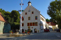
(6) Behind the church, we turn right and walk across the market square. We then continue north-west along Hersbrucker Straße. After just under 250 m, we turn right into Gartenstraße. Take the next left onto Hohenstädter Straße, which leads us back to the station (S/E).

Waypoints

  1. S/E : mi 0 - alt. 1,148 ft - Happurg railway station
  2. 1 : mi 1.04 - alt. 1,227 ft - Happurg Reservoir
  3. 2 : mi 1.84 - alt. 1,214 ft - Rohrbach
  4. 3 : mi 2.2 - alt. 1,211 ft - Kainsbach
  5. 4 : mi 2.57 - alt. 1,211 ft - Café Seeterrassen
  6. 5 : mi 3.16 - alt. 1,171 ft - Happurg Stream
  7. 6 : mi 3.42 - alt. 1,171 ft - Church
  8. S/E : mi 4.09 - alt. 1,148 ft - Happurg railway station

Notes

  • Easy route
  • Places to stop for refreshments, e.g. at Café Seeterrassen (4) right by the lake or in Happurg

Worth a visit

  • Happurg
  • Happurg Reservoir

Reviews and comments

5 / 5
Based on 1 review

Reliability of the description
5 / 5
Ease of following the route
5 / 5
Route interest
5 / 5
hebi19
hebi19

Overall rating : 5 / 5

Date of your route : Sep 13, 2026
Reliability of the description : ★★★★★ Very good
Ease of following the route : ★★★★★ Very good
Route interest : ★★★★★ Very good
Very busy route : No

As I live right by the lake, I regularly go for a walk there with our four-legged friends. At the moment (2026), the reservoir has been largely drained due to renovation work on the power station and has very little water in it. No boats when the weather’s good, and no dipping your feet in the water… but the walks are still lovely.
I don’t know when the lake will be fully filled again. But it’ll probably take a while yet.

Machine-translated

Other walks in the area

For more walks, use our search engine .

The GPS track and description are the property of this route's author. Please do not copy them without permission.