Country:
 City:
City:


Start: The Rednitz-Rezat Trail starts at the railway station in Rednitzhembach. From here, the trail is very well signposted.
(S) At the road (Am Bahnhof), we keep to the right (as seen from the tracks), walk past the cycle racks and take the path branching off to the right, which leads us along the tracks to the road Am Bahnweg. Here we turn right and walk slightly downhill to Walpersdorfer Straße, where we turn left (the old railway bridge is on the right). We follow Walpersdorfer Straße along the footpath to the left of the road.
(1) Then, just before the fire station, we turn right onto Rennweg. At the end of Rennweg, a wide dirt track leads us straight on. We continue along the edge of the woods and, at the fork in the fields, take the left-hand branch, which leads us a little further into the woods.
(2) Shortly after we emerge from the woods on the other side, we come to the Rednitz, which we follow from here on. After about 1 km, the gravel track curves to the right and leads us into the woods. Before the railway underpass, we turn left, following the ‘Rednitz-Rezat-Weg’ signpost. The route continues southwards along the railway tracks at the edge of the woods.
Just before Pfaffenhofen, the path veers left, past the sewage treatment works, through a short wooded stretch along the Rednitz towards Büchenbach. Here, after passing the first houses in the village, we come to Untere Bahnhofsstraße.
(3) This leads to the right towards Büchenbach railway station; the Rednitz is on the left. We carry on straight ahead, pass the P&R car park and continue walking alongside the tracks. After a good half a kilometre, the footpath turns left again across the fields towards the Rednitz.
(4) After crossing the Aurach, we turn right at the T-junction in front of the sewage treatment works for the district town of Roth (Büchenbacher Weg) and go round it by turning left behind the works. The Rednitz-Rezat Trail takes us over the Rednitz Bridge; once across, we turn left, then right into Sandgasse to go round the sports ground. On the right-hand side, we pass the municipal utilities building and eventually reach Nürnberger Straße, where we turn right.
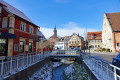
Following Nürnberger Straße, which shortly afterwards becomes Willy-Supf-Platz, we cross the Rednitz Bridge and, via the pedestrian traffic lights, reach the historic town centre of Roth (pedestrian zone).
(5) There are numerous shops around the market square. Behind the market square, we continue straight on through the pedestrian zone along the main street.
(6) On the left-hand side is the district town’s parish church.
(7) Barely 100 metres further on, on the left-hand side, is Ratibor Castle with its small but beautiful castle garden, which features the Harlequin Fountain. The castle dates back to the Margrave era and was built by George the Pious around 1535 as a hunting lodge for the surrounding forests, which were rich in game. Later, the Stieber family converted parts of the buildings into a factory and had the castle extensively remodelled. When the family donated the estate to the town of Roth, the town converted the castle into a museum, which has been open to the public since the mid-1980s.
We continue straight ahead along Münchener Straße and turn right onto Bleichstraße. At the end of the street, a narrower path leads into the parkland by the Rednitz. At the fork, we keep to the right and cross the Rednitz.
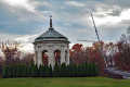
(8) We pass the pavilion and cross the Rednitz again.
(9) We then arrive at Roth railway station (Bahnhofstraße). Roughly in the middle of the P&R car park behind the station, the Rednitz-Rezat-Weg takes us to the right across a single track, before continuing southwards (slightly to the left via Kiefernstraße) alongside the remaining tracks. After crossing the Westring via a bridge, we continue straight ahead along the Barnsdorfer Weg. It leads us out of Roth and, at Orstrand, becomes a hard-surfaced track between the railway tracks and the Rednitz.
A good 2.5 km past the station, we cross to the other side of the tracks and walk for a short while along the Weinberg-Rednitztalweg until we reach the main road. There, we turn left, go under the tracks and, on the other side, keep to the right straight away onto Venezianerstraße.
(10) This takes us further along the tracks towards Unterheckenhofen. Behind the house at number 10, the road forks; we take the middle path (Wiesenweg) between the houses towards the fields. After crossing the Rednitz, we reach a fork at the edge of the wood. Here we keep to the left, cross the main road (be careful – there are no traffic lights!) and, on the opposite side, turn right onto the footpath alongside the road.
(11) In Bernlohe, shortly after Rosenstraße on the left-hand side, we turn right, walk round the houses and come back onto Bernloher Hauptstraße, where we continue along the cycle and footpath out of the village (at the edge of the village, the buildings of the company Schlenk Metallfolien can be seen on the opposite side of the road). We continue walking along the road.
(12) After crossing the Rednitz bridge, we pass through the village of Oberheckenhofen and walk towards Georgensgmünd along the Sculpture Trail.
(13) At the allotment gardens (behind the Kopp car dealership and Rednitzstraße), we cross to the other side of the road and continue along the footpath through the small wood alongside the main road.
At another Schlenk Metallfolien factory, we come to Rednitzstraße, where we continue straight ahead. In the immediate vicinity (a little further east, just behind the TSV Georgensgmünd sports grounds), the two rivers, the Schwäbische Rezat and the Fränkische Rezat, converge and continue from here as the Rednitz. From here, we walk along the Fränkische Rezat.
(14) To do this, we turn right before the sports ground, pass under the railway viaduct and, in a large meadow, see several sculptures from the Gmünd Sculpture Trail.
Once we reach Bruckespan Road, we cross to the opposite side and keep to the left across the car park towards the historic waterwheel.
(15) The waterwheel was built in 1912 for the former Bechtold hammer mill on Hammerweg. The 6-metre-high waterwheel, with its 44 wooden blades, is still in operation today, though now here on Bruckespan. Incidentally, the well-known Waterwheel Festival always takes place in Georgensgmünd at the end of May and is well worth a visit.
At the waterwheel building, we keep to the right on the footpath, cross Petersgmünder Straße just before the Rezat Bridge and walk through the small park on the opposite side. (If we cross the Rezat Bridge, we arrive at Georgensgmünd’s market square, which is well worth a detour).
(16) Behind a small tributary of the Rezat, we turn right and continue along the Fränkische Rezat on the Rednitz-Rezat Path, which follows the Planetenweg. After about 700 m, we turn right at the T-junction, cross the two branches of the Franconian Rezat and walk slightly to the right of the houses up the road until we reach the junction with the street ‘An der Ziegelhütte’. Here we turn left and then left again at the elevated road.
After about 150 m, the road ends. We continue straight on along the dirt track through the wood, always following the main path straight ahead (signposted Rednitz-Rezat-Weg and Hopfenweg). After a good 2.5 km, we come to a tarmac road.
(17) A few hundred metres to the left are the Mosbacher Baggerweiher ponds, which are worth a quick detour. Otherwise, turn right briefly and then immediately left again onto the dirt track.
Behind a farmstead, the gravel track ends at a road. We turn left and, at the next opportunity, immediately right onto the farm track, which takes us past Wasserzell to the south, sometimes across the fields, sometimes through the woods. At the junction, we continue straight ahead along Hopfenstraße, which, from the small car park, merges left into Dr.-Merkenschlager-Straße, until we reach a second junction.
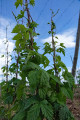
(18) We are surrounded by hop fields and keep to the left; after a short distance, we reach the Fränkische Rezat. Here, at the bridge, we turn left and follow the path.
Behind the first houses of the hop-growing town of Spalt, we reach Obeltshauserstraße and turn right. We walk past a large car park straight towards the former granary, built in sandstone and half-timbered style.
(19) This is where the HopfenBierGut is located, a museum dedicated to the tradition and history of beer brewing in the Spalt hop-growing region.
(E) In Spalt, we have reached the end of our walking tour.
Return journey by public transport
To return to the starting point, we head towards the car park and, immediately after the Hatzelbach stream (about 30 metres behind the museum), turn right onto the path. We follow this path to Bahnhofstraße and turn left. After a good 100 metres, the bus stop for route 623 is located behind the church on the opposite side of the road.
 Visorando Member
 Easy
Easy