Below the Palastre via the Sylvo-pastorale des Bayles

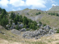
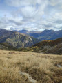
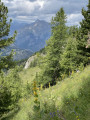
A very pleasant route offering beautiful views over the Champsaur valley and the Autannes. The descent via the so-called “Sylvo-pastoral route” of Les Bayles is a lovely stroll through the pastures.

Details

107228708
Creation:
Last update:
Last review:
  • Walking
    Activity: Walking
  • ↔
    Distance: 3.58 mi
  • ◔
    Average duration: 2h 35 
  • ▲
    Difficulty: Moderate

  • ⚐
    Back to start: Yes
  • ↗
    Ascent: + 1,112 ft
  • ↘
    Descent: - 1,112 ft

  • ▲
    Highest point: 5,807 ft
  • ▼
    Lowest point: 4,770 ft

Description of the walk

To reach the Richards car park, take the D481 on leaving Pont du Fossé. Les Richards is clearly signposted, as are the small car park and signs along the road.

(S/E) Start by heading down towards the few houses at Les Richards, passing behind the first cluster of houses. Look out for the red and white markings of the GR®50.

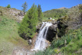
(1) After the last houses, go round a new building on the right, then follow the GR® markings and signposts. Take a few hairpin bends to rejoin the GR® below the meadow. Follow the GR®, crossing the Torrent des Bonnets, then the Brudou a little further down.

(2) Leave the GR® to the right and take a path on the right-hand side that climbs steeply towards Le Palastre via Les Hautes Bonnes. Join the Route Sylvo-pastorale des Bayles, a wide and very pleasant track.

(3) Carry on to the right along this track, which crosses the mountain pastures. Remember to close the gates to the enclosures properly. Take in the view of the valley and the River Autanne opposite.

(4) Ford the Brudou and carry on along this track heading south-east to return to the car park (S/E).

Waypoints

  1. S/E : mi 0 - alt. 5,125 ft - Car park – Les Richards
  2. 1 : mi 0.38 - alt. 5,052 ft - GR50 junction
  3. 2 : mi 0.93 - alt. 4,770 ft - Path junction
  4. 3 : mi 2.11 - alt. 5,797 ft - The Bayles Forest and Pasture Trail
  5. 4 : mi 2.81 - alt. 5,554 ft - Fording
  6. S/E : mi 3.58 - alt. 5,125 ft - Car park – Les Richards

Notes

There aren’t really any drinking water points on the route, but there are plenty of springs amongst the pastures.

Always be cautious and plan ahead when you're outdoors. Visorando and the author of this route cannot be held responsible for any accidents occurring on this route.

The GR® and PR® markings are the intellectual property of the Fédération Française de Randonnée Pédestre.

Other walks in the area

For more walks, use our search engine .

The GPS track and description are the property of this route's author. Please do not copy them without permission.