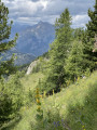
Walk around Lake L’Estang

A short, wild mid-mountain walk that alternates between forest paths and grassy areas, with some very beautiful views. Starting from the hamlet of Les Richards, this walk is easy and makes for a pleasant warm-up before tackling a more challenging hike.

Details

59858981
Creation:
Last update:
Last review:
  • Walking
    Activity: Walking
  • ↔
    Distance: 6.40 mi
  • ◔
    Average duration: 5h 25 
  • ▲
    Difficulty: Moderate

  • ⚐
    Back to start: Yes
  • ↗
    Ascent: + 2,831 ft
  • ↘
    Descent: - 2,835 ft

  • ▲
    Highest point: 7,605 ft
  • ▼
    Lowest point: 5,062 ft

Photos

Description of the walk

Park your car in the hamlet of Les Richards.

(S/E) With your back to the hamlet, carry on for about a hundred metres and turn right, heading towards the village of Les Borels (signposted) via theGR®50.

(1) The path splits: to the right is the hamlet of La Coche. Do not go that way, but carry on straight ahead uphill and continue along theGR®50.

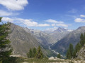
(2) Pass over the Aiguilles du Pertuis: a stunning view over the entrance to the Champoléon Valley. Carry on to the next junction.

(3) An old wooden sign reading “Lac de l’Estang” invites you to leave theGR®50, which continues towards the village of Les Borels. Head up to the left towards the lake.

(4) As you emerge from the forest, the path disappears. Carry on straight ahead (south-west), climbing up the southern slope of the mountain to reach Lac de l’Estang.

(5) This lake is more of a pond than a lake, but the setting is wild. Continue to the right towards the west, climbing up to the clearly visible pass.

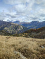
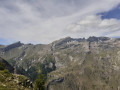
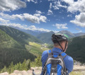
(6) Once you reach the pass, the other side comes into view: the Palastre and Soleil Bœuf are there for you to admire. Take the short detour to the north-west (a 10-minute walk) to admire the Tourrons valley.

(7) Head back to the pass.

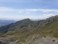
(6) Turn right and head down towards the Cabane de la Baume, which is visible from the pass. There’s no marked path, but the grassy slope is very easy to walk on and the route is very easy to follow.

(8) Once you reach the Cabane de la Baume, join (southbound) a well-marked path which winds through several hairpin bends before emerging onto a wider track called the Route Sylvo-Pastorale des Bayles.

(9) Turn left onto this path and head towards Les Richards (S/E).

Waypoints

  1. S/E : mi 0 - alt. 5,066 ft - Les Richards
  2. 1 : mi 0.16 - alt. 5,135 ft - Go straight ahead at the three-way junction
  3. 2 : mi 1.66 - alt. 6,060 ft - Aiguilles du Pertuis
  4. 3 : mi 1.93 - alt. 5,912 ft - Lac de l’Estang junction
  5. 4 : mi 2.81 - alt. 6,857 ft - Loss of the path
  6. 5 : mi 2.95 - alt. 7,096 ft - Lac de l'Estang (2160m)
  7. 6 : mi 3.39 - alt. 7,556 ft - Pass
  8. 7 : mi 3.47 - alt. 7,605 ft - Viewpoint
  9. 8 : mi 3.97 - alt. 6,919 ft - La Baume hut, rejoining the path
  10. 9 : mi 5.52 - alt. 5,505 ft - Track junction
  11. S/E : mi 6.4 - alt. 5,062 ft - Les Richards. Return to the starting point

Notes

There is a fountain in the village of Les Richards. The road leading to this village is tarmac-surfaced. It winds a great deal.

Worth a visit

Launch site for hang gliders at the bottom of the village of Les Richards.

Always be cautious and plan ahead when you're outdoors. Visorando and the author of this route cannot be held responsible for any accidents occurring on this route.

The GR® and PR® markings are the intellectual property of the Fédération Française de Randonnée Pédestre.

Reviews and comments

4.8 / 5
Based on 2 reviews

Reliability of the description
5 / 5
Ease of following the route
4.5 / 5
Route interest
5 / 5
Jérôme Vasseur
Jérôme Vasseur

Hello,
It’s true that between the Cabane de la Baume and the pass overlooking Lake Estang, there is no path. You have to make your way across the alpine grassland as you go. If you do the route in the opposite direction, you can see the Cabane de la Baume from the pass overlooking the lake, which makes the route clearer.

Machine-translated

suzie0405
suzie0405

Overall rating : 5 / 5

Date of your route : Nov 04, 2024
Reliability of the description : ★★★★★ Very good
Ease of following the route : ★★★★★ Very good
Route interest : ★★★★★ Very good
Very busy route : No

Hello, taken on Sunday 3 November, under a magnificent blue sky. It was a lovely surprise to arrive at the lake and see its shores frozen.
I walked up to the Pointe de la Pousterle and back, just dipping my hands in the water at the end.
I took a wrong turn after the Cabane de la Baume and all the way to the scree slope.
You really must follow the Visorando route, as this route, once you’ve left the GR, is no longer signposted at all.

Machine-translated

suzie0405
suzie0405

Thanks, Vincent.
Have a good weekend.
Sylviane.

Machine-translated

Vincent M8.
Vincent M8.

There is indeed a landslide. The path is only slightly affected. Please remain vigilant and follow the few detours. There are already clear tracks.

Machine-translated

suzie0405
suzie0405

Hello
I’d like to do it on Friday, but I’ve heard there’s a scree slope on the way down from the Cabane de la Baume. Could you let me know if it’s passable?

Machine-translated

Vincent M8.
Vincent M8.

Overall rating : 4.7 / 5

Date of your route : Oct 28, 2024
Reliability of the description : ★★★★★ Very good
Ease of following the route : ★★★★☆ Good
Route interest : ★★★★★ Very good
Very busy route : No

A magnificent route through the turning-yellow larch trees.
The ‘lake’ is right at the far left as you emerge from the forest.

Machine-translated

Other walks in the area

For more walks, use our search engine .

The GPS track and description are the property of this route's author. Please do not copy them without permission.