Sommet des Trois Seigneurs

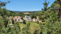
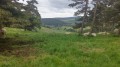
The walk is shaded for three-quarters of the route and is therefore pleasant during periods of intense heat.
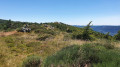
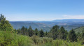
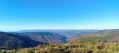
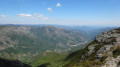
There is a panoramic view from the ridge, though only over a very short distance.
Please take note of the comment in the practical information section.

Details

3569018
Creation:
Last update:
Last review:
  • Walking
    Activity: Walking
  • ↔
    Distance: 8.28 mi
  • ◔
    Average duration: 5h 15 
  • ▲
    Difficulty: Moderate

  • ⚐
    Back to start: Yes
  • ↗
    Ascent: + 1,670 ft
  • ↘
    Descent: - 1,670 ft

  • ▲
    Highest point: 4,478 ft
  • ▼
    Lowest point: 3,304 ft

Photos

Description of the walk

Start from the village square in Saint-Étienne-de-Lugdarès.

(S/E) From the square, walk past the church and continue for about 200 m until you reach the signpost marked ‘Saint-Étienne-de-Lugdarès’.

(1) Turn left onto the tarmac path leading down to the river. Cross the bridge and continue along the road until you reach the signpost marked ‘Croix des Hubacs’.

(2) Carry on straight ahead along the road towards the hamlet of Les Hubacs. Follow the GRP®. Walk through the hamlet, passing a bread oven.

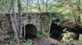
(3) Once you’ve left the hamlet, cross a small bridge and then take the path that climbs into the forest.

(4) When you reach a small pass with a four-way junction, turn right and follow this path for about 2 km until you reach a crossroads.

(5) Leave theGRP®. Turn left, following signs for Saint-Laurent-les-Bains. A little further on, stop following this direction and continue to the left until you reach another crossroads at the signpost marked ‘La Grise’.

(6) Turn left onto the ridge path towards Le Bez. Follow theGR® 7.

(7) Leave theGR® 7 and turn left for about 2 km.

(8) At the “Sommet de Pratazanier” signpost, take the path on the left which descends into the forest. Return to the junction you passed on the way out.

(2) Return to Saint-Étienne-de-Lugdarès by following the route back in the opposite direction to the outward journey, until you reach the car park (S/E)..

Waypoints

  1. S/E : mi 0 - alt. 3,389 ft - Starting car park
  2. 1 : mi 0.08 - alt. 3,373 ft - Signpost “Saint-Étienne-de-Lugdarès”
  3. 2 : mi 0.61 - alt. 3,560 ft - ‘Croix des Hubacs’ signpost. Junction of the circular route
  4. 3 : mi 1.46 - alt. 3,409 ft - Leaving the hamlet of Les Hubacs
  5. 4 : mi 1.79 - alt. 3,668 ft - Junction, turn left
  6. 5 : mi 2.99 - alt. 4,219 ft - Junction towards St-Laurent-les-Bains
  7. 6 : mi 3.61 - alt. 4,459 ft - Start: ridge line
  8. 7 : mi 4.64 - alt. 4,439 ft - End of the ridge line
  9. 8 : mi 6.37 - alt. 3,707 ft - Pratazanier summit, on the left
  10. S/E : mi 8.28 - alt. 3,389 ft - Car park

Notes

Please note that this guide must be accompanied by a GPS track as (as of July 2020) several signposts are dilapidated or misaligned, have been moved from their original positions, or are completely missing.

Always be cautious and plan ahead when you're outdoors. Visorando and the author of this route cannot be held responsible for any accidents occurring on this route.

The GR® and PR® markings are the intellectual property of the Fédération Française de Randonnée Pédestre.

Reviews and comments

4.4 / 5
Based on 3 reviews

Reliability of the description
4.5 / 5
Ease of following the route
4.3 / 5
Route interest
4.3 / 5
Zibounu
Zibounu

Overall rating : 4 / 5

Date of your route : Jul 21, 2025
Reliability of the description : Not used / Not applicable
Ease of following the route : ★★★★☆ Good
Route interest : ★★★★☆ Good
Very busy route : No

Mostly through woods, pleasant in summer. Beautiful views. Thank you.

Machine-translated

benoit.perrin
benoit.perrin

Coming from the Abbey of Notre-Dame des Neiges, I only walked along certain sections of this route.

Where the path passes beneath the summit of the Trois Seigneurs, it is fairly easy to find a clearing in the vegetation that leads up to the summit. The view is almost 360°, barely marred by a few ‘wind turbines’.

Furthermore, I can confirm that the signposts are often incorrect.

Machine-translated

baroulaïres
baroulaïres

Overall rating : 4.7 / 5

Date of your route : Aug 05, 2023
Reliability of the description : ★★★★★ Very good
Ease of following the route : ★★★★★ Very good
Route interest : ★★★★☆ Good
Very busy route : No

A lovely hike for a summer’s day.
Plenty of shaded sections through the forest. Superb views from the ridge.
Can also be done in autumn (mushrooms!!!).

Machine-translated

vonvonfan
vonvonfan

Overall rating : 4.3 / 5

Date of your route : Jul 02, 2023
Reliability of the description : ★★★★☆ Good
Ease of following the route : ★★★★☆ Good
Route interest : ★★★★★ Very good
Very busy route : No

A pleasant walk to enjoy in warm weather

Machine-translated

Other walks in the area

For more walks, use our search engine .

The GPS track and description are the property of this route's author. Please do not copy them without permission.