Yellow trail at the Blavet site

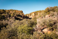
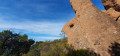
Nestled amongst vineyards and umbrella pines, La Bouverie – a charming residential neighbourhood – is the true green heart of Roquebrune-sur-Argens. At the foot of the majestic Blavet Gorges, where the red rock of the Estérel rises in sheer cliffs, the hiking trails lead in the footsteps of Homo Bouvérien. Indeed, archaeologists have established that the Roquebrune-sur-Argens area has been continuously inhabited throughout all periods of prehistory. The Bouverie caves provide the earliest evidence of this.

Details

n°73298765
Creation:
Last update:
Last review:
  • Walking
    Activity: Walking
  • ↔
    Distance: 1.88 mi
  • ◔
    Average duration: 1h 00 
  • ▲
    Difficulty: Easy

  • ⚐
    Back to start: Yes
  • ↗
    Ascent: + 194 ft
  • ↘
    Descent: - 180 ft

  • ▲
    Highest point: 486 ft
  • ▼
    Lowest point: 272 ft

Photos

Description of the walk

(S/E) From the Jean-Pierre Rabet car park, take the Piste de la Lieutenante. Turn left onto the Piste de la Bouverie and continue until you reach a junction marked by a sign.

(1) You can turn left to reach the lakeside picnic area. Otherwise, continue along the track to reach the caves and the signpost.

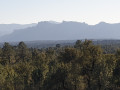
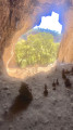
(2) At the signpost, turn right up the stone steps, then turn left. Carry on and turn right to reach the first cave. Follow the path, marked in yellow, which runs alongside all the caves. Then start the climb on the left. Once at the top, take a short detour to the left to admire the panoramic view over the Argens plain, the Rocher de Roquebrune and the Estérel.

(3) Retrace your steps and continue straight on to the track, without going back through the caves. Back on the track, turn left and carry on, then continue to the junction you passed on the way out.

(1) Turn left onto the Yellow Trail to join another track.

(4) When you reach a large Mediterranean pine tree lining the track, turn left and follow the track to the Blavet bridge. At the entrance to the bridge, a path on the right leads to a viewpoint overlooking the old sawmill: enjoy the panoramic view of the Blavet Gorges.

(5) Head back up to the bridge and retrace your steps along the track to reach the track junction.

(4) Carry straight on to reach the car park at the starting point (S/E).

Waypoints

  1. S/E : mi 0 - alt. 305 ft - Jean Pierre Rabet car park
  2. 1 : mi 0.55 - alt. 348 ft - The ‘circular’ junction
  3. 2 : mi 0.69 - alt. 397 ft - Caves
  4. 3 : mi 0.84 - alt. 476 ft - Viewpoint
  5. 4 : mi 1.27 - alt. 328 ft - Piste de la Lieutenante
  6. 5 : mi 1.42 - alt. 272 ft - Viewpoint
  7. S/E : mi 1.88 - alt. 305 ft - Jean Pierre Rabet car park

Notes

Access: A8 motorway, exit 36 Le Muy or 37 Puget-sur-Argens, then follow signs for Roquebrune-sur-Argens. At the ‘4 chemins’ roundabout, continue towards La Bouverie for approximately 4.5 km. At the roundabout in the centre of La Bouverie, take the second exit and continue straight on along Avenue Louis Blériot (signposted ‘Site du Blavet’).

Worth a visit

  • The prehistoric caves
  • The Blavet Gorges
  • The climbing site
  • Maison de la Préhistoire (1.3 km from the start of the walk)
  • Orientation board [43.516500, 6.652399]

Reviews and comments

5 / 5
Based on 1 review

Reliability of the description
5 / 5
Ease of following the route
5 / 5
Route interest
5 / 5
ray83520
ray83520

Overall rating : 5 / 5

Date of your route : Sep 04, 2025
Reliability of the description : ★★★★★ Very good
Ease of following the route : ★★★★★ Very good
Route interest : ★★★★★ Very good
Very busy route : No

A very beautiful hike for young and old alike, but the caves are not particularly interesting. The small lake with tables and benches is a lovely place to stop for a break. Maps are available from the tourist office in Roquebrune-sur-Argens, 3 Place Germain Ollier, 83520 Roquebrune-sur-Argens

Machine-translated

Other walks in the area

For more walks, use our search engine .

The GPS track and description are the property of this route's author. Please do not copy them without permission.