Barbade Ravine Trail

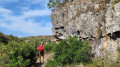
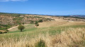
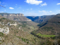
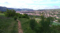
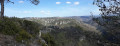
Just a stone’s throw from a quarry and a railway line, the Barbade ravine and its stream immerse you in the heart of nature, with a cliff-top path and a ford. A cave shelter, a small aqueduct and magnificent views over the wooded hillsides punctuate this highly enjoyable route.
Please note, however: take care on the cliff-top path and at the section with the rope. Quite challenging in places.
Avoid this route in wet weather on the steep sections.

Details

39526098
Creation:
Last update:
Last review:
  • Walking
    Activity: Walking
  • ↔
    Distance: 4.16 mi
  • ◔
    Average duration: 2h 35 
  • ▲
    Difficulty: Moderate

  • ⚐
    Back to start: Yes
  • ↗
    Ascent: + 771 ft
  • ↘
    Descent: - 745 ft

  • ▲
    Highest point: 1,745 ft
  • ▼
    Lowest point: 1,207 ft

Photos

Description of the walk

In Aguessac, follow signs for “Gorges du Tarn”. After the bridge, turn right towards the Place de la Sablière car park (next to the campsite).

(S/E) At the far end of the car park, an information sign points to the start of the trail. Climb up to the road via a small flight of steps, cross the road and continue along the path opposite.

Yellow markings.

Follow the path along the canal, go under the railway bridge and carry on to the road.

(1) Follow this road to the left and, before the Stop sign, turn right onto a path that leads down towards the stream. Cross the stream (over the rock) and, immediately after the bridge, climb the steps on the right and continue above the N9.

(2) Carry on along the ledge; take care on the edges and on the rocky descent.

(3) Two options:
- Take the small path that descends directly to the left, or continue to the right until you reach a rock and use the rope to climb down. “Take care in wet weather”.
- Continue along the path that passes under an aqueduct and reaches the Barbade stream; cross it (it is dry, and there is no footbridge). Climb back up via earthen steps and follow the path, keeping to the yellow markings, until you reach La Baume. (Troglodyte shelter).

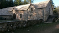
(4) Turn right, then take the small path on your left. Follow a canal running alongside the stream to the Source de Font Liane.

(5) Turn left and follow the path along a wide track that climbs up through the fields to the D168.

(6) Take the road on the left which leads down towards Aguessac. Pass the Ravin de Gros and continue for 50 metres.

(7) Take the small path on the right. Cross the first small road and carry on straight ahead, then cross the D168.

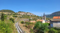
(8) Carry on to the entrance to Aguessac. Continue through the housing estate (follow the yellow markings carefully). Go over the railway line and head for the car park (S/E).

Waypoints

  1. S/E : mi 0 - alt. 1,211 ft - La Sablière car park (campsite)
  2. 1 : mi 0.46 - alt. 1,266 ft - Junction – Road
  3. 2 : mi 0.8 - alt. 1,342 ft - Along the cliff-top path
  4. 3 : mi 1.22 - alt. 1,391 ft - Steep descent or section requiring a rope
  5. 4 : mi 1.43 - alt. 1,444 ft - La Baume – Cave shelter
  6. 5 : mi 1.98 - alt. 1,457 ft - Font Liane spring – Fork in the path
  7. 6 : mi 2.38 - alt. 1,745 ft - Junction. Road to Aguessac
  8. 7 : mi 3.18 - alt. 1,516 ft - Gros Ravine – Fork in the path
  9. 8 : mi 3.58 - alt. 1,414 ft - Crossing the D168
  10. S/E : mi 4.16 - alt. 1,214 ft - La Sablière car park (campsite)

Notes

Wear sturdy footwear, carry walking poles and take water with you in hot weather.

Worth a visit

Places of interest include the villages of Compeyres, Peyre, Paulhe, Millau and its belfry.
Further on, the Gorges du Tarn: Le Rozier, Peyreleau, Sainte-Énimie.
Peyrelade Castle, Fontaneilles Pedestal, the Entre-Deux-Monts cellars.

Reviews and comments

4.7 / 5
Based on 2 reviews

Reliability of the description
5 / 5
Ease of following the route
4.5 / 5
Route interest
4.5 / 5
remi2930
remi2930

Overall rating : 4.3 / 5

Date of your route : May 11, 2024
Reliability of the description : ★★★★★ Very good
Ease of following the route : ★★★★☆ Good
Route interest : ★★★★☆ Good
Very busy route : No

A lovely walk in glorious sunshine.

Machine-translated

bergpaden
bergpaden

Sorry, I took the wrong route

Machine-translated

bergpaden
bergpaden

Overall rating : 5 / 5

Date of your route : Oct 14, 2023
Reliability of the description : ★★★★★ Very good
Ease of following the route : ★★★★★ Very good
Route interest : ★★★★★ Very good
Very busy route : No

A lovely walk along the coastal path

Machine-translated

Other walks in the area

For more walks, use our search engine .

The GPS track and description are the property of this route's author. Please do not copy them without permission.