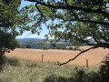
Circular loop around Le Cade

A walk with therapeutic benefits.
More seriously, a very straightforward walk with no particular difficulties.
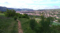
The walk follows paths that wind through Scots pine forests and then along wide, easy-to-walk forest tracks.
Very little elevation gain; suitable for young children and people with reduced mobility.

Details

1851771
Creation:
Last update:
Last review:
  • Walking
    Activity: Walking
  • ↔
    Distance: 4.12 mi
  • ◔
    Average duration: 2h 05 
  • ▲
    Difficulty: Easy

  • ⚐
    Back to start: Yes
  • ↗
    Ascent: + 223 ft
  • ↘
    Descent: - 213 ft

  • ▲
    Highest point: 2,815 ft
  • ▼
    Lowest point: 2,625 ft

Photos

Description of the walk

To get there from Millau, follow the D110 towards Longuiers.
When you reach the Farm de Cade (road sign), park in the car park next to the road, opposite the farm.

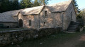
(S/E) Take the path leading to the farm buildings.
Then carry on straight ahead, cross the meadow near La Cade Farm and head into the pine woods. The path winds its way through the trees and descends gradually in a south-easterly direction.

(1) At the T-junction, follow the path on the left. At the next T-junction, continue straight ahead.
The path climbs gently and, when you reach the three-way junction, follow the path that runs alongside the road.

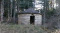
(2) Cross the road and take a well-marked path. About a hundred metres further on, a barrier blocks access to the site for motor vehicles but not for walkers, serving as a reminder that these woods are fragile.
The path then crosses a track coming from the right – ignore this one – and continues straight on.
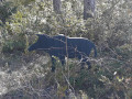
Fun fact: Don’t miss the photo of the rubber wild boar stuck in the ground.
At the end of the path, you’ll come out onto a wide forest track.

(3) Turn left onto this track. Stay on this track until you reach the tarmac road.

(4) Cross the junction and follow the signs for Pouncho d’Agast (road sign)
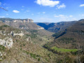
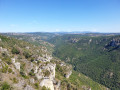
Continue along the road for a few metres and turn left onto the forest track (fitness trail). This track descends gently, revealing the Dourbie valley below.

(5) At the inverted Y-junction, turn sharply left. The well-marked path climbs through the pine trees, heading due north.
Carry on straight ahead, without ever leaving this path, until you reach the Cade farm.
At the farm, take the same route as on the way there to return to the car park (S/E).


Waypoints

  1. S/E : mi 0 - alt. 2,743 ft - Car park next to the road in front of the farm
  2. 1 : mi 0.46 - alt. 2,690 ft - T-junction, take the left-hand path
  3. 2 : mi 1.33 - alt. 2,749 ft - Cross the road and take the path on the right
  4. 3 : mi 1.77 - alt. 2,690 ft - Forest track
  5. 4 : mi 2.54 - alt. 2,635 ft - Straight on at the crossroads
  6. 5 : mi 3.2 - alt. 2,671 ft - Hairpin bend
  7. S/E : mi 4.12 - alt. 2,743 ft - Car park next to the road in front of the farm

Notes

Caution
From spring to autumn, watch out for colonies of processionary caterpillars, which are particularly itchy.
No special equipment is required apart from the essentials: a hat, something to drink, etc.

Reviews and comments

3.9 / 5
Based on 4 reviews

Reliability of the description
4 / 5
Ease of following the route
4 / 5
Route interest
3.8 / 5
natureamour
natureamour

Overall rating : 4.3 / 5

Date of your route : Jun 06, 2025
Reliability of the description : ★★★★★ Very good
Ease of following the route : ★★★★☆ Good
Route interest : ★★★★☆ Good
Very busy route : No

Lovely hike with some fine views, just be careful as there are a lot of exposed roots.

Machine-translated

chephilor
chephilor

Overall rating : 2.7 / 5

Date of your route : Dec 25, 2023
Reliability of the description : ★★☆☆☆ Disappointing
Ease of following the route : ★★★★☆ Good
Route interest : ★★☆☆☆ Disappointing
Very busy route : No

The weather didn’t help, as the lovely winter sunshine was quickly obscured by a persistent mist, ruining any chance of a view of the landscape or the panorama over the Dourbie. Very disappointing!

Machine-translated

Fernandez Benjamin
Fernandez Benjamin

Overall rating : 4.3 / 5

Date of your route : Jul 04, 2023
Reliability of the description : ★★★★★ Very good
Ease of following the route : ★★★★☆ Good
Route interest : ★★★★☆ Good
Very busy route : No

We have extended the Viso Rando route to the Mouna Ravine and the Boffi Rock.
It’s a lovely part of the route – it would be a shame to miss it.
Otherwise, it’s an interesting route – we even got to see some hang-gliders taking off.
In fact, the best option is to follow the PR path and its alternative route.
Thank you for your hiking suggestions.

Machine-translated

chilette
chilette

Overall rating : 4.3 / 5

Date of your route : Apr 21, 2019
Reliability of the description : ★★★★☆ Good
Ease of following the route : ★★★★☆ Good
Route interest : ★★★★★ Very good

A truly beautiful walk. A feast for the eyes. A wonderful connection with nature. A real breath of fresh air. Thank you for this lovely suggestion.

Machine-translated

Other walks in the area

For more walks, use our search engine .

The GPS track and description are the property of this route's author. Please do not copy them without permission.