A circular loop starting from Larribal Campsite

A circular loop to get back into shape, with a bit of an incline starting from the campsite.

Details

4480272
Creation:
Last update:
Last review:
  • Walking
    Activity: Walking
  • ↔
    Distance: 2.02 mi
  • ◔
    Average duration: 1h 15 
  • ▲
    Difficulty: Easy

  • ⚐
    Back to start: Yes
  • ↗
    Ascent: + 400 ft
  • ↘
    Descent: - 397 ft

  • ▲
    Highest point: 1,578 ft
  • ▼
    Lowest point: 1,175 ft

Photos

Description of the walk

Park near the Larribal campsite on the left bank of the River Tarn in Millau.

(S/E) As you leave the campsite, turn left onto the cycle and footpath. Head towards the junction with Chemin Saint-Estève.

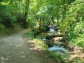
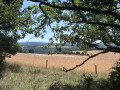
(1) Turn right here and begin the climb. Continue uphill, then veer right into the woods. As you emerge from the woods, stay on the path – do not go into the field. Continue climbing along this path, which skirts round the field. You’ll reach the Equestrian Centre and theGR®62.

(2) Turn right onto the road marked with the red and whiteGR® signs. At the junction in a hairpin bend, join Rue du Causse Noir.

(3) Turn right onto it; a few metres further on, you’ll come to a path junction.

(4) Turn right onto this path, staying on theGR®, and complete the descent by joining the road leading to the various campsites. Turn right onto this road to return via the path running alongside the houses to the car park near the Larribal campsite (S/E).

Waypoints

  1. S/E : mi 0 - alt. 1,178 ft - Car park near the Larribal campsite and the - Tarn (rivère)
  2. 1 : mi 0.26 - alt. 1,181 ft - Saint-Estève crossroads
  3. 2 : mi 0.93 - alt. 1,578 ft - Equestrian Centre
  4. 3 : mi 1.1 - alt. 1,470 ft - Rue du Causse Noir
  5. 4 : mi 1.35 - alt. 1,394 ft - GR junction
  6. S/E : mi 2.02 - alt. 1,181 ft - Car park near the Larribal campsite

Notes

An easy walk, with just a slight incline as you pass behind Saint-Estève.

Worth a visit

(S/E) Larribal Campsite
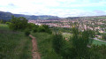
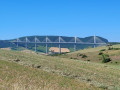
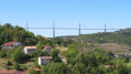
Between (2) and (4) Enjoy the magnificent view of Millau and its viaduct once you’re on the path.

Always be cautious and plan ahead when you're outdoors. Visorando and the author of this route cannot be held responsible for any accidents occurring on this route.

The GR® and PR® markings are the intellectual property of the Fédération Française de Randonnée Pédestre.

Reviews and comments

3.9 / 5
Based on 3 reviews

Reliability of the description
3.7 / 5
Ease of following the route
3.7 / 5
Route interest
4.3 / 5
User 29847713

Overall rating : 5 / 5

Date of your route : Jul 13, 2026
Reliability of the description : ★★★★★ Very good
Ease of following the route : ★★★★★ Very good
Route interest : ★★★★★ Very good
Very busy route : Yes

This route is perfect for beginners and is well signposted.
It took us a bit longer as we stopped off for a while to take some photos of the Millau Viaduct.

Machine-translated

JOURY Alain
JOURY Alain

Overall rating : 2.7 / 5

Date of your route : Jul 23, 2023
Reliability of the description : ★★☆☆☆ Disappointing
Ease of following the route : ★★☆☆☆ Disappointing
Route interest : ★★★★☆ Good
Very busy route : No

This walk offers a superb view. However, at the start, after the Saint Estève crossroads and before beginning the climb, it’s important to make sure you don’t miss the small GR-marked path on the right at the start of the climb.
Further on, at a hairpin bend, you must leave the GR path and go straight on, passing through a gate to reach Rue du Causse Noir near the equestrian centre
And… further on in the hairpin bend, do not take the road on the right, but follow this road down for about 500 metres to rejoin the GR path on the right, which leads to the campsites.

Machine-translated

jhaddi
jhaddi

Overall rating : 4 / 5

Date of your route : Jul 05, 2021
Reliability of the description : ★★★★☆ Good
Ease of following the route : ★★★★☆ Good
Route interest : ★★★★☆ Good
Very busy route : No

Thank you for the walk.

I got it wrong because a chain across a path led me to believe it was the entrance to a private property, when in fact it was the access point to the GR62.

I went a bit too far, but never mind – there was a brilliant view with paragliders making the most of the air currents. That would certainly be enough to turn this walk into a longer route.

j.h.

Machine-translated

Other walks in the area

For more walks, use our search engine .

The GPS track and description are the property of this route's author. Please do not copy them without permission.