Country:
 City:
City:


Car park on the corner of Pirmasenser Straße and Hauptstraße in Rodalben.
(S/E) With your back to the car park entrance, cross Hauptstraße and take the footpath opposite, which starts under the bridge. This leads to a flight of steps; go up them. At the top, turn left and cross the bridge. Take thefirst road on the left. Ignore the footpath on the left and then the road; continue along Ringstraße.
(1) When you reach No. 47, take the steps on your left. Climb them up to the road, cross over and continue up the next set of steps. Turn right and you’ll soon spot the path on your left. Climb up until you join another path.
Marked ‘F’ in a White Circle
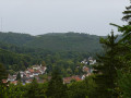
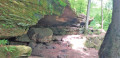
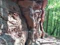
Turn right. At the junction, ignore the path leading off to the left which climbs over the top of the rocks and go round the bottom of the Krappenfelsen rocks. View of Rodalben.
(2) Take the path on the left after the rocks. Then ignore the path leading down to the right.
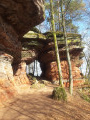
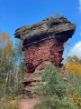
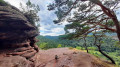
(3) At the crossroads, carry on straight ahead. Walk past Hilschbergfelsen on your left. Further on, ignore the steps ahead of you – unless you wish to see the view from the top of the rocks – and walk alongside the Saufelsen rocks, still on your left. Ignore the path leading down to the right and continue walking alongside the rocks.
(4) At the fork in the road, turn right. Discover Am Rappenteich, a rocky outcrop.
(5) At the crossroads, carry on straight ahead. The path winds round the rocks, zigzags and joins a wider forest track. Continue to the left.
(6) At a fork in the road, turn right. Pass a rocky outcrop. The path descends.
(7) Join another path and carry on straight ahead.
(8) Ignore the path on your left and carry on straight ahead.
(9) At the Gippelsturmer Hütte, go round the picnic table and follow the path to the right for about 1 km.
(10) At the junction, go straight on. Pass the Zigeunerbrunnen spring. You’ll come to a forest track; continue straight on along the path almost directly opposite. Cross a second forest track and continue along the path opposite. The path curves sharply to the right.
(11) When you reach a wide forest track, continue to the left. Stay on the forest track until you reach the Am Kuhfelsen rocks.
(12) Walk past the rocks and, a little further up, turn right. Ford the stream. Head uphill and, at the junction, turn right. Continue uphill. Follow the path, skirting the Eisenbornchen rocks. The path turns sharply to the right and descends to the stream. Cross the footbridge and head back up into the forest. At the forest track, cross over and continue along the path opposite for approximately 1.4 km, passing Klausbergfelsen.
(13) At the fork in the road, turn right. At the next junction, turn right again. At the junction with the forest track, go straight on along the descending path. At the next forest track, turn left and follow the stream. At the car park, head towards the picnic table not far from the road.
(14) Take the path on your left leading down towards the stream and cross the road via the underpass. Cross the wooden bridge and continue along the path opposite. Turn right. At the Fork in the road, turn right, head back up onto the forest track and continue to the right.
(15) At the junction, turn left onto the hairpin bend. The path bends sharply to the right; ignore the poorly marked path in the bend.
(16) A little further up, take the path on your left. Follow the main path. Walk past the houses and, at the pylon, turn left. At the next junction, keep to the right and head back up to the road.
Diversion signs: If the diversion is no longer in place, carry on straight ahead
(17) Turn right until you reach the hairpin bend on your left. Turn off and take Neulandstraße. Ignore the road on your right and carry on until you reach No. 36 on your left in the bend.
(18) Take the path to the left of the gate leading into the property.
Marked ‘F’ in a White Circle
The original path rejoins on your left. Continue to the right. Once back on a forest track, continue to the right.
(19) At the junction with another forest track, cross over and head straight on up the ascending path. Then keep to your right. At the crossroads after the rocks, go straight on. Walk alongside the Hoher-Kopf-Felsen. Go downhill, keep to your right and, when you reach the forest track, turn left.
(20) At the fork in the road, turn left and walk alongside the Karl May Felsen rocks. Once you reach the forest track, continue to the left and turn onto thefirst path on your right. Walk past the Hungerpfuhlfelsen rock formation.
(21) At the junction, go straight on. Then cross the forest track to continue straight on along the path opposite. Once back on another forest track, continue to the left and then take the path on your right. Ignore the next path on your right and carry on straight ahead. Pass a spring trickling over a rock. 700m further on. At the fork in the road, turn right.
(22) At the junction with another forest track, cross over and continue along the path opposite.
(23) At the next junction, carry on straight ahead. Walk past Seibelsbachfelsen and continue to the hut.
(24) With your back to the hut, head straight on along the path opposite. Take thefirst path on the right at the hairpin bend and descend to the forest track, which you follow to the left. At the fork in the road, after the rocky outcrop, take the path on the right. Stay on the main path for approximately 2.7 km until you reach the footbridge over the stream; the junctions you encounter will be more or less clearly marked.
(25) Cross the footbridge and continue along the path. At the crossroads, take the path straight ahead, which branches off to the left. After the rocks, continue straight on and you’ll reach Barenhohle.
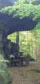
(26) After passing the entrance to the cave, take the path on the left and walk uphill to the long picnic table.
If you’d like to see the bear sculpture, you’ll need to head down to the forest track below.
With your back to the table, take the highest path on the left. Walk for about 1.8 km to the side road, passing the Barenhalde spring bubbling over the rocks. Turn left and head back up to the L482.
At the road, turn right. Walk downhill and back to the car park on Hauptstraße (S/E).



 Visorando Member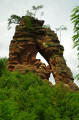
 Moderate
 Easy
Easy