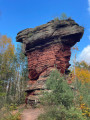
A walk past Rodalben’s iconic rocks

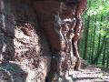
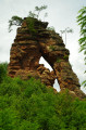
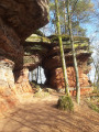
This route passes by the Bruderfelsen (Brother’s Rock), the town’s landmark, then in front of the Alten Bierkeller (Old Beer Cellar) to reach the imposing Alte Burg (Old Castle) rock formation, which offers a view over Rodalben, and ends at the Hettersbachfelsen rocks, from where you return in the opposite direction to avoid the tarmac.

Details

n°2094738
Creation:
Last update:
Last review:
  • Walking
    Activity: Walking
  • ↔
    Distance: 5.69 mi
  • ◔
    Average duration: 3h 20 
  • ▲
    Difficulty: Easy

  • ⚐
    Back to start: Yes
  • ↗
    Ascent: + 846 ft
  • ↘
    Descent: - 846 ft

  • ▲
    Highest point: 1,188 ft
  • ▼
    Lowest point: 837 ft

Photos

Description of the walk

Car park on the corner of Pirmasenser Straße and Hauptstraße in Rodalben.

(S/E) Leave the car park, near the trail information board, and head along Pirmasenser Straße. Turn left and follow the road uphill towards Pirmasens. Cross over the railway line and then go under the bridge. Carry on straight ahead, ignoring the roads on your right.

Marked ‘F’ in a White Circle

(1) Turn right onto the forest path (Felsenwanderweg). At the Fork in the road, after the house, take the path on the left and discover Bruderfelsen.

(2) Then take the path furthest to the left near the picnic tables. Further on, head down towards the forest track.

(3) On your left, you’ll find Alter Bierkeller (a cave). Continue along the forest path as it climbs.

(4) At the multi-way junction, take thefirst path on your right. Walk alongside the rocks.

(5) Further on, turn left as close as possible to the Kiesfelsen rock formation. Stay on the path overlooking the forest track.

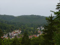
(6) Cross the forest track and carry on straight ahead along the path opposite. Ignore the next path coming from your right. Walk past Alte Burg; there’s a viewpoint over Rodalben just after it.

(7) At the signpost, take the path leading uphill to the left. The path joins a forest track; continue along it to the left. The track then bends to the right.

(8) Stay on the path closest to the rocks, ignoring those leading down into the valley, and discover Hettersbachfelsen and its rock shelter.

Turn back and return via the same paths you took on the way there, to avoid having to walk back through the town, until you reach the Rodalben car park (S/E).

Waypoints

  1. S/E : mi 0 - alt. 837 ft - Car park at the entrance to Hauptstraße
  2. 1 : mi 0.45 - alt. 978 ft - Turn right onto the forest track
  3. 2 : mi 0.62 - alt. 1,040 ft - Bruderfelsen: take the path furthest to the left
  4. 3 : mi 1.13 - alt. 1,033 ft - Alter Bierkeller
  5. 4 : mi 1.29 - alt. 1,161 ft - At the multi-way junction, take the first path on the right
  6. 5 : mi 1.69 - alt. 1,063 ft - Keep to the left, as close as possible to the rocky outcrop
  7. 6 : mi 2.02 - alt. 1,047 ft - Cross over and carry on straight ahead
  8. 7 : mi 2.35 - alt. 1,001 ft - At the signpost, take the path leading uphill to the left
  9. 8 : mi 2.84 - alt. 991 ft - Hettersbachfelsen
  10. S/E : mi 5.69 - alt. 837 ft - Car park at the entrance to Hauptstraße

Notes

At (8), you can quench your thirst at the foot of the rocks, at the “Wanderertreff” run by the Hettersbach Rabbit Breeders’ Association.
Benches and picnic tables can be found at (2), at (3), at Alte Burg after (6) and at (8)
A short section of the Felsenwanderweg from Rodalben; if you’d like to explore a larger part of this 45.5 km circular route, click here.

Worth a visit

Along the way

- Bruderfelsen (Brother’s Rock)
- Alten Bierkeller (the old beer cellar)
- Kiesfelsen (Gravel Rocks)
- Felsenbunker
- Alte Burg (Old Castle)
- Hettersbachfelsen

Reviews and comments

4.7 / 5
Based on 1 review

Reliability of the description
5 / 5
Ease of following the route
5 / 5
Route interest
4 / 5
ac92
ac92

Overall rating : 4.7 / 5

Date of your route : Oct 03, 2021
Reliability of the description : ★★★★★ Very good
Ease of following the route : ★★★★★ Very good
Route interest : ★★★★☆ Good
Very busy route : No

A very easy hike, as the path largely follows a contour line.
Our only regret is that the access route, from the recommended car park at 1, takes a busy, noisy road, with a very narrow pavement on one section: we looked at another car park halfway along which seemed more suitable. For the return journey, we left the path at point 3 to walk through the town of Rodalben to the car park via the narrow streets, which was quieter and more pleasant.
The views from the path over Rodalben and the adjacent valleys were very pretty, and the flat path through the undergrowth was really very pleasant. The rocks may not be as spectacular as those at Roppeviller, but the walk is very charming.
This short section of the rocky path makes you want to plan the longer version!

Machine-translated

Other walks in the area

For more walks, use our search engine .

The GPS track and description are the property of this route's author. Please do not copy them without permission.