Country:

 City:
City:


Park on Rue de Mittlach in the large car park beside the D10.6, on the right-hand side when coming from Metzeral; open to all.
(S/E) Walk up through the car park, cross the bridge on the right and pass an inn. Then turn left and continue straight on for about 800 m along the access path tothe GR®®5until you reach the three-way junction.
(1) Turn left, cross a bridge and pass a statue, then reach a T-junction.
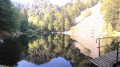
(2) Take the path on the right and walk straight on, following theGR®®5(Red Rectangle) for about 2 km. Shortly after the junction with a path (Red Saltire) coming from the right, you’ll reach Fischboedle Lake.
(3) Take the path leading uphill to the right (GR®® 5, Red Rectangle). On this section, make sure you stay on the main path and do not take any shortcuts, as this damages the environment. You will reach a crossroads.
(4) Continue straight on to reach Lake Schiessrothried. Pass the first path on the left at the dam and you’ll immediately come to a fork.
(5) Head up the path on the left (Blue RectangleGR®®531) until you reach a fork.
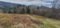
(6) Pass the Blue Triangle-marked path on your right and turn left, heading south-east. Climb up to a fork at a small pass at the foot of the first Spitzkoepfe. Turn left towards the viewpoint. Enjoy the view.
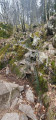
(7) Turn back and return to the fork at the small pass; leave the climb towards the Spitzkoepfe on your right and continue left along theGR®®531. This is where the challenging part of the hike begins, with handrails to help you make your way up.
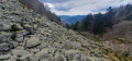
(8) Cross along the mountainside over the rocks, following the blue markings (markings on the stones). Be careful and take your time. You’ll pass a few more sections with handrails set into the rock. Once you’ve got past this section, continue along the blue-marked path for about 1,600 metres. This narrow path is very picturesque, crossed by the Wormsa stream, with a few more rocks and lush green surroundings. You’ll arrive at a clearing where there’s a private chalet at a crossroads in the hamlet of Kerbholz.
(9) Leave theGR®® and continue along the path on the left (marked with a Blue Cross) for about 250 m until you reach a sharp bend to the right.
(10) Turn right onto this path and you’ll reach a junction at asecond sharp bend to the right. Leave the descent towards Fischboedle Lake on your left and continue to the right to join the forest track.
(11) Continue to a fork in the track at a sharp left-hand bend.
(12) Go straight on for about 150 m and look out for a path on the left marked with a Blue Triangle.
(13) Turn onto this path and follow it for about 1,400 m down a steep descent. This section includes several stream crossings in the shade of the forest, creating a very idyllic setting. You’ll come to a road.
(14) Continue to the left along the road, keeping close to the left, until you reach the fork you passed on the way out.
(2) Carry on straight ahead along the access path tothe GR®®5, heading in the opposite direction to the outward journey, until you reach the car park (S/E).



 Visorando Member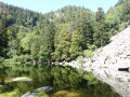
 Moderate
 Very difficult