The Wormsa Valley

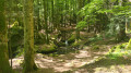
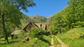
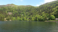
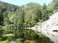
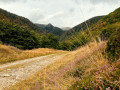
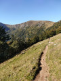
The Wormsa Valley offers spectacular, unspoilt landscapes. Steep trails, waterfalls, rocky cirques and glacial moraines await you on this beautiful walk. A classic in the Vosges mountains.

Details

26573166
Creation:
Last update:
Last review:
  • Walking
    Activity: Walking
  • ↔
    Distance: 5.14 mi
  • ◔
    Average duration: 3h 15 
  • ▲
    Difficulty: Moderate

  • ⚐
    Back to start: Yes
  • ↗
    Ascent: + 991 ft
  • ↘
    Descent: - 991 ft

  • ▲
    Highest point: 2,612 ft
  • ▼
    Lowest point: 1,621 ft

Photos

Description of the walk

Park in the Steinabruck car park.

(S/E) On leaving the car park, cross the bridge on the right and take the path on the left which runs alongside the Fecht. Head towards the memorial to Engineer François.

(1) Turn left onto the path towards Fischboedle Lake through the Wormsa valley, then you’ll reach a crossroads of paths.

(2) Keep left towards Mittlach. Walk past the sculpture of the last bear killed in the Vosges in 1760. You’ll soon reach the junction with theGR®®5.

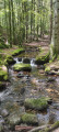
(3) Take the path on the right towards Fischboedle, following the Red Rectangle markings. At the next junction, follow the signs for Fischboedle, veering slightly to the left. Stay on theGR®®5, also known as the Sentier de la Wormsa. This path climbs up the mountainside, crosses glacial moraines and crosses the torrent several times via wooden bridges.
Turn left onto the track and then join the GR®®5/RedRectanglevariant which climbs up to Fischboedle Lake.

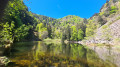
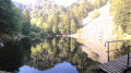
(4) Walk along the lake, head back down the narrow path, then retrace your steps and continue to the left along the track, also known as the Chemin du Fischboedle (Red Saltire). Pass through a tunnel and you’ll then come to a crossroads of paths.

(5) Leave the track and take the path on the right which descends into the valley. After a few hairpin bends, you’ll arrive at the remains of the 1914–18 cable car.

(6) Continue the descent along a wider track and return to the junction you passed on the way out.

(2) Follow the route taken on the way out in the opposite direction to return to the Steinabruck car park (S/E).

Waypoints

  1. S/E : mi 0 - alt. 1,621 ft - Steinabruck car park - Source de la Fecht
  2. 1 : mi 0.15 - alt. 1,644 ft - Memorial to Engineer François. Towards the - Ruisseau de la Wormsa
  3. 2 : mi 0.6 - alt. 1,709 ft - Junction of the circular loop
  4. 3 : mi 0.84 - alt. 1,736 ft - GR5
  5. 4 : mi 2.43 - alt. 2,612 ft - Lac de Fischboedle
  6. 5 : mi 3.16 - alt. 2,247 ft - Trail junction
  7. 6 : mi 3.75 - alt. 1,913 ft - Remains of the 1914–1918 cable car
  8. S/E : mi 5.14 - alt. 1,621 ft - Steinabruck car park

Notes

Food and refreshments:

  • options available at the Auberge and Chalets de la Wormsa and in the centre of Metzeral

Worth a visit

Along the route:

  • Moraines of the former glacier
  • Small wooden bridges
  • Lake Fischboedle
  • Remains of the cable car dating from the First World War
  • Memorial to Engineer François.
  • Sculpture of the last bear of the Vosges.
  • Club Vosgien memorial.
  • Scout memorial

Always be cautious and plan ahead when you're outdoors. Visorando and the author of this route cannot be held responsible for any accidents occurring on this route.

The GR® and PR® markings are the intellectual property of the Fédération Française de Randonnée Pédestre.

Reviews and comments

4.8 / 5
Based on 21 reviews

Reliability of the description
4.8 / 5
Ease of following the route
4.7 / 5
Route interest
4.9 / 5
User 17807852

Overall rating : 4.3 / 5

Date of your route : Jul 14, 2026
Reliability of the description : ★★★★☆ Good
Ease of following the route : ★★★★☆ Good
Route interest : ★★★★★ Very good
Very busy route : Yes

A lovely little walk, the pretty little Fischboedle lake, an easy route to follow

Machine-translated

User 29612774

Overall rating : 5 / 5

Date of your route : Jul 02, 2026
Reliability of the description : ★★★★★ Very good
Ease of following the route : ★★★★★ Very good
Route interest : ★★★★★ Very good
Very busy route : No

A very pleasant and varied route; the lake and its surroundings are well worth a visit
No major difficulties, a gentle climb – a few scree sections
A very pleasant walk, mostly in the shade

Machine-translated

User 6471494

Overall rating : 4.7 / 5

Date of your route : Jun 22, 2026
Reliability of the description : ★★★★★ Very good
Ease of following the route : ★★★★★ Very good
Route interest : ★★★★☆ Good
Very busy route : No

There weren’t many people around during this heatwave, with the threat of a thunderstorm.
We didn’t complete the whole route as there was a loud rumble of thunder, so we cut a section of the route short.
A varied and pleasant route with spots where you can cool off in fresh water – a lovely walk.

Machine-translated

ktombre
ktombre

Overall rating : 5 / 5

Date of your route : May 01, 2026
Reliability of the description : ★★★★★ Very good
Ease of following the route : ★★★★★ Very good
Route interest : ★★★★★ Very good
Very busy route : Yes

A lovely walk, suitable for all ages. You pass through varied landscapes and can enjoy the view of the lake once you reach the top.

Machine-translated

reitop
reitop

Overall rating : 4.7 / 5

Date of your route : Apr 08, 2026
Reliability of the description : ★★★★★ Very good
Ease of following the route : ★★★★☆ Good
Route interest : ★★★★★ Very good
Very busy route : Yes

A lovely walk through the forest, past waterfalls and over wooden bridges – highly recommended!

Machine-translated

User 16081536

Overall rating : 5 / 5

Date of your route : Sep 08, 2025
Reliability of the description : ★★★★★ Very good
Ease of following the route : ★★★★★ Very good
Route interest : ★★★★★ Very good
Very busy route : No

Regular user of Visorando and very often satisfied

Machine-translated

sylvie68
sylvie68

Overall rating : 5 / 5

Date of your route : Jun 16, 2025
Reliability of the description : ★★★★★ Very good
Ease of following the route : ★★★★★ Very good
Route interest : ★★★★★ Very good
Very busy route : Yes

Very beautiful hike. You do need good shoes though, as the trail is very rocky but perfectly passable.

Machine-translated

jmplume3
jmplume3
• Edited:

Overall rating : 5 / 5

Date of your route : Mar 09, 2025
Reliability of the description : ★★★★★ Very good
Ease of following the route : ★★★★★ Very good
Route interest : ★★★★★ Very good
Very busy route : Yes

A very beautiful hike, sometimes difficult due to numerous rocky steps.
Be sure to wear good shoes and avoid this hike in heavy rain.
There are beautiful waterfalls and photo opportunities on the way up, and the lake at the end is a wonderful reward, especially as the weather was very nice on the day we went. The path down is wide and easy.

Machine-translated

Bat68
Bat68

Overall rating : 5 / 5

Date of your route : Oct 20, 2024
Reliability of the description : ★★★★★ Very good
Ease of following the route : ★★★★★ Very good
Route interest : ★★★★★ Very good
Very busy route : No

Magnificent hike!
As described, the first part of the climb requires good shoes (walking sticks are very useful) as there are many scree slopes and slippery sections due to recent heavy rain.
The arrival at the lake with the autumn colours is magnificent.
The return is much easier, with wider paths that are less wet.
The estimated time was 3 hours and 25 minutes, but I did it in just over 2 hours with a brisk pace.

Machine-translated

JPElise
JPElise

Overall rating : 4 / 5

Date of your route : Oct 12, 2024
Reliability of the description : ★★★★☆ Good
Ease of following the route : ★★★★☆ Good
Route interest : ★★★★☆ Good
Very busy route : No

Climb up to the lake through a physically challenging but stunning environment of moraines. The arrival at the lake is a reward for your efforts. The descent back down is very easy.

Machine-translated

BABEL67
BABEL67

Overall rating : 5 / 5

Date of your route : Sep 13, 2024
Reliability of the description : ★★★★★ Very good
Ease of following the route : ★★★★★ Very good
Route interest : ★★★★★ Very good
Very busy route : No

It's a relatively easy hike, but part of the trail is rocky. It's slippery when wet and not accessible to everyone... The waterfall is magnificent and Fischboedlé Lake is a great place for a picnic (there's a gazebo with benches and a table). It's probably very busy in summer, but we had it almost to ourselves!

Machine-translated

FKr
FKr

Overall rating : 5 / 5

Date of your route : Sep 14, 2024
Reliability of the description : ★★★★★ Very good
Ease of following the route : ★★★★★ Very good
Route interest : ★★★★★ Very good
Very busy route : No

Superb hike, breathtaking waterfalls, rocky climb but worth it! Highly recommended!

Machine-translated

SP67
SP67

Overall rating : 5 / 5

Date of your route : Jul 09, 2024
Reliability of the description : ★★★★★ Very good
Ease of following the route : ★★★★★ Very good
Route interest : ★★★★★ Very good
Very busy route : No

Superb walk

Machine-translated

Vogepat
Vogepat

A wonderful trail when the snow melts. Full and magnificent waterfalls.
An excellent route for teaching children about the history of the last glaciers in the Vosges.
The ideal season to avoid the crowds on this trail.

Machine-translated

ZB
ZB

Overall rating : 5 / 5

Date of your route : Dec 27, 2023
Reliability of the description : ★★★★★ Very good
Ease of following the route : ★★★★★ Very good
Route interest : ★★★★★ Very good
Very busy route : No

A very beautiful hike with stunning scenery.

Machine-translated

Other walks in the area

For more walks, use our search engine .

The GPS track and description are the property of this route's author. Please do not copy them without permission.