


Refine your search for walks in Sari-Solenzara
Sari-Solenzara walks


 Circular Monte Santu via Punta di Pascialella
 Visorando Member
 4.22 mi
 +988 ft
 -968 ft
 2h 50
2h 50
 Moderate
 Departure from Sari-Solenzara (Corse-du-Sud)
Views of the Tyrrhenian Sea from Solenzara and Pinarellu, the Aiguilles de Bavella massif and the Monastery of the Assunta Gloriosa via the ascent of Monte Santu... What superb panoramas... Tra mare a monte!
Circular inspired by the Monte Santu d'Incantesimu hike.
Monte Santu
 2.15 mi
+640 ft
-640 ft
1h 35
Moderate
Departure from Sari-Solenzara (Corse-du-Sud)
2.15 mi
+640 ft
-640 ft
1h 35
Moderate
Departure from Sari-Solenzara (Corse-du-Sud)
Rocky summit with beautiful panoramic views.
Climbing towards Sari Solenzara, view of the Bavella peaks.
Located between earth and sky, in the shadow of Monte Santu, in the heart of untouched wild scrubland, the monastery of Assunta Gloriosa is set in a majestic landscape. To the west, the Bavella peaks rise up with force and grandeur. To the south, the terrain overlooks the Tyrrhenian Sea, which stretches as far as the eye can see.
From Sulaghju to the Rùvoli stream
 Local authority
 5.15 mi
+1,017 ft
-1,014 ft
3h 15
Moderate
Departure from Haute-Corse
5.15 mi
+1,017 ft
-1,014 ft
3h 15
Moderate
Departure from Haute-Corse
This path takes you through the pine woods to traditional sheepfolds on the banks of a beautiful mountain stream, less than a 2-hour walk from the village of u Sulaghju.
Da U Pinu a U piralzu (From Bread to Alder) starting from Solaro
 2.46 mi
+492 ft
-492 ft
1h 35
2.46 mi
+492 ft
-492 ft
1h 35
 Easy
Departure from Haute-Corse
Easy
Departure from Haute-Corse
Starting from Solaro, walk through the forest. Focus mainly on discovering the flora.
The route is suitable for different audiences, fun and family-friendly, punctuated by several workshops, and focuses on discovering the riches of the heritage and preserving biodiversity.
From the Asinau refuge to Conca
 Association / Club / Walk leader
 17.38 mi
+3,356 ft
-7,631 ft
10h 55
Moderate
Departure from Quenza (Corse-du-Sud)
17.38 mi
+3,356 ft
-7,631 ft
10h 55
Moderate
Departure from Quenza (Corse-du-Sud)
Our thirteenth and final stage on theGR®20. The landscapes are magnificent and very different from what we have seen so far. The mountains are red and the vegetation much drier.
Tour of the Aiguilles de Bavella
 6.82 mi
+2,841 ft
-2,854 ft
7 hrs
6.82 mi
+2,841 ft
-2,854 ft
7 hrs
 Very difficult
Departure from Quenza (Corse-du-Sud)
Very difficult
Departure from Quenza (Corse-du-Sud)
A sublime hike around the Aiguilles de Bavella.
A long and demanding hike (see practical information).
Col de Bavella: "U Cumpuleddu" (The Bomb Hole)
 3.54 mi
+643 ft
-663 ft
2h 10
Moderate
Departure from Quenza (Corse-du-Sud)
3.54 mi
+643 ft
-663 ft
2h 10
Moderate
Departure from Quenza (Corse-du-Sud)
This hike will take you to "U Cumpuleddu", more commonly known as "Trou de la Bombe" (Bomb Hole), a geological formation caused by erosion. The route also offers beautiful views of the Aiguilles de Bavella mountain range. Much of the hike takes place under the cover of Laricio pine trees.
Bavella - Velaco - Promontoire - Bavella loop
 4.85 mi
+1,631 ft
-1,647 ft
3h 40
4.85 mi
+1,631 ft
-1,647 ft
3h 40
 Difficult
Departure from Quenza (Corse-du-Sud)
Difficult
Departure from Quenza (Corse-du-Sud)
This loop allows you to visit the various remarkable points of the southern Bavella massif (Velacu massif), including Punta Velacu, the Promontory, the Campanile de Sainte-Lucie, the tafonu di u Cumpuleddu (incorrectly called "trou de la bombe" or "bomb hole"), the belvedere and the chapel, through the forest and rocky peaks. Magnificent views of the ravines of Punta Velacu and Calanca Murata, all with less than 500 m of elevation gain.
U Saparghionu Cave via the heights of Chisa
 4.94 mi
+1,732 ft
-1,752 ft
3h 45
Moderate
Departure from Chisa (Haute-Corse)
4.94 mi
+1,732 ft
-1,752 ft
3h 45
Moderate
Departure from Chisa (Haute-Corse)
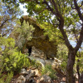
The walk to the heights of Chisa and the U Saparghionu cave is a short hike. Before setting off, we met Antonin, a village elder who speaks highly of it – a close-knit village that has lost its soul over the years. We also met two Brittany Spaniels who accompanied us throughout the walk. You’ll no doubt spot them in the village: true guides....
Cavu – Paliri – San-Martinu circular loop
 14.18 mi
+3,839 ft
-3,829 ft
9h 50
Very difficult
Departure from Zonza (Corse-du-Sud)
14.18 mi
+3,839 ft
-3,829 ft
9h 50
Very difficult
Departure from Zonza (Corse-du-Sud)
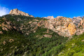
A circular route which, from the Cavu valley, takes you to theGR®20and then on to the Paliri refuge. The return journey follows theGR® towards Conca, then onto a path that descends towards the San-Martinu track in the Cavu valley.
The Brèche du Carciara... and a little further
 9.33 mi
+2,661 ft
-2,631 ft
6h 35
Very difficult
Departure from Zonza (Corse-du-Sud)
9.33 mi
+2,661 ft
-2,631 ft
6h 35
Very difficult
Departure from Zonza (Corse-du-Sud)
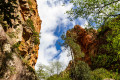
A hike towards the Brèche du Carciara, and a little further, amidst a landscape of rocky chaos and numerous magnificent waterfalls and crystal-clear pools! The final section requires climbing metal rungs, scaling a rope ladder and ascending with the aid of a cable (but without additional equipment), which may put some people off. Furthermore, many sections involve walking over rocks and can therefore be very tricky.
The Cavu pools and the Sainte-Lucie stream
 5.58 mi
+843 ft
-837 ft
3h 20
Moderate
Departure from Zonza (Corse-du-Sud)
5.58 mi
+843 ft
-837 ft
3h 20
Moderate
Departure from Zonza (Corse-du-Sud)
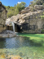
Walk and swim in the beautiful pools of Cavu.
Étang de Palo : à la rencontre de deux univers
3.05 mi
+3 ft
-3 ft
1h 25
Easy
Departure from Serra-di-Fiumorbo (Haute-Corse)
Au Sud d’un chapelet de zones humides qui s’étend du Fiumorbu au Travu, l’Étang de Palo est une vaste lagune sédimentaire de 110 ha. Quatrième de l’île par sa taille, il a gardé depuis ses origines un caractère naturel. Palo accueille l’un des plus grands ensembles de sansouires de Corse (milieu limoneux stérile couvert d'efflorescence saline) avec une surface de plus de quarante hectares.
Sainte-Lucie River and Cavu pools
 7.13 mi
+961 ft
-942 ft
4h 05
Moderate
Departure from Zonza (Corse-du-Sud)
7.13 mi
+961 ft
-942 ft
4h 05
Moderate
Departure from Zonza (Corse-du-Sud)
This hike starts in the same way as the one described under no. 4375623, from which I have taken the opening paragraphs, but returns via a different route, including a section of water hiking, and ends at the three pools, which avoids the need to go back and forth as on the original route we had chosen.
On the other side of U Cavu
 3.92 mi
+1,411 ft
-1,411 ft
3h 00
Moderate
Departure from Zonza (Corse-du-Sud)
3.92 mi
+1,411 ft
-1,411 ft
3h 00
Moderate
Departure from Zonza (Corse-du-Sud)
Follow this challenging circular route along the Cinaghja and Barola paths towards Li Ponti di Marionu and return via the path of the same name, which runs along the left bank of the Cavu.
The Cavu Valley
 6.49 mi
+1,430 ft
-1,430 ft
4h 15
Moderate
Departure from Zonza (Corse-du-Sud)
6.49 mi
+1,430 ft
-1,430 ft
4h 15
Moderate
Departure from Zonza (Corse-du-Sud)
The Cavu Valley is characterised by natural pools and large slabs of bleached granite with rounded shapes along its course.
The hike follows the river before climbing through the scrubland along a discreet path leading to a first viewpoint (401m) and then a second (509m), offering panoramic views over the Cavu and the mountainous cirque at the bottom of the valley dominated by Punta de Quercitello (1461m). To the east, Pinarello Bay beckons.
Luviu sheepfold, starting from Tagliu Rossu
 9.45 mi
+3,907 ft
-3,904 ft
7h 45
Difficult
Departure from Zonza (Corse-du-Sud)
9.45 mi
+3,907 ft
-3,904 ft
7h 45
Difficult
Departure from Zonza (Corse-du-Sud)
The Luviu sheepfolds are spread out along the ridges of a pine forest, facing Monte Calva. The ascent passes through woods and scrubland, and the route is mostly in the shade. Throughout the walk, you’ll be treated to views of the bays of Pinarello and Saint-Cyprien, the Gulf of Porto Vecchio, and the islands (Monte Cristo, Elba, the Cerbicales and the Lavezzi), stretching as far as Sardinia.
From Ghisonaccia to Serra-di-Fiumorbu
 4.78 mi
+1,483 ft
-7 ft
3h 30
Moderate
Departure from Serra-di-Fiumorbo (Haute-Corse)
4.78 mi
+1,483 ft
-7 ft
3h 30
Moderate
Departure from Serra-di-Fiumorbo (Haute-Corse)
This hike forms an integral part of the Mare a Mare Centre route.
From flat terrain to mountainous areas, the route takes you past various bodies of water: rivers, natural springs of sparkling water (drinkable!), streams… You’ll enjoy a wealth of refreshing scenery.
Fumicosa Pass or Bocca di Fumicosa
 4.30 mi
+1,198 ft
-1,194 ft
3h 00
Moderate
Departure from Zonza (Corse-du-Sud)
4.30 mi
+1,198 ft
-1,194 ft
3h 00
Moderate
Departure from Zonza (Corse-du-Sud)
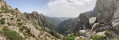
This is a hike off the beaten track where you are unlikely to meet many other walkers.
The name Fumicosa in the Corsican language evokes a smoky place, a metaphor here for a place where fog is quite common.
U Castellu, Circinellu cave and Bocca di Ghjuva from Ania
 6.38 mi
+1,709 ft
-1,683 ft
4h 25
Moderate
Departure from Serra-di-Fiumorbo (Haute-Corse)
6.38 mi
+1,709 ft
-1,683 ft
4h 25
Moderate
Departure from Serra-di-Fiumorbo (Haute-Corse)
Set off to explore U Castellu and the Circinellu Cave, a prehistoric site steeped in revolutionary history from the time of Paoli. Then climb up to Bocca di Ghjuva via the Mare a Mare Centre and, after passing Bocca di Minagoli, descend through a chestnut forest towards Ania.
From Serra-di-Fiumorbu to Catastaghju
 7.29 mi
+1,893 ft
-1,686 ft
5h 00
Moderate
Departure from Serra-di-Fiumorbo (Haute-Corse)
7.29 mi
+1,893 ft
-1,686 ft
5h 00
Moderate
Departure from Serra-di-Fiumorbo (Haute-Corse)
This walk forms part of the Mare a Mare Centre route. The Mare a Mare Centre route links the east coast at Ghisonaccia with the west coast at Porticcio in the southern Gulf of Ajaccio.
On the ridge between the sea and the Abatescu valley, you’ll discover varied landscapes as well as hilltop villages overlooking the sea.
The Undella Waterfall at San Gavinu di Fium'Orbu
 4.33 mi
+1,765 ft
-1,739 ft
3h 30
Moderate
Departure from San-Gavino-di-Fiumorbo (Haute-Corse)
4.33 mi
+1,765 ft
-1,739 ft
3h 30
Moderate
Departure from San-Gavino-di-Fiumorbo (Haute-Corse)
You will be delighted to discover the surrounding high peaks; this path will lead you through a beautiful beech forest and to the foot of the Undella waterfall (Ondella waterfall).
From the Usciolu Refuge to the Asinau Refuge
 9.71 mi
+3,091 ft
-3,743 ft
7h 10
Moderate
Departure from Cozzano (Corse-du-Sud)
9.71 mi
+3,091 ft
-3,743 ft
7h 10
Moderate
Departure from Cozzano (Corse-du-Sud)
Our twelfth day of walking on the legendaryGR®20in Corsica, another day with ridges, but also a nice stretch on a plateau and therefore a big change of scenery.
GR® 20 - Stage 13: from Usciolu to the Croci sheepfold (new route from 2011)
 8.29 mi
+1,713 ft
-2,369 ft
5h 20
Difficult
Departure from Cozzano (Corse-du-Sud)
8.29 mi
+1,713 ft
-2,369 ft
5h 20
Difficult
Departure from Cozzano (Corse-du-Sud)
Stage 13 between the Usciolu PNRC refuge and the Croci sheepfold follows the new route via Matalza (since 2011). A stage with not much elevation gain, but one that should not be underestimated. The start along the ridge is a bit technical up to Punta di a Scaddatta. Then a descent through the forest, crossing fields of ferns before a gruelling climb, part of which is on a track, up to the Croci sheepfold on the Coscione plateau.
The Bughja Waterfall
 2.67 mi
+784 ft
-797 ft
1h 55
Easy
Departure from San-Gavino-di-Fiumorbo (Haute-Corse)
2.67 mi
+784 ft
-797 ft
1h 55
Easy
Departure from San-Gavino-di-Fiumorbo (Haute-Corse)
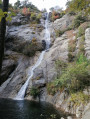
At a height of 100 metres, the Buja waterfall (Piscia di a Bughja) is one of the highest in Corsica. At its base is a pool where you can enjoy a refreshing dip, and you can relax on the rocks. If you look carefully, this waterfall is visible from a distance, particularly from the road leading to the village. The long white trail it leaves on the mountainside is particularly impressive in winter, when the water flows in abundance.Bughja (from the word ‘Bughju’: darkness).
Luviu sheepfolds and Monte Calva from the Illarata pass
 6.65 mi
+1,752 ft
-1,736 ft
4h 35
Moderate
Departure from Zonza (Corse-du-Sud)
6.65 mi
+1,752 ft
-1,736 ft
4h 35
Moderate
Departure from Zonza (Corse-du-Sud)
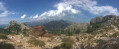
In Alta Rocca, in the Ospédale forest, a beautiful hike leads first along a shaded path to the Luviu sheepfolds in a beautiful clearing. From Monte Calva, after a short climb, there is a magnificent view of both sides of the island, to the south and the bay of Porto-Vecchio. At the Col d'Illarata (start and finish), to the west, the beautiful summit of the Pointe du Diamant (1,227 m) is clearly visible.