Country:
 City:
City:


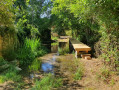
There is an ideal car park at the inter-municipal leisure area, by the Chez Birot bridge.
(S/E) Walk up the slope of Route Célestin Lacoux for 100 m. Turn left to pass beneath the pine forest. Emerge into the clearing and cross the meadow towards the Romanesque church in sight. Walk past the church, then turn right towards the cemetery and walk alongside it. At the next crossroads, turn left towards Chez Jean Petit.
(1) Before reaching the hamlet, turn right onto a grassy path that runs alongside copses. At the crossroads at Chez Bahuet, turn left into the overgrown heathland and enter the woods. Then turn left and continue to the next junction (elevation 158).
(2) Turn left again. At the next crossroads, turn right onto the gently ascending path. Then take the left-hand bend in the path, which runs alongside a meadow on the left and cultivated fields on the right.
(3) At this junction, turn right to join the D76, and follow it to the right for 100 m.
(4) Take the first road on the left, towards Chez Guilloux. Walk a few dozen metres, then follow the grassy path to the left, passing by the mast. Join the road, turn right, then head down into the valley via the wooded path on the left. Continue to the left at the three-way junction, staying on the wide path that runs along the hillside. Join the road and continue to the right for about fifty metres.
(5) Turn left onto the white track which descends for 200 m. Take the grassy track on the right, follow it and reach the first houses of Chez Cognet, but do not go through the hamlet. As you leave the track, cross the small road and continue to the right along a lovely wooded path.
(6) At this junction, turn right, then left onto the wide forest track. Carry on and turn right at the T-junction.
(7) When you reach the road at La Crouzade, take the path on the right without going through the hamlet. Turn right again at the next junction, at elevation 149, and you’ll come to a Fork in the road.
(8) Follow the path on the left which leads downhill. Carry on, then head back uphill to the D102.
(9) Cross the road to enter the hamlet of Chez Mailloux. Walk through it and continue along the path. Ignore the junction on the right and head back down into the valley.
(10) Turn right at the place known as Les Châtaigneraies. Pass Chez Guilloux, and carry on straight ahead along the road to join the D76, which you took on the way there.
(4) Turn right here and rejoin the white track on the left, after crossing the road and reaching a junction you passed on the way out.
(3) At this junction, turn right and, at the next fork, turn left onto a track that leads back down to the dirt track.
(11) Turn right to reach Saint-Sulpice via the hamlet of Chez Fantin. Keep left at the three-way junction to cross it, then turn left again towards Chez Jean Petit, where you’ll rejoin the original path.
(1) Continue straight on, then turn left to pass the cemetery and the church once more, before returning to the local leisure area (S/E).

 Visorando Member
 Easy
Easy