


 Country:

 City:


Start from the car park of the Jacques Anquetil sports hall.
(S/E) Join the D36.
(1) Take the cycle path on the right which runs alongside the D36, then take the path on the right before the cemetery. Cross Route de Bonnefamille and continue along the path opposite.
(2) At the Route de Saint-Quentin, turn left and ignore two turn-offs to the right. After the rubbish bins, turn right (at the junction with a small T-junction) then immediately turn left downhill and follow the path alongside the pond.
(3) Take the path on the right in front of the pond car park. Ignore a turn-off to the left and, at the three-way junction, veer left then continue straight up the hill. Carry on along the road until you reach the roundabout.
(4) Carry on straight ahead. Enter the housing estate on the left and take the first path on the right.
Carry on to the bottom of the descent.
(5) As you leave the forest, turn right and walk alongside the fields.
(6) At the farm, turn right downhill, then left along the railway line. At the road, turn right onto the uphill path. Join a road and continue to the left until you reach the first path on the left.
(7) Follow this track and continue uphill.
(6) Join the route you took earlier and carry on straight ahead to the edge of the woods.
(5) Take the Montée du Château on the right.
(8) At La Fessy, carry on to the left along the road, then turn right onto the first path – a stony descent.
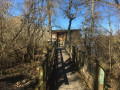
(9) At the bottom of the descent, just before a small bridge, turn sharply left and follow the fitness trail, crossing the stream twice after the pond via two wooden bridges and continuing to the road.
(10) Turn right, then walk your bike along the no-entry section on the right.
(11) At the road, first turn left then right; this is a tricky road crossing. At the crossroads, continue uphill to the right, then after the farm, carry on straight ahead along the track, ignoring the paths branching off on either side. At the road, turn left and head for the next junction.
(12) Take the hairpin bend to the left, then continue along a path that is steep at the start.
(13) At the end of the field, turn onto the path on the right and head downhill. Turn left onto the Bonnefamille road. Carry on until you pass a house on your right and reach the next junction.
(14) Turn left up the track, keep to the right and carry on until you reach the road.
(15) Turn right onto the road at the bottom of the descent. Cross the D36 and head uphill to the village of Bonnefamille (cycle path).
(16) Just before the village square, turn left, then, on leaving the village, follow the path uphill to the right.
(17) At the end of the field on your right, turn right onto the path and cross the stream. Continue uphill to the right. A short stretch where you’ll need to carry your bike to get past an obstacle.
(18) At the fork, keep left and continue uphill. Leave the forest and carry on between the fields. At the crossroads, turn right onto a stony descent.
(19) Turn left onto Route de Roche and turn left at the entrance to the village.
(20) At the start of the climb, follow the path on the right.
(21) At the four-way junction, turn left, then head up to the left at the bottom of the descent.
(22) At the top of the climb, head down to the right and continue down to the right. A few metres further on, do not take the path up to the left; continue down to the right. Cross the D36 and take the cycle path on the left.
(1) Turn right onto Avenue des Pins to reach the car park at the Jacques Anquetil sports hall (S/E).

 Visorando Member
 Easy

 Difficult

