Country:

 City:
City:


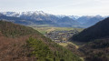
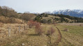
Park near Susville Town Hall, where there is plenty of space. The ‘Nantizon’ bus stop is served by bus routes T90 and T92 operated by Cars Région Auvergne-Rhône-Alpes.
(S/E) Cross the D529 road using the pedestrian crossings on either side of the railway line to take Rue de Nantizon to the left of the war memorial. Enter the hamlet of Nantizon by following this small road westwards. You’ll reach a crossroads in a small square.
(1) Pass the Montée de la Roche Paviotte (the return route) straight ahead and take the Montée des Merlins on the right. After a bend to the left and near a detached house, leave the Montée des Merlins and take a path marked in yellow on the left. It rejoins the road shortly before reaching Versenat; enter this hamlet.
(2) Take a street on the right, passing in front of the chapel and ending at a fork. Continue straight on towards the north for about 100 metres, then take a new path on the left (end of the yellow markings). Shortly afterwards, leave the track again and take a path on the right. Running initially along the bottom of a meadow, it eventually enters the forest. After crossing a valley, the path leading to the Rocher Siéroux begins on the left.
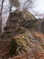
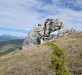
(3) Head straight north, after passing a pile of rocks on the left. The path is level for a short while and bordered by a low wall. It then climbs westwards towards the cliffs of Rocher Siéroux. You’ll reach its grassy, crevassed plateau very quickly. However, it’s more interesting to follow a well-trodden track along the base of the rocks (the Grand Versenat climbing routes) to emerge easily at the far end.
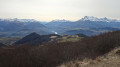
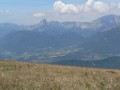
(4) From the top of the Rocher Siéroux cliffs, the views across the Matheysin plateau are unique. A pleasant path then emerges along the edge of the wooded slope, joining a farm track. Follow it due south. After a gentle descent, you’ll reach a path on the right, lined with trees.
(5) Follow it westwards, then leave it as soon as it enters the undergrowth and take a new path on the right. You’ll come across yet another path to follow to the north. Leave this path quickly and take a new one on the left.
(6) It climbs first towards the south-west, then north along a short level stretch, and finally north-west up a fairly steep slope. At the top, at around 1,350 m, it disappears into clear-cut areas of woodland before quickly emerging onto a track. Following this to the right, we soon reach the entrance to the Treize Bises mountain pasture, marked by a fence that can be crossed via a turnstile.
(7) A wide track takes us westwards to the Abri du Curé, then joins the classic, signposted route from Les Merlins. Follow this route uphill to quickly reach a junction (elevation 1,411 on the IGN map). Then take the forest track on the left, reaching the ridge line leading from Pierre Plantée as you emerge from the forest. Leave the track for an alpine path on the left that climbs diagonally. Then, at an altitude of around 1,500 m, head up the grassy slope due east to the summit of Pierre Plantée.
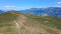
(8) After taking in the magnificent views over the Matheysine, the Trièves and the Vercors massif, head due south along a gentle, grassy ridge. As soon as possible, switch to the steep eastern slope, taking care to stay close to the edge of the forest. You will then reach a path winding through a valley. Follow it downwards to quickly reach a crossroads of paths
(9) Turn left, where the path runs for some time towards the north-east. It eventually opens out into the grassy peatland of Les Sagnes. The classic route from Les Merlins winds its way through here; follow it down for about a hundred metres to a junction (elevation 1342, reservoir).
(10) Look out for a path on the left which enters the forest again at a fence and its turnstile. It soon joins another, more inviting path which you follow down to the right towards the south-east. Cut across a signposted track (sign – elevation 1244), eventually coming out onto another path less than 300 metres further on. Follow this to the left; it leads to the Route des Merlins, at a bend at the entrance to the hamlet of La Sausie.
(11) Cross the road and take the ridge path opposite, which leads to a small pass. The Roche Paviotte viewpoint is on the other side, but the slope is too steep to reach it directly. The easiest way is therefore to find a track slightly to the east and then climb the narrow peak from the west.
(12) After enjoying a beautiful view over Susville and the Écrins massif, head back down the short track you came up to rejoin a path leading from the small pass down towards the north-east. Leave this very quickly to take a path on the right. Joining the ridge line, it eventually leaves it to descend the southern slope. It passes below the imposing Roche Paviotte, then, after a hairpin bend, heads due east. It emerges at the bend (elevation 975) onto a good path leading down to the hamlet of Les Chusins. Finally, a small road takes us eastwards back to Nantizon, to the junction with the Montée des Merlins and then to the car park (S/E).

 Visorando Member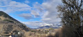

 Easy
Easy