


Refine your search for walks in Rocher du Salut (785m)
Rocher du Salut (785m) walks


 Tour of the Charade valley in Royat
 Visorando Member
 4.87 mi
 +1,142 ft
 -1,155 ft
 3h 15
3h 15
 Easy
Easy
 Departure from Royat (Puy-de-Dôme)
A beautiful hike, not too busy, mostly through the woods. The first climb is a little steep but not particularly difficult. Beautiful views of Sancy, Limagne and Les Puys.
The Rocher du Salut from Beaumont
8.92 mi
+1,818 ft
-1,808 ft
5h 40
 Moderate
Departure from Beaumont (Puy-de-Dôme) (Puy-de-Dôme)
Moderate
Departure from Beaumont (Puy-de-Dôme) (Puy-de-Dôme)
Hike along the slopes of the Montaudoux and Gravenoire puys to reach the viewpoint of the Rocher du Salut. On the way back, you can visit the town and the Royat spa district.
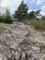
Rocher du Salut Viewpoint
 1.72 mi
+259 ft
-276 ft
1h 00
Easy
Departure from Royat (Puy-de-Dôme)
1.72 mi
+259 ft
-276 ft
1h 00
Easy
Departure from Royat (Puy-de-Dôme)
Enjoy a stroll through the forest to take in the scenery and the view of the Clermont-Ferrand conurbation from the Rocher du Salut.
Royat - Place de Jaude via Rocher du Salut and Chamalières
7.90 mi
+1,017 ft
-1,529 ft
4h 30
Moderate
Departure from Royat (Puy-de-Dôme)
This seventh and final stage, which is partly urban, allows you to continue exploring Royat, which you started at the end of the previous stage, first in the wooded hills of the town, passing by the Rocher du Salut promontory, then through the streets and park of the spa district, with its beautiful seaside architecture. Finally, the return route to Clermont allows you to discover the centre of Chamalières.
From Place de Jaude to the summit of Puy de Dôme, in a circular route and at a leisurely pace
48.66 mi
+8,196 ft
-8,202 ft
7 days
Moderate
Departure from Clermont-Ferrand (Puy-de-Dôme)
In the Clermont-Ferrand metropolitan area, the Transport à la Demande (TAD) service, in addition to regular bus and tram lines, allows you to travel quite far around the city. This seven-stage itinerary takes advantage of this. Each stage begins and ends at a bus or TAD stop. In between, the routes allow you to discover the villages of the metropolitan area's green belt and the foot of the Puy de Dôme: the built heritage of their old wine-growing or mountain villages, their spa resorts, their natural environments and a few geological curiosities. The first stages follow the course of the Artière, and the last ones follow the course of the Tiretaine, two pretty little rivers, tributaries of the Allier, which originate at the foot of the puys.See "Practical information" for a 4-stage variant with accommodation.
Walks near Rocher du Salut (785m)
Beaumont - Ceyrat via Puy de Montrognon
4.98 mi
+1,004 ft
-735 ft
3h 10
Easy
Departure from Beaumont (Puy-de-Dôme) (Puy-de-Dôme)
A fairly short second stage between Beaumont and Ceyrat, passing by the pretty Moulin de la Tranchère, a renovated mill on the banks of the Artière, then by the summit of Puy de Montrognon, crowned by a tower that is the remains of a medieval castle.
Orcines - Royat via the Chemin des Crêtes
5.96 mi
+404 ft
-1,332 ft
3h 05
Easy
Departure from Orcines (Puy-de-Dôme)
This sixth stage takes you gently closer to the city of Clermont-Ferrand, passing through the hamlet of Villars, which has preserved its beautiful old buildings, before following the stunning Chemin des Crêtes, overlooking the Tiretaine valley, to reach the old village of Royat.
Ceyrat - Saint-Genès village via Chaos de la Faille and Artière
8.67 mi
+2,264 ft
-1,224 ft
5h 55
Moderate
Departure from Ceyrat (Puy-de-Dôme)
A third, very "geological" stage, allowing you to discover an impressive rock chaos, evidence of the Limagne Fault that borders the Plateau des Dômes, and the small gorges of the Artière. The itinerary also allows you to continue your discovery of Ceyrat with a visit to its second ancient village, Boisséjour.
Beautiful architecture in Clermont, east side.
3.19 mi
+69 ft
-75 ft
1h 30
Easy
Departure from Clermont-Ferrand (Puy-de-Dôme)
An urban itinerary to discover the beautiful late 19th and early 20th century buildings in the eastern districts of Clermont-Ferrand city centre.
Four monumental murals in Clermont
2.79 mi
+39 ft
-108 ft
1h 20
Easy
Departure from Clermont-Ferrand (Puy-de-Dôme)
Exploratory walk through the neighbourhoods north of Clermont's central plateau, discovering recent street art (2022).
Place de Jaude - Beaumont via Puy de Montaudoux
6.64 mi
+768 ft
-492 ft
3h 45
Easy
Departure from Clermont-Ferrand (Puy-de-Dôme)
This first stage is mainly urban, with a few green interludes at Parc Bargoin in Chamalières, on the slopes of Puy de Montaudoux, in the chestnut grove of Beaumont and in the small parks along the Artière.
The Blaise Pascal ascent via the Chemin des Muletiers
10.84 mi
+3,570 ft
-207 ft
8h 05
 Difficult
Departure from Clermont-Ferrand (Puy-de-Dôme)
Difficult
Departure from Clermont-Ferrand (Puy-de-Dôme)
On 19 September 1648, Blaise Pascal stood before his Torricelli tube in the Jardin des Minimes – now Place de Jaude – in Clairmont (Clermont). His brother-in-law, Florin Périer, had set off earlier with his own Torricelli tube for the summit of the Puy de Dôme. Over the course of the day, 17 experiments were carried out to measure the mercury level in the tubes, which had been placed at different altitudes; these experiments would go on to confirm the hypothesis of the “weight of the air”, which would later become known as atmospheric pressure. At both locations, once filled to the brim, the tube was turned upside down so that its open base was in contact with the mercury contained in a vessel. Due to its weight, the liquid inside the tube dropped under the effect of gravity. In Clermont, the mercury remains at a height of 71.2 cm. At the summit of the Puy de Dôme, it drops to 62.70 cm. This difference of a few centimetres is the result of a height difference of 1,078 metres, which I invite you to appreciate for what it is.
The Blaise Pascal ascent via the Montée des Chèvres
10.46 mi
+3,694 ft
-331 ft
8h 00
Difficult
Departure from Clermont-Ferrand (Puy-de-Dôme)
On 19 September 1648, Blaise Pascal stood before his Torricelli tube in the Jardin des Minimes – now Place de Jaude – in Clairmont (Clermont). His brother-in-law, Florin Périer, had set off earlier with his own Torricelli tube for the summit of the Puy de Dôme. Over the course of the day, 17 experiments were carried out to measure the level of mercury in the tubes, which had been placed at different altitudes; these experiments would go on to confirm the hypothesis of the ‘weight of the mass of air’, which would later become known as atmospheric pressure. At both locations, once filled to the brim, the tube was turned upside down so that its open base was in contact with the mercury contained in a vessel. Due to its weight, the liquid inside the tube sank under the force of gravity. In Clermont, the mercury remained at a height of 71.2 cm. At the summit of the Puy de Dôme, it dropped to 62.70 cm. This difference of a few centimetres is the result of a height difference of 1,078 metres, which I invite you to appreciate for what it is.
Saint-Genès bourg - Laschamps via the pass between Mercœur and Lassolas
6.49 mi
+1,076 ft
-761 ft
3h 55
Moderate
Departure from Saint-Genès-Champanelle (Puy-de-Dôme)
This fourth stage marks the beginning of a wilder route that leads to the foot of the puys, through mountain pastures and woods. It also allows you to discover a pretty village, Beaune le Chaud, which has a beautiful traditional architectural heritage.
Laschamps - Orcines via Puy de Dôme
8.03 mi
+1,663 ft
-2,129 ft
5h 10
Moderate
Departure from Saint-Genès-Champanelle (Puy-de-Dôme)
And finally, here is the fifth stage, marked by the ascent of Puy de Dôme. The route takes the Chemin des Muletiers for the ascent, then the Sentier des Chèvres to descend towards Orcines. There is, of course, a vast panorama from the highest point of this stage, overlooking the city of Clermont-Ferrand, the chain of puys, the Combrailles, the Plateau des Dôme and the Massif du Sancy.