Old railway lines in Pont-l’Abbé

Pont-l’Abbé station was a major railway junction for three railway lines.
The main line, linking Quimper to Pont-l’Abbé, closed in 1988 (freight).
In 1907, the Pont-l’Abbé–Saint-Guénolé line opened to link the ports of the Bigouden region. This train, known as the ‘Train Birinik (bernique)’, mainly carried fish and shellfish. It was also widely used by locals to get around, travelling at a speed of 20 km/h. The line closed in 1963.
Finally, the line from Audierne, opened in 1912, was known as the “carrot train” as it was mainly used to transport vegetables. It was also used by passengers. Its existence was short-lived, as it closed in 1935.
This walk follows sections of these tracks

Details

n°32159678
Creation:
Last update:
Last review:
  • Walking
    Activity: Walking
  • ↔
    Distance: 3.44 mi
  • ◔
    Average duration: 1h 40 
  • ▲
    Difficulty: Easy

  • ⚐
    Back to start: Yes
  • ↗
    Ascent: + 95 ft
  • ↘
    Descent: - 95 ft

  • ▲
    Highest point: 108 ft
  • ▼
    Lowest point: 10 ft

Photos

Description of the walk

Park in the car park of the “Le Triskell” theatre in Pont-l’Abbé.

No signposting (ignore any existing signs)

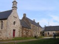
(S/E) With your back to the car park, walk round the front of the venue to the left and head towards Rue de la Gare. Walk past the town’s technical services buildings, the fire station, the community centre (the former railway station) and the Cinéville. The railway station premises used to be on this site. Continue along the edge of a future residential area (Les Arcades).

(1) Pass the recycling centre building, continue uphill along Rue de Ster Vad, which branches off to the right and becomes Rue de Bringall – closed to vehicles over 3.5 tonnes – and arrive at a junction.

(2) Turn left onto Rue de Menez, which leads uphill. The street continues as a wide, tree-lined path. Pass the pedestrian and cycle access to the water park on your right. Cross a road leading to a new residential estate, continue alongside a property on your right and emerge onto the D785.

(3) Turn right and follow the road to the large roundabout nearby.

(4) Turn left and cross the D785 with care. Turn left again and follow this road in the opposite direction. Near the postboxes, turn right onto a path that leads through a pine forest.

Yellow markings

(5) Join aPR® path, follow it straight ahead, pass a small rustic wash house on the left (fountain shown on the map) and continue through the woods. Turn right where the path meets the former ‘Transbigouden’ railway line, now aGRP® trail in the Pays Bigouden, just before an old gatekeeper’s cottage.

GRP® of the Pays Bigouden marked in yellow and red + yellowPR®

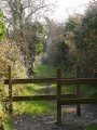
(6) Turn left, cross the bridge over the Ruisseau de Pont-l’Abbé and follow this greenway, a former railway line. Pass through a gate to cross a small road, reach the bridge on the D785 and rejoin the Rivière de Pont-l’Abbé.

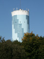
(7) Continue straight on, passing close to the sewage treatment works and the water treatment plant. Note the blue-painted water tower, a landmark visible from a distance. You’ll arrive at the banks of the Ruisseau de Pont-l’Abbé.

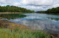
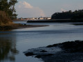
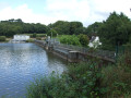
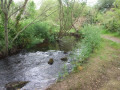
(8) Follow a quiet path that runs alongside the stream and leads to the Pont-l’Abbé pond. You’ll arrive at the theatre and its car park (S/E).

Waypoints

  1. S/E : mi 0 - alt. 13 ft - Car park at ‘Le Triskell’ theatre - Rivière de Pont-l'Abbé (fleuve)
  2. 1 : mi 0.47 - alt. 13 ft - Recycling centre
  3. 2 : mi 0.71 - alt. 59 ft - Crossroads
  4. 3 : mi 1.03 - alt. 92 ft - D785 road
  5. 4 : mi 1.15 - alt. 89 ft - Roundabout
  6. 5 : mi 1.42 - alt. 66 ft - PR junction
  7. 6 : mi 1.89 - alt. 52 ft - GRP junction
  8. 7 : mi 2.57 - alt. 23 ft - Bridge under the D785
  9. 8 : mi 3 - alt. 16 ft - Pont-l’Abbé stream
  10. S/E : mi 3.44 - alt. 13 ft - Car park at ‘Le Triskell’ theatre - Rivière de Pont-l'Abbé (fleuve)

Notes

An easy family walk that can be done in ordinary shoes, except in winter. The section up to point (2) is less pleasant: streets and a residential area under construction in 2024.

Worth a visit

Always be cautious and plan ahead when you're outdoors. Visorando and the author of this route cannot be held responsible for any accidents occurring on this route.

The GR® and PR® markings are the intellectual property of the Fédération Française de Randonnée Pédestre.

Reviews and comments

5 / 5
Based on 1 review

Reliability of the description
5 / 5
Ease of following the route
5 / 5
Route interest
5 / 5
User 11563525

Overall rating : 5 / 5

Date of your route : Aug 18, 2025
Reliability of the description : ★★★★★ Very good
Ease of following the route : ★★★★★ Very good
Route interest : ★★★★★ Very good
Very busy route : Yes

I didn't know this greenway. It's a beautiful, peaceful and quiet route, definitely worth doing again

Machine-translated

Other walks in the area

For more walks, use our search engine .

The GPS track and description are the property of this route's author. Please do not copy them without permission.