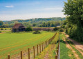
Rickmansworth to West Drayton

This is the fifth stage of the multi-day route "Railways and Waterways, between Oxford and London".

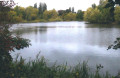
There is water, water everywhere on this walk, starting with the diverse habitats of the Rickmansworth Aquadrome, then passing more lakes and nature reserves. A stark contrast is the massive HS2 Colne Valley viaduct crossing the canal.

This walk is part of a multi-day hike: Railways and Waterways, between Oxford and London

Details

100292567
Creation:
Last update:
Last review:
  • Walking
    Activity: Walking
  • ↔
    Distance: 10.52 mi
  • ◔
    Average duration: 4h 50 
  • ▲
    Difficulty: Moderate

  • ⚐
    Back to start: No
  • ↗
    Ascent: + 13 ft
  • ↘
    Descent: - 108 ft

  • ▲
    Highest point: 203 ft
  • ▼
    Lowest point: 89 ft

Photos

Description of the walk

Start: Rickmansworth Station (TQ 057 945)

(S) From the station, turn right onto Station Road and follow it under the railway lines.

(1) At the High Street, keep ahead on the footpath opposite (slightly to your right).

(2) Turn right on Ebury Road, then right and left to reach the roundabout.

(3) Keep left, cross the road and turn left, then right over the footbridge into the Aquadrome Local Nature Reserve.

(4) Turn right and follow the Colne Valley Trail to the Aquadrome car park. Turn right and keep following the Cole Valley Trail and any diversions to reach the canal.

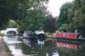
(5) Turn right along the towpath and pass three locks before reaching the Coy Carp Pub at Pynesfield Lake.

(6) From the pub, continue past the Broadwater Lake Nature Reserve to reach the River Garden pub.

(7) A little further on, the canal goes under the new bridge constructed for the HS2 railway line, followed by the one carrying the Chiltern Railway line. The next lock is Denham, the deepest on the Grand Union Canal.
Option
:
Just before the busy A40, a footbridge on the right leads to the Denham Country Park, where there are amenities.

(8) Continue under the A40 as the surroundings become more urban, although the River Colne still runs alongside. Go under the A4020 and the A4007, and after a mile, reach the Malt Shovel at Cowley Lock.

(9) After another mile, the Slough Arm of the canal takes off on the right. This was built in the late 19th Century to transport bricks from Slough to London.

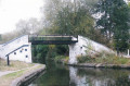
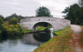
(10) Keep following the Grand Union Canal and go under a minor road bridge.

(11) After the following bridge, leave the canal and keep turning left to reach West Drayton Station.(E)

Waypoints

  1. S : mi 0 - alt. 197 ft - Rickmansworth station - Rickmansworth, Chilterns
  2. 1 : mi 0.15 - alt. 167 ft - High Street - Take the footpath opposite (right)
  3. 2 : mi 0.22 - alt. 157 ft - Ebury Road - Turn right
  4. 3 : mi 0.42 - alt. 161 ft - Roundabout - Go left
  5. 4 : mi 0.54 - alt. 161 ft - Aquadrome Local Nature Reserve - Turn right
  6. 5 : mi 1.24 - alt. 151 ft - Towpath - Turn right - Stocker's Lake
  7. 6 : mi 3.11 - alt. 138 ft - Coy Carp pub
  8. 7 : mi 4.79 - alt. 125 ft - River Garden pub
  9. 8 : mi 6.38 - alt. 115 ft - Footbridge to Denham Country Park (on the right)
  10. 9 : mi 8.89 - alt. 105 ft - Malt Shovel at Cowley Lock
  11. 10 : mi 9.81 - alt. 95 ft - Slough Arm of the canal
  12. 11 : mi 10.37 - alt. 105 ft - Leave the canal to the station
  13. E : mi 10.52 - alt. 102 ft - West Drayton station

Notes

Travel Information:

  • Start - Rickmansworth Station is on the London Underground and Metropolitan Line.
  • Finish - West Drayton Station is on the Elizabeth Line. To return to Rickmansworth from West Drayton Station, take the Elizabeth Line train to Farringdon, then change to the Metropolitan Line.

OS Explorer Map

160

Grid References

  • Start TQ 057 945
  • Finish TQ 060 801

Refreshments and facilities

(4) There is a café and toilets at Aquadrome Local Nature Reserve.

Worth a visit

Other walks in the area

For more walks, use our search engine .

The GPS track and description are the property of this route's author. Please do not copy them without permission.