


Refine your search for walks in Stocker's Lake
Stocker's Lake walks


 Rickmansworth to West Drayton
 Visorando Member
 10.52 mi
 +13 ft
 -108 ft
 4h 50
4h 50
 Moderate
 Departure from Batchworth (Hertfordshire)
This is the fifth stage of the multi-day route "Railways and Waterways, between Oxford and London".
There is water, water everywhere on this walk, starting with the diverse habitats of the Rickmansworth Aquadrome, then passing more lakes and nature reserves. A stark contrast is the massive HS2 Colne Valley viaduct crossing the canal.
Railways and Waterways, between Oxford and London
 150.37 mi
+1,572 ft
-1,637 ft
14 days
150.37 mi
+1,572 ft
-1,637 ft
14 days
 Difficult
Departure from Forest Hill with Shotover (Oxfordshire)
Difficult
Departure from Forest Hill with Shotover (Oxfordshire)
A mainly level circular walk of about 150 miles along the waterways between Oxford and the London suburbs. It can be done in day trips by train or express bus from all the towns en route.
This circular long-distance path starts in rural Oxfordshire, then follows the Grand Union Canal, which has a close-knit narrowboat community, into the Chilterns before winding through the suburbs of London. It crosses the playing fields of Eton to join the Thames Path, which meanders all the way back to Oxford. The route passes over and under bridges of every kind, through country parks, idyllic villages with thatched cottages, grand estates and historic market towns like Aylesbury, Henley-on-Thames and Wallingford. The lakes, chalk rivers and water meadows are home to a diversity of wildlife, and traditional waterside pubs provide welcome refreshment.
Colne Valley Wildlife, Chilterns
 Association / Club / Walk leader6.16 mi
+144 ft
-144 ft
2h 55
Moderate
Departure from Batchworth (Hertfordshire)
Association / Club / Walk leader6.16 mi
+144 ft
-144 ft
2h 55
Moderate
Departure from Batchworth (Hertfordshire)
This walk gives you the opportunity to experience the abundance of wildlife in the beautiful Colne Valley across many different types of habitat. It’s a wonderful location for all ages to explore and enjoy with the possibility of spotting rare migrating birds.
Walks near Stocker's Lake
Sarratt Bottom and Chenies from Little Chalfont
6.69 mi
+236 ft
-226 ft
3h 15
 Easy
Departure from Little Chalfont (Buckinghamshire)
Easy
Departure from Little Chalfont (Buckinghamshire)
This walk along the River Chess starts from Little Chalfont in Buckinghamshire and walks east through pleasant surroundings before turning west to Chenies and a return to the start.
Chalfont and Latimer to Chorleywood via Flaunden
11.76 mi
+712 ft
-833 ft
6h 00
Moderate
Departure from Little Chalfont (Buckinghamshire)
This Chilterns walk takes in parts of the Chess Valley walk at the start and end of the route and a section of the Chiltern Way in between. There is a variety of scenery with undulating landscapes, pastoral scenes of grazing animals, fields of wild flowers in summer, a cricket pitch, a golf course, a quarry, two churches and the shallow chalk stream of the River Chess.
Chipperfield to St Albans Abbey Station
9.00 mi
+404 ft
-574 ft
4h 30
Easy
Departure from Chipperfield (Hertfordshire)
Starts at Two Brewers Inn, Chipperfield. Passes thru' Kings Langley where we join the Grand Union Canal for a short distance. Then thru' Bedmond & Potters Crouch before descending past the Roman wall into Verulamium Park and past St Albans Cathedral to finish at St Albans Abbey Station.
The Celandine Way - Pinner to Eastcote
1.51 mi
+16 ft
-30 ft
0h 40
Easy
Departure from London Borough of Harrow (Greater London)
This is the first section of a 12 mile walking route which follows the River Pinn from Pinner to Uxbridge. Of all Middlesex's 'lost rivers' the River Pinn is perhaps the most visible.
Old Amersham to Chipperfield
8.09 mi
+489 ft
-358 ft
4h 10
Easy
Departure from Amersham (Buckinghamshire)
A tough walk through the rolling Chiltern Hills taking in Chess Valley Walk, Chilterns Way and Hertfordshire Way. Starts in Old Amersham, near St Mary's Church. Big climb up to pass Martyrs Memorial on the hill above Amersham, then through Chiltern Forest, Latimer, Flaunden and Chipperfield Common to finish at the Two Brewers Inn, Chipperfield.
Across the Chilterns: Chesham to Wendover
 10.44 mi
+764 ft
-699 ft
5h 30
Moderate
Departure from Chesham (Buckinghamshire)
10.44 mi
+764 ft
-699 ft
5h 30
Moderate
Departure from Chesham (Buckinghamshire)
A linear walk from Chesham to Wendover climbing to the top of the Chiltern escarpment with spectacular views over the Oxford plains from the top of Coombe Hill. The Chiltern Hills are the main point of interest - you walk up one side, to the shoulder, then back down to civilisation. The physical nature of the geography and geology makes this walk feel bigger than it is.
The Wealdstone Brook
1.75 mi
+3 ft
-95 ft
0h 50
Easy
Departure from London Borough of Harrow (Greater London)
The Wealdstone Brook is one of the lost rivers of Middlesex. It's a short urban walk, one of my 'lost landscapes' routes around the Harrow area. Ironically, there is no trace of the river left in Wealdstone itself, where it has all been culverted. However, it meanders very prettily through Woodcock Park in Kenton, surrounded by grassy banks and willow trees. This is the best bit! There are further glimpses of it along the route of this walk.
From Hemel Hempstead station
 6.36 mi
+256 ft
-282 ft
3h 10
Moderate
Departure from Dacorum (Hertfordshire)
6.36 mi
+256 ft
-282 ft
3h 10
Moderate
Departure from Dacorum (Hertfordshire)
Starting from Hemel Hempstead Station this is a walk which can be enjoyed without a car. The station is right on the edge of the town so virtually all the route is through the open country, much of it through Boxmoor Trust land, on the plateau of the Chilterns and along the Grand Union Canal. There are lots of reminders of the history of the area from 1594 through WWII. If you are lucky you may see a couple of rare farm breeds kept on Trust land and some interesting birds along the canal.
West Drayton to Windsor
 8.69 mi
+39 ft
-49 ft
4h 00
Moderate
Departure from London Borough of Hillingdon (Greater London)
8.69 mi
+39 ft
-49 ft
4h 00
Moderate
Departure from London Borough of Hillingdon (Greater London)
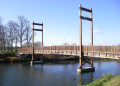
This is the sixth stage of the multi-day route "Railways and Waterways, between Oxford and London".
A varied walk across an aqueduct on a quiet branch of the canal, then following a cycleway to the Jubilee River, where a footpath crosses the playing fields of Eton College to the historic towns of Eton and Windsor and the Thames Path.
This is a short stage allowing plenty of time for a stroll along the Long Walk in Windsor Great Park and/or to sample the tourist attractions of Windsor with its royal connections.
Berkhamsted to Rickmansworth
 14.36 mi
+30 ft
-184 ft
6h 40
Difficult
Departure from Berkhamsted (Hertfordshire)
14.36 mi
+30 ft
-184 ft
6h 40
Difficult
Departure from Berkhamsted (Hertfordshire)
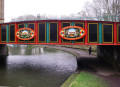
This is the fourth stage of the multi-day route "Railways and Waterways, between Oxford and London".
Following the River Bulbourne, then the River Gade along the valley, there is plenty to see on this walk, from the narrowboats, historic locks and bridges and the oldest mechanised paper mill in the world, to nature reserves and the popular Cassiobury Park.