Country:

 City:
City:


Start: Reading Station (SU 714 739)
(S) Leave the station on the northern side. Cross the bus station, then the main road at the traffic lights. Turn right, then left down Norman Place on the cycleway to the river.
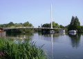
(1) Turn left along the bank and pass the Christchurch footbridge, then go under Caversham Bridge.
Waterfowl congregate here, and river cruises may be booked. There are seats along the promenade and panoramic views across the river. Further along is the site of the popular Reading Festival, which takes place at the end of August. Motor boats, kayaks and canoes may be hired from the boatyard at Scours Lane.
At the end of the promenade, the path becomes squeezed between the railway and the river. Pass Appletree Eyot and Poplar Island and continue to the obsolete Roebuck Hotel sign.
(2) Take the steps on the left up to the road. Turn right for the Thames Path and soon right again into a copse. Turn right into Skerrit Way, and further on left into Hazel Rd and go up the hill.
From the top is a good view over Purley.
Descend to the road junction.
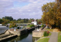
(3) Turn right over the railway. At the next road junction, jink left and right down Mapledurham Drive and go through the gate to the river at Mapledurham Lock.
(4) Turn left and follow the River Thames.
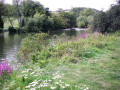
The next two miles are a pleasant meander through the water meadows with the picturesque Chiltern Hills on the right.
Just before the toll bridge between Pangbourne and Whitchurch, turn left through the trees to the Dolphin Activity Centre.
(5) Turn right onto the road, cross carefully and turn right across the toll bridge. Soon a diversion goes left to St Mary’s Church, which dates from the 9th Century. Once you're back on the High Street, turn left, pass the Greyhound and continue up the hill through Whitchurch.
(6) Turn left at the Thames Path sign along a drive. At the junction, the path descends steeply, then rises again before going into woodland.
(7) Option: At the far end of the wood, there is a nature reserve on the right with a steep climb to a seat with a view, but turn left at the next junction to follow the Thames Path (or continue ahead for a shortcut to Goring and Streatley Station).
(8) Turn right back to the river and turn right along it. Go under Brunel’s railway bridge into Little Meadow.
(9) At the path diversion sign, turn right along the path, then left along the lane. Keep ahead at the end of the diversion and at the crossroads, turn right and continue to Goring and Streatley Station.(E)
 Visorando Member
 Easy
Easy  Tourism professional
 Association / Club / Walk leader