


 Country:
 City:
City:


(S) From Clayfield Copse car park, take the path on the right hand edge by the tennis courts which leads to the back of the copse onto Foxhill Lane.
(1) Turn right onto the lane and after a few hundred yards take the bridleway on the left which takes you to Church Lane. Loddon Brewery and Dunsden Green Farm are immediately on your left.
(2) Turn right down Church Lane and then right at the end into Dunsden Way. After the row of houses on the left of the road, take the footpath through the farm gate across and down the hill.
(3) At the bottom, turn left along the line of hedges parallel with Henley Road until you reach steps opposite the pub.
(4) Turn right, climb steps opposite the pub and follow Spring Lane. After a few hundred meters, take the footpath on your left and follow it until you reach Playhatch Road.
(5) Turn right onto Playhatch Road. After a few meters, turn right again to walk on the footpath parallel to the road.
(6) Cross Playhatch Road, pass the roundabout and take Henley Road.
(7) Turn right onto Caversham Park Road.
(8) Turn right to join the Copse. Walk toward the north then west back to the car park.(E)
 Tourism professional
 Association / Club / Walk leader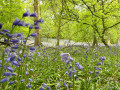
 Moderate
