Country:
 City:


To get to Bussy-Rabutin Castle, come by car or bike. Parking is easy as there is a car park near the castle.
(S/E) From the entrance to the Château de Bussy-Rabutin, take the small road that runs alongside the surrounding wall heading south-east (to the right, with your back to the château). Keep to the right at the first fork. Shortly afterwards, you’ll pass a gate from which you can catch a glimpse of the château. Continue along the wall, which leads to the 368-metre mark at the edge of the fields.
(1) Turn right. Leave the path that follows the castle wall on your right and take the path on the left, which climbs gently across the field towards the power lines. Continue on to the woodland, which lies down towards the valley.
(2) Along the main path, you’ll come across large clearings, first on the right and then on the left. At elevation 322, keep to the right to begin the descent along the Chemin de Ravousse to the road (D6).
(3) Turn left onto this road and follow the railway line until you come to a small tunnel that allows you to pass underneath it. (This passage may be flooded after heavy rain). * See practical information for an alternative route. On the other side of the railway line is a track suitable for vehicles; take this to the right. Continue until you reach the junction and turn left, crossing the River Oze via the Ponts des Romains.
(4) After the bridge, continue along the track which crosses a field before turning sharply left and climbing gently towards the road coming from the Ravousse farm. Turn right to reach the crossroads (elevation 312).
(5) On the left, you’ll find a good track suitable for vehicles, which you should follow. Take a path on the right to skirt the fields, then follow a power line at the foot of the vineyards until you reach a crossroads.
(6) Stay on the same path to pass above the Pont-Laizan Farm just as it begins to follow the course of the Ozerain. Then turn right towards the bridge (elevation 263).
(7) Continue until you reach the road (D9); take this to the left for a short while before you soon come to a path on the right which climbs up towards Flavigny-sur-Ozerain. Keep to the left until you reach the road. Leave the road leading to the cemetery on your left and carry on straight ahead until you reach the Porte du Val, which provides access to the fortified town.
(8) Enter through the Porte du Val to walk round the village and explore its beautiful old houses and church. At the junction after the gate, first turn left then right. Pass two junctions, then turn left onto Rue Gaufrin, followed by a right onto Rue de la Fonderie to see the church. Turn right in front of the town hall, keep right onto Rue de l’Église, then at the end, continue almost straight ahead before keeping left and going straight on until you reach Rue de la Porte du Val. Return to the Porte du Val.
(8) After leaving the housing estate, turn left and follow the road down to the bottom of the valley, passing one junction. You’ll come to the hamlet known as Les Tanneries. Stay on the road to the right to pass between a small pond and a very beautiful house from which the Ru de la Récluse flows. Then head slightly uphill to rejoin the D9, which you must cross at elevation 337.
(9) On the other side of the road, you’ll find a wide, unpaved track leading uphill towards Le Poirier aux Filles. The tree-lined track offers lovely views over the valley, making for a very pleasant walk. Continue towards La Croix Sainte-Anne until you reach a fork in the path.
(10) Take the path on the right and enjoy the open, green landscape. The path descends to the bridge over the Ozerain.
(11) After the bridge, carry on straight ahead to reach the road (D103), which you must cross. Take the small road on the right which climbs towards the Ferme Saint-Georges, which you can just make out a little way up. Further on, on the left, lies the hamlet of Les Celliers. Continue uphill until you come out onto another small road (elevation 314)
(12) Turn right, then shortly afterwards take a well-marked, tree-lined path that climbs to the left towards the Croix Saint-Charles until you reach the crossroads.
(13) Turn left onto a wide path that climbs towards Mont-Auxois. The path is lined with sculptures on the theme of Alesia. Soon, you’ll walk alongside the archaeological site for a short while before beginning to descend towards Alise-Sainte-Reine. On the right, you’ll find a beautiful stone cross and, further down on the left, the cemetery.
(14) Well before reaching the cemetery, turn right onto a wide path that climbs to the top of the plateau before veering left towards the statue of Vercingétorix, which stands proudly facing the battlefield where he was defeated by Caesar’s armies.
(15) From the statue of the Gallic hero, continue towards the edge of the plateau before turning right, then left onto a lovely path leading towards Alise-Sainte-Reine, which quickly turns into a fairly steep wooden staircase leading into the village on Rue du Miroir.
(16) Turn right, then keep to the right at the first fork before coming to the start of the Chemin du Rochon, which begins above the road, still on the right.
(17) Take the path, which is tarmac-surfaced at the start, and walk past the houses on your right; it then turns into a good, fairly level path that follows the foot of Mont-Auxois. Continue along what is now just a simple footpath heading north-east. In the distance, you can see the villages of Grésigny-Sainte-Reine and Bussy-le-Grand. Further on, on the right, you’ll find the path leading to the Source de Sainte-Reine.
(18) Carry on straight along the path, which now descends towards the bottom of the Oze Valley. The landscape of meadows allows you to make out the road and the railway line that you will need to cross. You will soon pass under a power line before reaching a wide track just beside the road (D 954).
(19) Turn right; a little further on, turn left towards the Pont de Sainte-Reine and cross the River Oze. Then, at the first bend, the track branches off to the right.
Almost directly opposite, take a small tunnel that takes you under the railway line, emerging onto a road (D6).
(20) Cross the road and head uphill opposite, through a passage between two fields. A little further up, you’ll come to a large copse which you’ll need to go round to the right before reaching the Croix des Vignes, a good path followed by a road leading down from the plateau.
(21) From the Croix des Vignes, turn left onto the road heading towards Grésigny-Sainte-Reine. Leave this road to take the first path on the right, which takes you to the village whilst remaining roughly on the same contour line. At elevation 281, you’ll come out onto a street which, on the left, descends towards the lower part of the village to rejoin the road that runs through it.
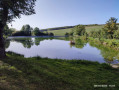
(22) On the other side of the road, you’ll come across a remarkable wayside cross and, a little to the right, a sort of fortified farmstead and the village hall. Carry on straight ahead; shortly afterwards, you’ll come to a very pleasant lake. Go round it on the right to emerge onto Rue de la Lignière, running alongside the River Rabutin, which flows to your left. Turn right to walk alongside the lake before reaching a large crossroads from where you can see the rear of the village church.
(23) Take the Grande Rue (heading north) and follow it all the way to the end. It runs parallel to the River Rabutin, which you can just make out on your left. At the end of the street, you’ll come to another cross and Rue des Callias.
(24) Take this street on the left and you will soon cross the Rabutin via a small bridge. The path soon veers to the right before passing under a power line. A little further on, at elevation 265, you’ll come to a fork.
(25) Turn right onto a good path that climbs quite steeply up the Rappé hillside. As the climb levels off, you’ll come to a spring on the right and, shortly afterwards, a fork in the path. Follow the path on the left to climb until you reach another good path a little further up at Pranon.
(26) Turn right onto this path, which follows the contour line north-eastwards to the next fork at elevation 334. Take the path climbing up to the left to reach another, roughly level path which now heads right towards Bussy-le-Grand, which is now clearly visible. Turn right onto the tree-lined path before reaching a lovely meadow at the foot of the village. A little further on, you’ll come across a large farm building, which you’ll soon be passing in front of.
At this building, the path turns into a tarmac road and climbs towards the village entrance, leading onto Rue du Bas.
(27) Turn right onto it until you reach the D21b road, which you must cross.
(28) Continue to the right. At the bend, leave the road and take a path slightly to the left which descends towards Rue de la Rivière. Then follow a path (elevation 288) which, after the first few houses, leads back to the road at the bottom of the hamlet.
(29) On the road, turn left then immediately right towards the bridge crossing the River Rabutin. Continue until you reach the D954, which you must cross. Slightly to the left, take a path which crosses the fields and heads uphill towards the hamlet known as la Rue du Château. You will then catch sight of the castle’s towers before reaching the main road.
(30) Turn left and follow the road that runs alongside the castle to return to the car park (S/E).

 Visorando Member
 Easy


 Moderate