


 Country:

 City:


(S/E) From the Fermonds car park, start the descent and immediately turn left towards Les Beaumes, then quickly go straight on, still heading towards Les Beaumes and Le Châtelard.
At Le Châtelard, follow the path towards Les Beaumes until you reach the track leading up to the water reservoir; take this track, keeping to the left, until you reach point 1371 m.
(1) Climb to the right along the left bank of the ravine until you reach the rocky outcrop bordering it on this side.
From there, on the right, the path begins which does not appear on the latest IGN maps. Take this path. It climbs steadily in switchbacks and at times becomes a little overgrown (with fallen trees or other obstacles). Reach the shoulder by traversing due north towards the end.
(2) Continue behind the ridge in the same direction. The path climbs again, becoming lost a little more often amongst the rhododendrons and other scrub until it reaches a ridge
(3) Follow the small ridge that follows, then the path winds its way down the slope (mainly grassy) until it reaches the ridge line at the top left.
(4) Follow the ridge a little further, without coming up against the rock face above (–20 m).
Continue down the southern slope (cairn on the ridge line) and reach the next ridge line via the narrow grassy slope opposite, then cross a second ridge line 30 m further on, heading for a slight gap at almost the same level.
Once you have reached this gap, descend 10 m behind it and continue diagonally to reach the next ridge line; pass behind it via a small, short rocky ledge,
Now climb up the slope on the right to reach the ridge line above.
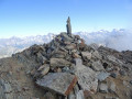
(5) Follow the ridge to the summit.
(6) Begin the descent by following the ridge until you are 20 metres from a small gap (rocky outcrop).
Veer slightly onto the western slope to follow a sloping ramp that passes beneath the rock face, then rejoin the contour-line ridge and follow it to the edge of the break.
(7) Descend to the left via a series of small steps and gain a foothold on the chamois ledge.
Follow it due south, pass a small rocky section and descend the dihedral that follows, facing the drop-off (solid lateral footholds but loose scree in the groove).
Head due north to rejoin the ridge line further on (a short detour to the point with an altitude of 2651m is an option).
Continue the descent to the Col de Prè du Bouc.
(8) Continue due west along the contour line to cross the Muande and climb the gully directly ahead (due west). The route branches off to the south to reach Lac des Celliers.
(9) From the lake, leave the basin to the south-east to cross a first scree slope diagonally before heading straight up the slope to the vicinity of L’Arche. From there, the path reappears, running on level ground to cross the ridge in the distance to the west.
(10) Descend the western slope of the ridge to around the 215-metre mark, where you’ll come across an almost flat path; take this to the right (west). Follow it to the spring.
(11) Turn back and this time follow the path heading due east, which passes by the Jas des Pierres shepherd’s hut and continues down to the Refuge du Tourond.
(12) Then turn left onto theGR® de pays trail to the village of Les Fermonds (S/E).


 Visorando Member
 Moderate

 Difficult

 Extremely difficult

