Family walk in Hermanville-sur-Mer

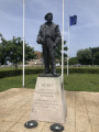
A short stroll through the village streets and back roads. On this family walk, you’ll come across horses and other farm animals and discover the village’s British war cemetery.
You can also enjoy a fitness trail around the football pitches.

Details

n°3158335
Creation:
Last update:
Last review:
  • Walking
    Activity: Walking
  • ↔
    Distance: 3.39 mi
  • ◔
    Average duration: 1h 35 
  • ▲
    Difficulty: Easy

  • ⚐
    Back to start: Yes
  • ↗
    Ascent: + 26 ft
  • ↘
    Descent: - 26 ft

  • ▲
    Highest point: 59 ft
  • ▼
    Lowest point: 16 ft

Description of the walk

Park in one of the car parks around the village football pitch.

(S/E) With your back to the sports ground, turn left onto Avenue André Malraux, go round the bend, then turn left onto Rue Guy Baudry. Then turn right onto Rue de la Haie aux Fèves.

(1) Turn left at the junction, then right onto Grande Rue for 100 metres, and finally left onto Impasse Vasnier, which leads onto Rue du Tour de Ville. Turn left.

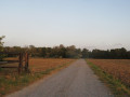
(2) At the crossroads, take a dirt track on the right (Chemin de Calais) and follow it to the next junction. Turn left towards the Bois Cantel and continue to the British cemetery.

(3) Turn right onto Chemin des Hautes Sentes towards the Hermanville campsites; the beaches are 1 km away.

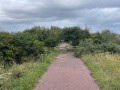
(4) Turn left onto Chemin du Douet, then at the end of the path, turn right onto Avenue du 6 Juin. Turn left straight away onto Rue de l’Amiral Giret. Carry on straight ahead between the houses until you come out onto a grassy path (Chemin des Clos). Turn right, then left, onto Rue de la Laiterie. At the end of the street, keep to the left.

(5) Turn left to head up Chemin du Hamel. Cross the main road carefully and continue straight ahead onto Rue de la Mare aux Fanets. At the end, turn right and continue for about 100 metres.

(6) Turn left onto Chemin de la Marque, which runs alongside the main road. At the village cemetery, turn left onto Chemin du Moulin, then left again onto Avenue Nelson Mandela and finally right to return to the car park (S/E).

Waypoints

  1. S/E : mi 0 - alt. 43 ft - Football ground car park
  2. 1 : mi 0.3 - alt. 39 ft - Junction, turn left
  3. 2 : mi 0.66 - alt. 39 ft - Chemin de Calais
  4. 3 : mi 1.52 - alt. 30 ft - Cimetière militaire britannique (Hermanville-sur-Mer)
  5. 4 : mi 1.75 - alt. 26 ft - Chemin du Douet
  6. 5 : mi 2.32 - alt. 20 ft - Chemin du Hamel
  7. 6 : mi 2.72 - alt. 33 ft - Chemin de la Marque
  8. S/E : mi 3.39 - alt. 43 ft - Football ground car park

Worth a visit

Fitness trail.

(3) Explore the British military cemetery.

Reviews and comments

4 / 5
Based on 2 reviews

Reliability of the description
3.5 / 5
Ease of following the route
5 / 5
Route interest
3.5 / 5
AmandineC
AmandineC

Overall rating : 4 / 5

Date of your route : Aug 23, 2021
Reliability of the description : ★★★★☆ Good
Ease of following the route : ★★★★★ Very good
Route interest : ★★★☆☆ Average
Very busy route : Yes

A pleasant walk if you’re in the area, to enjoy Hermanville, but it’s not worth making a special detour for a hike; there aren’t many natural spots, and you’ll mainly be passing through rather pretty housing estates.
The paths and roads are very accessible, but the start of the route has clearly changed since it was first marked out. However, it’s still fairly easy to find your way around with the map. The description and the route map complement each other well.
We came across plenty of visitors, given the cemetery and the proximity to the campsites.

Machine-translated

Brigitte91Y
Brigitte91Y

Overall rating : 3.5 / 5

Date of your route : May 30, 2021
Reliability of the description : ★★★☆☆ Average
Ease of following the route : Not used / Not applicable
Route interest : ★★★★☆ Good
Very busy route : No

A lovely walk, but we had a bit of trouble finding our way at the start. We ended up getting lost in the new housing estates. So we got back in the car and started from Impasse Vasnier. It wasn’t the circular route described in the guide, then. It was a very moving moment at the British cemetery.

Machine-translated

Other walks in the area

For more walks, use our search engine .

The GPS track and description are the property of this route's author. Please do not copy them without permission.