Country:

 City:
City:


Car park at Moulin Cambier, brasserie. Arrive early; if full, there is parking available on the forest road further up.
(S/E) With your back to the Semois and the mill on your left, take the path with the wooden steps leading up into the forest; there are streetlights along the way. At the top, turn right. Keep to your left and walk until you reach the path on your left, 10 metres from the road.
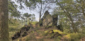
(1) Turn left onto the path towards Les Neuf Hêtres. Walk uphill, ignoring the paths branching off on either side, until you reach a wide track at the top. Turn right. At the road, take in the view from the Roche du Corbeau. Retrace your steps, pass the path you came from and turn right. You’ll come out onto the N894.
(2) Cross diagonally to the left and continue along the forest track. Keep to your left, despite the well-marked path branching off to the right, and you’ll reach a wide path. Turn left. Walk just under 300 m, cross a stream and, 300 m further on, you’ll reach a Fork in the road.
(3) Keep to your right. Cross the Ruisseau de la Foulerie and continue along the track. Ford another branch of the stream, then continue for 1.2 km along this forest track until you reach the N858. Cross diagonally to the left and continue along the track opposite. Leave the forest track on your left and head down the wide track for about 700 m until you reach a junction on your left.
(4) Turn left and then immediately right. At the Fork in the road, keep to the right. At the end of the track, keep to the right and you’ll reach the path running alongside the Vierre. Be careful, as vehicles may use this path. Continue to the right for about 300 m until you reach a forest track leading uphill on your right.
(5) At a tree marked P17 at the entrance, head uphill. At the next junction, turn right and immediately keep to the left. The path turns left and joins another path. Follow this for about 750 m, ignoring the poorly marked side paths along the way, until you reach a Fork in the road with deep ruts, some of which may be filled with water (not shown on maps).
(6) Turn right. Pass a barely visible junction and, further on, cross a stream. The track becomes a path and turns left. Continue along the main path. At the three-way junction, keep to the left. At the junction immediately after, look out for the tree with the number 30 written in fluorescent green on the trunk opposite.
(7) Carry on straight ahead. Follow the main track for just over 650 m. A track (not shown on the map) joins from your left; carry on. Look out for a footpath on your left, before the road and before the sign, with a tree marked ‘13’ at the entrance.
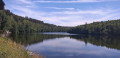
(8) Take this forest track and walk to the tarmac road. Turn left and walk down to the dam,taking care as the road may be used by vehicles.
(9) Take the path on your right just before the dam.
GR® signposting
The path becomes a track and turns sharply to the right. Ignore the path at the bend, head uphill and ignore thefirst hairpin bend to the left. Continue uphill to the next one.
(10) Take the hairpin bend to the left. At the junction (not shown on maps), carry on straight ahead and, at the next fork, turn left. Go downhill and then uphill again until you reach the start of a grassy path on your left.
(11) Turn left at theGR® cross. Leave the GR® markings for a short while. Follow this path and head downhill to the wide track. Turn left. Return to theGR® markings. The path turns right. Walk for 1.5 km along the Vierre to the iron bridge.
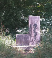
(12) Turn right. You’ll come to the barbecue area with a playground. On your right is the memorial stone marking the site of the Chapelle du Maquis. Take the path to the left of the memorial stone.
No signposts
Walk for about 400 m, ignoring any side paths, until you reach a Fork in the road.
(13) Take the path on the left. At the next Fork in the road (not shown on maps), keep to the right. Walk until you reach a forest track (not shown on maps).
(14) Continue to the left and walk for just under 900 m along the forest track, ignoring any side paths, until you reach the hairpin bend to the right that you took on the way there.
(10) Ignore it and carry on straight ahead to reach the road. Cross carefully and turn right. Walk carefully along the road for just under 400 m until you reach thesecond forest track on your left.
(15) Turn left and take the path furthest to the left. Follow this forest track for 600 m, ignoring any other paths branching off. Follow the yellow markings on the tree trunks where necessary. You’ll come out onto a wide forest track; turn right until you reach a junction with a hunter’s chair.
GR® signposting
(16) Turn left and head downhill. At the T-junction, turn right. Walk past the power station. Continue along this forest track for 1.2 km until you reach the campsite, ignoring any paths on your right.
(17) Walk past the campsite and you’ll come out onto the road near the Saint-Nicolas Bridge. Cross the bridge, turn right, then immediately turn left onto the road leading to Moulin Cambier and your car park (S/E).


 Visorando Member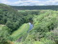

 Difficult