Walk in Elbes

A short circular route starting from the village of Elbes (in the municipality of Martiel). No signposting, but easy to follow using the route map, or, better still, the Visorando app. The route begins on a tarmac road up to the point (2), but traffic is very light.

Details

n°7350611
Creation:
Last update:
Last review:
  • Walking
    Activity: Walking
  • ↔
    Distance: 3.26 mi
  • ◔
    Average duration: 1h 35 
  • ▲
    Difficulty: Easy

  • ⚐
    Back to start: Yes
  • ↗
    Ascent: + 66 ft
  • ↘
    Descent: - 85 ft

  • ▲
    Highest point: 1,306 ft
  • ▼
    Lowest point: 1,227 ft

Photos

Description of the walk

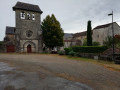
Car park in the village centre, in front of the church.

(S/E) Turn right behind the church and continue to the junction with the D76.

(1) After about ten metres on the departmental road, turn right, passing Le Roucaillou, then Les Cayssats.

(2) Leave the tarmac road and turn right onto the dirt track; 40 metres further on, turn right again. Follow this track, which turns at a right angle to the left and then to the right, heading north-east. You’ll come to a crossroads.

(3) Ignore the track on the right and continue in the same direction until you reach the Fork in the road.

(4) Turn right, ignore a track on the left and arrive at a crossroads.

(5) Carry on straight ahead until you reach the tarmac road.

(6) Turn right onto this road and, in the centre of the village, head for the car park in front of the church (S/E).

Waypoints

  1. S/E : mi 0 - alt. 1,260 ft - Car park in front of the - Église Saint-Jacques (Elbes)
  2. 1 : mi 0.32 - alt. 1,302 ft - Crossroads (cross)
  3. 2 : mi 1.41 - alt. 1,247 ft - Dirt track junction
  4. 3 : mi 2.06 - alt. 1,240 ft - Fork in the road
  5. 4 : mi 2.16 - alt. 1,253 ft - Fork in the road
  6. 5 : mi 2.69 - alt. 1,289 ft - Crossroads
  7. 6 : mi 2.92 - alt. 1,306 ft - Junction with tarmac road
  8. S/E : mi 3.26 - alt. 1,260 ft - Car park in front of the - Église Saint-Jacques (Elbes)

Worth a visit

Nearby: Loc-Dieu Abbey.

Reviews and comments

5 / 5
Based on 1 review

Reliability of the description
5 / 5
Ease of following the route
5 / 5
Route interest
5 / 5
simon2904
simon2904

Overall rating : 5 / 5

Date of your route : Apr 26, 2021
Reliability of the description : ★★★★★ Very good
Ease of following the route : ★★★★★ Very good
Route interest : ★★★★★ Very good
Very busy route : No

A very pleasant walk along shaded paths. We’ll do it again

Machine-translated

Other walks in the area

For more walks, use our search engine .

The GPS track and description are the property of this route's author. Please do not copy them without permission.