Pont du Roy – Kerviniou – Santig Gouesnou Fountain – Paul Sérusier Valley

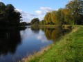
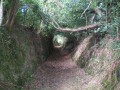
A lovely, varied walk that runs alongside the canal, passes through the woodland and allows you to explore part of the Paul Sérusier trail in Châteauneuf-du-Faou.

Details

15087697
Creation:
Last update:
Last review:
  • Walking
    Activity: Walking
  • ↔
    Distance: 8.88 mi
  • ◔
    Average duration: 4h 30 
  • ▲
    Difficulty: Moderate

  • ⚐
    Back to start: Yes
  • ↗
    Ascent: + 466 ft
  • ↘
    Descent: - 495 ft

  • ▲
    Highest point: 427 ft
  • ▼
    Lowest point: 115 ft

Photos

Description of the walk

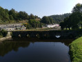
The walk starts at the car park located before the Pont du Roy (before entering Châteauneuf-du-Faou).

The route is signposted with Yellow Rectangles throughout the walk.

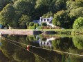
(S/E) From the car park, cross the bridge and follow the path which descends immediately after the bridge to the right towards Quai Jean Guivarc’h, then turn right again straight away to walk alongside the canal towards the Châteauneuf lock. Continue straight on, still following the canal, and ignore the paths branching off to the right on two occasions. You will reach the Kerbaoured lock.

(1) Carry on along the canal until you reach the first road on the right.

(2) Leave the canal path and follow the road to the right through the hamlet of Keralain.

(3) After the hamlet, follow the path branching off to the left, which winds through the woodland and meadows.

(4) Follow the path on the left to reach Kerviniou.

(5) At the entrance to Kerviniou, turn left, then at the bottom of the short descent, turn right to join the D72, which you follow for a few metres on the left.

(6) Cross the D72 with care and take the path opposite, which branches off to the right towards Kernolen. Stay on this path throughout.

(7) Cross the road near Kêr Marguerite and continue straight on to follow a path that climbs gently through the forest.

(8) Turn left, then immediately turn right onto a path which, after a bend, joins Rue de Châteaulun; cross the street and continue straight on along a path.

(9) When you reach Rue du Gledig, continue along the street opposite to join Rue du Général de Gaulle.

(10) Follow it to the left for a few metres, then turn right onto Place du 19 Mars 1962.

(11) As you leave the town, turn right and follow the path that runs past the football pitch. After the pitch, follow Rue Frédéric Le Guyader, which branches off to the left. Turn left again two streets further on.

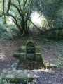
(12) At the bend, take a path leading into the woods for a return trip to the Santig Gouesnou Fountain. On your return from the fountain, take the path leading down to the cemetery on the left.

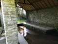
(13) Turn left onto the path heading towards the cemetery and walk alongside it until you reach Rue Paul Serusier; follow this to the left for a few metres, then cross the street and take the path branching off to the right, which passes by an old wash house a few metres further on.

(14) Follow the path to the right until you reach Rue de Pontadig, which you cross to continue, on the opposite side, along Rue des Peupliers and reach Quai Jean Guivarc’h, which you follow to the right to reach Pont du Roy and the car park where you started (S/E).


Waypoints

  1. S/E : mi 0 - alt. 190 ft - Car park before the Pont du Roy
  2. 1 : mi 2.12 - alt. 121 ft - Kerbaoured Lock
  3. 2 : mi 2.6 - alt. 118 ft - Junction on the road
  4. 3 : mi 2.87 - alt. 180 ft - Junction on the footpath
  5. 4 : mi 3.45 - alt. 262 ft - Junction
  6. 5 : mi 3.61 - alt. 200 ft - Entrance to Kerviniou
  7. 6 : mi 3.9 - alt. 171 ft - Crossing the D71
  8. 7 : mi 4.58 - alt. 246 ft - Cross the road near Kêr Marguerite
  9. 8 : mi 5.37 - alt. 328 ft - Left/right at the road
  10. 9 : mi 5.77 - alt. 371 ft - Rue du Gledig
  11. 10 : mi 6.23 - alt. 420 ft - Rue du Général de Gaulle
  12. 11 : mi 6.5 - alt. 420 ft - Junction on the path
  13. 12 : mi 7.03 - alt. 381 ft - Path towards the forest
  14. 13 : mi 7.78 - alt. 351 ft - Cemetery Trail
  15. 14 : mi 8.06 - alt. 230 ft - Washing house
  16. S/E : mi 8.88 - alt. 190 ft - Car park before the Pont du Roy

Notes

There are several benches and tables along the route.

Reviews and comments

4.5 / 5
Based on 2 reviews

Reliability of the description
4 / 5
Ease of following the route
4.5 / 5
Route interest
5 / 5
Cat29
Cat29

Overall rating : 5 / 5

Date of your route : Dec 29, 2025
Reliability of the description : Not used / Not applicable
Ease of following the route : ★★★★★ Very good
Route interest : ★★★★★ Very good
Very busy route : No

A lovely surprise on this route, which we shortened to a 10 km walk (leaving the towpath at the pond to reach point 7).
Very peaceful, with lots of passerine birds along the route and the discovery of the old Plouescat-Rosporden railway line (potato train), which we followed for a few kilometres.
It is passable in winter (at least on the 10 km route).

Machine-translated

BSA
BSA
• Edited:

Overall rating : 4.3 / 5

Date of your route : May 29, 2023
Reliability of the description : ★★★★☆ Good
Ease of following the route : ★★★★☆ Good
Route interest : ★★★★★ Very good
Very busy route : Yes

A lovely route along the canal and through shaded paths. One slight drawback regarding the signposting: it’s hard to see in some places and non-existent in the town itself. But the town centre is magnificent, with its narrow streets. We had a brilliant time on this route and highly recommend it.

Machine-translated

Other walks in the area

For more walks, use our search engine .

The GPS track and description are the property of this route's author. Please do not copy them without permission.