Route of Saint Thois via the Chapel of La Roche

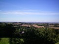
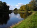
A countryside route along narrow roads and sunken lanes.

Details

63579
Creation:
Last update:
Last review:
  • Walking
    Activity: Walking
  • ↔
    Distance: 5.79 mi
  • ◔
    Average duration: 3h 05 
  • ▲
    Difficulty: Easy

  • ⚐
    Back to start: Yes
  • ↗
    Ascent: + 459 ft
  • ↘
    Descent: - 459 ft

  • ▲
    Highest point: 571 ft
  • ▼
    Lowest point: 240 ft
  • ⚐ Country: France
  • ⚐ City: Saint-Thois (29520)
  • ⚑
    Start/End: N 48.166622° / W 3.889512°
  • ❏
    IGN map(s): Ref. 0618OT
  • Hour-by-hour weather

Photos

Description of the walk

Starting point: car park at the Saint Thois sports hall.
Green markings for the ‘3 Valleys’ route (in part).

(1) From the car park, head down towards Kernéac’h. Before reaching the village, turn left onto a sunken path which climbs up to join a road at Ti Form. Turn right, continue past Groaz Hir and then, on the right, Goarem Kernéac’h. After the road to Kergoff Huella (equestrian centre), turn left onto a path leading to Garn Ton, then turn right to reach Zabret.

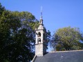
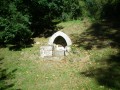
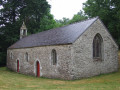
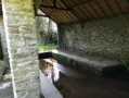
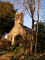
(2) Turn left towards Penn ar Voez, then right towards Kervern. Walk through the old hamlet to join the D41 road leading to Gouézec. Follow the road to the left and, at the Moulin de la Roche, head up to the left along the signposted path (the ‘Route des 3 Vallées’) to reach the fountain and La Roche Chapel. This is the ideal spot for a break.

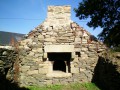
(3) Continue on to Le Merdy (old bread oven). At the gable end of a restored farmhouse, turn left onto a grassy path which leads out onto a small road. Turn left and follow this road to the entrance to Kerlogan.

(4) Turn right onto a sunken lane which then bends left (green signpost). Follow this long sunken lane, which turns right at a 90° angle, to rejoin a small road opposite Kerolivier.

(5) Turn right and follow this road, which passes Ty Floc’h on the left. Continue and, at Ty Cariou, turn left onto a steep grassy path. (On the right, a path climbs up to a reservoir offering a lovely view.) The path joins a small road just before a livestock farm on the left. Turn left and follow this road straight on to return to the village of Saint Thois.

Waypoints

  1. S/E : mi 0 - alt. 292 ft - Sports hall car park
  2. 1 : mi 1.55 - alt. 463 ft - Towards Penn ar Voaëz
  3. 2 : mi 2.98 - alt. 489 ft - La Roche Chapel
  4. 3 : mi 3.54 - alt. 515 ft - Sunken lane on the right
  5. 4 : mi 4.21 - alt. 433 ft - Turn right towards Ty Floc’h
  6. S/E : mi 5.79 - alt. 292 ft

Worth a visit

Trévarez Estate
Set in the heart of an 85-hectare park, Trévarez Castle – now recognised as a “20th-Century Heritage Site” – has overlooked the Aulne Valley for over a century. It bears witness to the dream of one man, the politician James de Kerjégu, who in 1893 undertook the construction of a prestigious residence, at the cutting edge of modernity, against the vibrant backdrop of the Belle Époque.

Reviews and comments

4 / 5
Based on 4 reviews

Reliability of the description
4 / 5
Ease of following the route
4.3 / 5
Route interest
3.8 / 5
buzidan2002
buzidan2002

Overall rating : 4.3 / 5

Date of your route : Aug 10, 2016
Reliability of the description : ★★★★☆ Good
Ease of following the route : ★★★★★ Very good
Route interest : ★★★★☆ Good

A lovely walk that took a little less time than expected (2 hours 20 minutes).
We did the walk with children (aged 9, 11 and 13).
We didn’t see many green markings along the route, as mentioned in the description.
The Chapel of La Roche was a lovely discovery.

Machine-translated

Jeannine G1.
Jeannine G1.

Overall rating : 4.7 / 5

Date of your route : Sep 28, 2015
Reliability of the description : ★★★★★ Very good
Ease of following the route : ★★★★★ Very good
Route interest : ★★★★☆ Good

Hello,

I think I’ve already replied, but I can’t find any trace of it.
This is the second hike I’ve done on my own (with my two dogs); I quite like this route, though it’s a shame there are a bit too many roads – I have to keep my dogs on a lead every time, and they’re not exactly small, so they pull me along.

It took me a bit longer as my feet were aching.

I’ve taken some photos and would like to share them, but I don’t know how.

Thanks to the team

Machine-translated

gazok54
gazok54 ★

Hello MARIE-JOSEE, and thank you for your comment.
I understand that walking on tarmac isn’t necessarily pleasant and that’s why you’ve rated this walk as ‘average’ in terms of its appeal. However, does this rating really apply to the description and the map? If so, do you think there are any improvements that could be made?

Machine-translated

MARIEJOSEE
MARIEJOSEE

Overall rating : 3 / 5

Date of your route : May 08, 2015
Reliability of the description : ★★★☆☆ Average
Ease of following the route : ★★★☆☆ Average
Route interest : ★★★☆☆ Average

Hello,
We found that, apart from the almost non-existent signposting, this route involved too much cycling on roads.

Machine-translated

Sylvie L2.
Sylvie L2.

Overall rating : 4 / 5

Date of your route : Oct 05, 2014
Reliability of the description : ★★★★☆ Good
Ease of following the route : ★★★★☆ Good
Route interest : ★★★★☆ Good

It’s a bit dangerous on the D41, but otherwise nothing to complain about.
A lovely drive through the Breton countryside.

Machine-translated

Other walks in the area

For more walks, use our search engine .

The GPS track and description are the property of this route's author. Please do not copy them without permission.